In recent years—and largely after the September 11, 2001, terrorist attacks in the United States—national security has become more important for governments around the world. Many of them realized how critical it is to create a collaborative environment that various security organizations and agencies can use to ensure citizen safety.
Portugal’s Ministry of Internal Administration (known by its Portuguese acronym MAI) is responsible for public security and emergency management, in addition to supporting the electoral administration, road safety agency, and immigration and refugee affairs. With this increased focus on national security, the MAI was compelled to get Portugal’s security forces and services to work in a more coordinated and integrated manner.

To that end, Esri Portugal—Sistemas e Informação Geográfica, S.A.—and telecommunications company Altice, in collaboration with MAI, built a geospatial platform called GeoMAI that allows security personnel from a range of organizations to integrate data so they know where dangerous situations are happening, how these incidents are unfolding, and what to do to quickly and appropriately quell them. The platform aggregates Esri technology—including ArcGIS Enterprise, ArcGIS Online, ArcGIS Pro, and several apps—along with solution engineering and consulting and training services to make gathering, combining, and visualizing disparate data swift and simple.
GeoMAI’s main objective is to make data from multiple sources and systems (both internal and external) available to the MAI and to have various solutions on hand to help staff analyze and act on that data. Through this, the system supports the country’s planning, prevention, and operational security and safety services, including the National Republican Guard, the Public Security Police, the National Authority for Civil Protection, the National Road Safety Authority, and the Immigration and Borders Service.
But GeoMAI is more than an information platform. It makes available tools and solutions that increase the efficiency and effectiveness of data integration when it comes to analyzing risk and understanding social criminal phenomena. It is also a tactical support tool that ministry staff, the police, and the general public can use to combat crime and create public security policies.
At the start of the project in 2014, Esri Portugal’s sector lead manager for defense and security conceptualized that, due to MAI’s very specific needs and requirements, GeoMAI would need a strong app development component. But as the ArcGIS platform evolved, making available better templates and configuration tools, the team, together with the client, changed the focus of the project to have GeoMAI rely more on configured information products. This would significantly increase the speed at which data and apps could be delivered to meet the demands of the ministry and its public safety and security agencies.
One of the big challenges with this project was that Portugal’s security forces and services were at different maturity levels in the ArcGIS platform. To remedy this, the team selected various ArcGIS software components—including web apps, dashboards, and story maps—to adapt to each organization’s needs. For instance, Esri Portugal worked with key MAI personnel to create geoprocessing services published in ArcGIS Enterprise that can be used to report all sorts of information about various incidents, such as which species and economic sectors got damaged in a specific wildfire burn area. With this data, the National Republican Guard can generate maps, story maps, and printed materials to give to other entities that do environmental evaluation. These organizations can then use those visuals to showcase environmental statistics and come up with viable wildfire prevention measures.
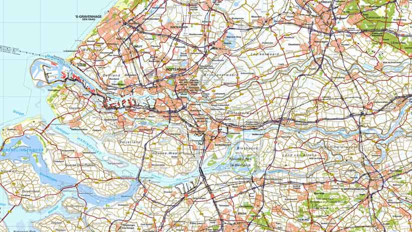
The MAI and security forces also share a secure network, called the National Homeland Security Information Network (known by its Portuguese acronym RNSI), that provides network and telecommunications services, as well as map services with basic geographic information for Portugal. So ministry officials and security forces alike can use the same orthoimagery, administrative boundaries, and street networks as the basis for their maps.

As the project progressed, Esri Portugal collaborated with key personnel at all the agencies, in coordination with the ministry, to analyze their capabilities, needs, and potential.
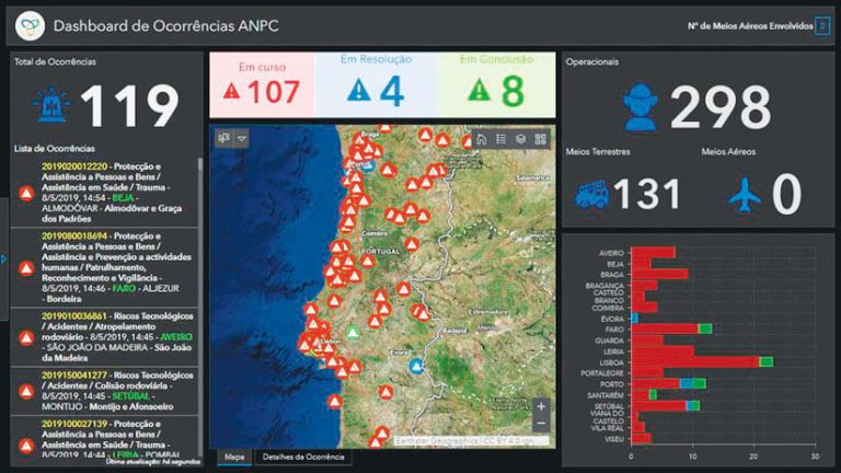
With the National Authority for Civil Protection, for example, Esri Portugal started by building up its operational capacity. The team then implemented Operations Dashboard for ArcGIS so the agency could monitor incidents and assets in the field, instituted Web AppBuilder for ArcGIS so staff could create web apps that would aid with team coordination, and set up Collector for ArcGIS and Survey123 for ArcGIS to make it easier for staff to gather information in the field. Once these components were in place, the National Authority for Civil Protection could configure its own solutions, using ArcGIS Pro to harvest, sort, and manage incoming data.
For the Public Security Police, Esri Portugal set the organization up with Operations Dashboard and ArcGIS Enterprise Sites. Although neither of these is fully functional yet, the police will be able use them in conjunction with Web AppBuilder to create tailored web apps and pages that show criminal statistics and various kinds of business information.
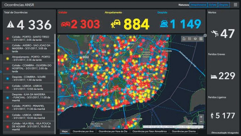
In working with the National Road Safety Authority, Esri Portugal started by using ArcGIS API for Python to develop algorithms that could standardize and validate information gathered about accidents. The team then made it possible to present this data using Operations Dashboard. Now, the agency can monitor traffic incidents on a dashboard, making it easier to manage traffic and road safety.
Through GeoMAI, Portugal’s internal administration ministry and all the safety and security agencies under its auspices are able to more easily and comprehensively visualize data, which helps them contextualize security challenges and obtain better results.

