Tapping into their own technological and sector expertise, Esri partners around the globe deploy software, services, and applications that enable users to become more efficient and effective. With these GIS solutions, people at all levels of an organization—from policy makers and executives to knowledge workers and GIS analysts—can apply geography to every decision they make.
Making Public Safety Decisions More Quickly
Location is key to meeting the stringent and demanding requirements of mission-critical emergency response GIS. To address this need, Geo-Comm uses the ArcGIS platform to power its GeoLynx family of software and services for end-to-end public safety GIS needs, which range from 9-1-1 GIS data management and mobile responder mapping to tactically connecting Public Safety Answering Points in real time. By employing accurate, authoritative data and maps, policy makers and public safety and law enforcement agencies can work together to make sound decisions in a hurry. Learn more.

Improving Natural Resources Production
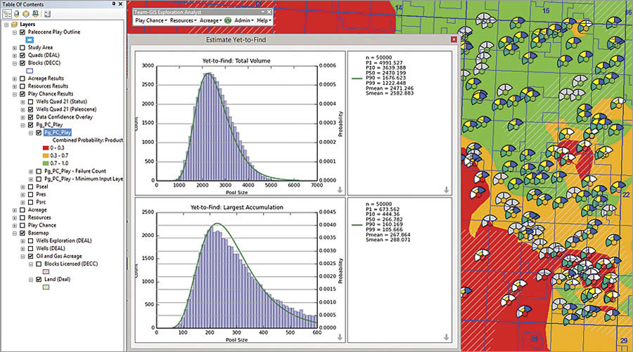
Drawing on a unique blend of geoscience and GIS expertise, Exprodat helps oil and gas companies improve their exploration and production processes by applying spatial analysis. Exprodat’s Exploration Analyst extension for ArcGIS simplifies assessments of potential petroleum systems, basins, and plays using play-based exploration tools in conjunction with in-house, vendor, and public domain data. This allows executives and geoscientists in oil and gas exploration to have more immediate access to results, analysis, and statistics, enabling them to stay on top of performance metrics. Learn more.

Enabling Enterprise-Wide GIS
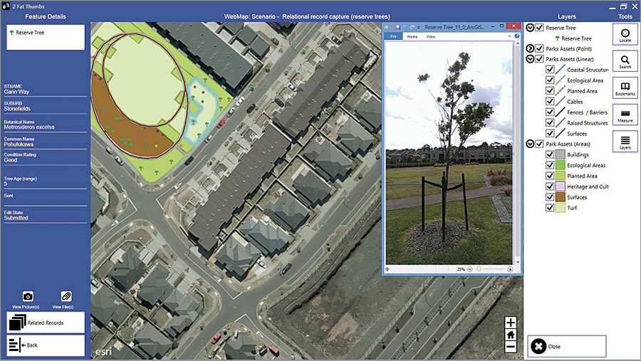
Working in a broad range of sectors, Geographic Business Solutions (GBS) helps users embrace and expand enterprise-wide GIS. GBS’s 2 Fat Thumbs solution lets knowledge workers tap into field-based data viewing, editing, and collection. Using Windows tablets or laptops, users can take data offline and into the field, make updates, and sync back to ArcGIS Online or Portal for ArcGIS when collection is complete. They can view, edit, and create related tables and records and also attach photos and files, download basemaps, and provision devices with prebuilt basemaps—all leading to more informed conclusions. Learn more.
Esri’s more than 2,000 global partners provide customer-focused, geoenabled solutions that span Esri’s core sectors and industries. Products and services range from configured apps and custom-built solutions to complete ArcGIS system implementations and content. To search and discover partners, solutions, and services that meet your needs, visit esri.com/partners.

