In Gilbert, Arizona, ArcGIS Hub Helps City Departments and Citizens Collaborate
Lean governments—that is, governments that eliminate wasted time and effort while still providing citizens with quality services—find better ways of doing things.
One measurement used to determine whether a government is lean or not is a city’s employee-to-population ratio. Despite its growing population, which the US Census Bureau estimated at 242,000 in 2017, Gilbert, Arizona, has managed to keep its employee-to-population ratio at one staff member per 193 residents. This is, in part, because the city’s Office of Digital Government helps the community do more with less.
The Office of Digital Government strives to connect residents with Gilbert’s local government, which is why the department decided to enhance the city’s existing geospatial platform by incorporating an information hub. With this, departments and citizens throughout Gilbert can access open data and maps via one data portal to gain a better understanding of what is happening in the community.
Since Gilbert was already deeply invested in the ArcGIS platform, the Office of Digital Government used ArcGIS Hub to open up its data to citizens. A capability of ArcGIS Online, ArcGIS Hub can be used to increase public awareness of the various services offered by the government, as well as any community projects that affect residents. This is exactly what Gilbert needed it for.

Now with the Gilbert Open Data Portal, residents have access to information that helps them make sense of local issues so they can aid in coming up with solutions. Moreover, citizens can see this data in a geographic context, which enables them to conduct more thorough research so they can clearly articulate their ideas and concerns when presenting them to government administrators.
An Organic Start to Open Data
In Arizona, cities are not required to make government data available. Some municipalities give a nod to transparency by providing information only to people who ask for it. But oftentimes, people think their governments are participating in transparency activities solely to comply with federal mandates that try to ensure that leaders are acting honestly.
Gilbert’s open data initiatives, however, began organically a couple years ago. That’s when the town hosted its first SPARK App League, a coding competition in which junior high and high school students try to make the best apps and games using local government data.
Gilbert’s Office of Digital Government, along with the town manager, quickly realized that it might be beneficial to release this same information to all residents.
“We don’t want our citizens to have to ask us for information about a government building that is already going up in their area,” said Derek Konofalski, a data and technology analyst in Gilbert’s Office of Digital Government. “We want them to know what’s going on from the start.”
Some departments were already exchanging data with outside agencies prior to even launching the open data hub. But the data they were sharing had typically been manually entered onto spreadsheets. Those departments immediately saw the value of being able to share open data via a digital platform. Additionally, GIS users within the city understood that having an information hub would simply make data sharing easier.
Getting Past the Skepticism
To begin the hub project, the Office of Digital Government hosted a committee meeting that included one representative from every city department. Each attendee had a bird’s-eye view of what kinds of data their departments had and how they used the information.
Some committee members were skeptical. They questioned the wisdom of making their data open and accessible internally and especially externally. Reluctant departments wanted to maintain ownership of their data and dole it out only when someone specifically requested it, which is what they had always done. They couldn’t imagine how a data portal might help them get their work done more efficiently.

The Office of Digital Government pointed out, however, that the data was not really theirs to stockpile but rather belonged to residents. The office also showed committee members how sharing data could make their work easier. In the end, all departments agreed to participate in the open data initiative.
To make the transition simple, everyone on the committee agreed that employees would use the GIS tools they already had access to and experience with to interact with open data. In addition, ArcGIS would be integrated into non-GIS users’ workflows in ways that were compatible with familiar processes.
“[We] definitely moved the needle,” said Konofalski. “I would say that staff are no longer resistant. The town’s departments are undergoing a culture shift from owning data to proactively thinking about data possibilities. Staff are learning to think holistically and considering what additional data they need to create a bigger picture. Furthermore, while deciding what data they need to present project proposals, they are also thinking about other types of data that will add greater context to their proposals.”
Now that open data is a widely accepted concept throughout the Town of Gilbert, more staff members, directors, and residents are requesting datasets. This means the city needs to prioritize them.
To do so, managers ask questions such as, Which existing projects and strategic initiatives would benefit from open data sharing? Is there an upcoming initiative that would gain from having published data to help residents better understand it? How might this data help citizens?
Alex, the Open Data Avatar
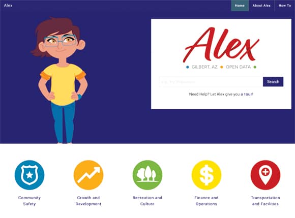
With managers thinking about their data in terms of how it can serve Gilbert’s citizens, the next step was to ensure that members of the public could find the data they need. To that end, the Office of Digital Government created Alex, an open data avatar that walks residents through various datasets and shows them exactly how the town is using this data to make decisions on behalf of residents.

Alex helps citizens connect the dots between datasets and visualize data in different ways. In the future, Alex will also integrate with platforms such as Facebook Messenger, Amazon Echo, and iOS and Android devices via Esri’s Sonar, a chat bot (that is currently an open-source project) that lets users ask questions about their communities via voice or text and then searches for answers by way of open data.
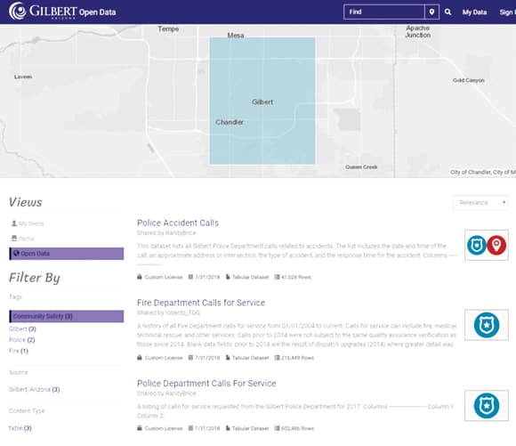
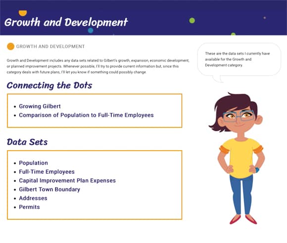
The Gilbert Open Data Portal also organizes datasets into categories. Users can select Community Safety, for example, and see datasets for all the calls made to the police department about accidents and all the service calls made to the fire department. The portal links to ArcGIS Online, where users can then add the data to a basemap to better visualize it. Other data categories include Growth and Development, Recreation and Culture, Finance and Operations, and Transportation and Facilities. Eventually, users will also be able to see datasets about Gilbert’s strategic initiatives, which are outlined in each year’s strategic plan.
Better Communication by Sharing More Information
Being able to prioritize projects based on residents’ needs has been a good way to introduce the open data initiative to the community. Citizens can see the open data that’s directly related to upcoming projects. Furthermore, if Alex appears on a sign or website, it means that Gilbert has provided additional data about the project on its open data site.
Given that initial efforts focused on residents rather than the government, increasing interdepartmental collaboration within the Town of Gilbert is phase two of its open data strategy and what the town is looking toward doing in the future.
“Once we have information that’s useful for residents, we’re going to start connecting the dots internally and making those connections public,” said Konofalski. “As connections to open data grow, city departments will better communicate and share information.”
Looking ahead, the Office of Digital Government plans to extend its data to the community in ways that are tangible. For instance, if citizens can easily find out—through open data and maps—that the city has filled the potholes they skirt every day or that it has fixed the streetlight on that dark corner, then they will be able to see that their government is indeed working to make everyone’s quality of life better.

