For the First Time in Its History, the Country Plans to Use Digital Tools to Prepare an Accurate Population Count
Based on 2006 census data, the United Nations (UN) estimates that 224 million people now live in Nigeria. According to this estimate, Nigeria is Africa’s third-most populous country and the sixth-most populous country in the world. The UN predicts that by 2050, Nigeria will be the third-most populous country in the world, behind only China and India.
Having a more accurate count of how many Nigerians there are—and a better understanding of where they live—is critical for many reasons, including implementing health and education plans and discovering where housing may be in short supply. However, it’s been nearly 18 years since Nigeria conducted an official census.
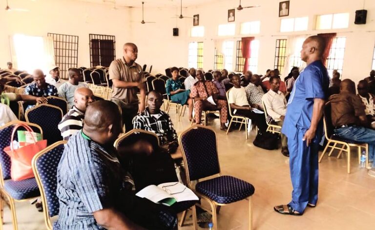
In 2006, Nigeria’s census information was collected and recorded on paper. Now, Nigeria is preparing for its first digital census. Nigeria’s National Population Commission (NPC), which conducts the census, has embraced GIS technology—in particular, ArcGIS Online, ArcGIS Pro, and ArcGIS Enterprise—as it prepares to create a digital record of the country’s population and housing. The census will be essential for eventually determining where to invest the country’s resources and provide services to the people who live there.
Former Nigerian president Muhammadu Buhari has said that the country’s inability to conduct a census since 2006 had created an “information vacuum,” as the data had become out-of-date. Originally scheduled to take place in March 2023—less than a month after a presidential election—the census has been postponed twice as the country continues to wait (as of press time) for its new president to declare when it will be conducted.
Using GIS for an Accurate Count
In the meantime, the NPC has spent years preparing, including conducting a trial census to test its operations. Its mission is focused on accurate and reliable data collection and analysis. That’s why the NPC turned to cutting-edge technology, said Foluke Yetunde Adebayo, coordinating director for the NPC’s GIS and data quality management.
“We developed a suite of customized geoprocessing tools designed to streamline and enhance critical aspects of our data management processes,” she said. The tools address several key functions in the NPC’s data management workflow, including data cleaning, editing, boundary delineation, geocoding, and data validation.
The NPC based the foundation of its mapping work on the Global Statistical Geospatial Framework, established by the UN.
“A fundamental aspect of this approach is the assignment of precise geospatial attributes to all new entities or records of persons, households, and buildings that are collected from the field,” Adebayo said. “These attributes are assigned based on the geographical location of the entities, enabling a robust geospatial dimension in the database.”
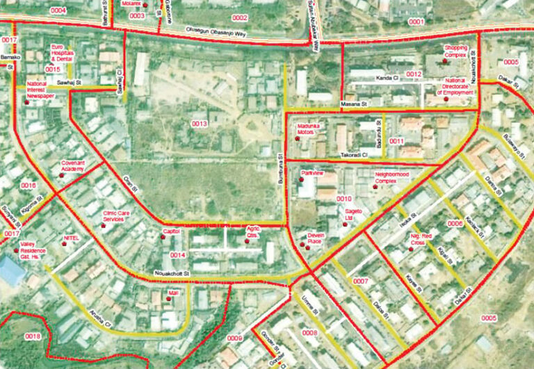
The NPC began introducing GIS into its census preparations in 2014 using ArcGIS technology. High-resolution satellite imagery was used to identify features on the ground, including buildings, roads, railways, water bodies, and boundaries of villages and towns. The identified features were then geocoded, resulting in a countrywide basemap. The basemap was then used to create enumeration areas, the geographic areas that census takers canvass.
Technology Plays a Critical Role in Preparations
ArcGIS Online serves as a central repository for the NPC’s large dataset, which includes millions of building records and the enumeration area frame. During an end-to-end test conducted in preparation for the census, ArcGIS Online also allowed for about 600,000 devices in the field to access the server simultaneously without any glitches or downtime, Adebayo said. This enabled workers to access and update data seamlessly, a critical aspect of a successful census operation.
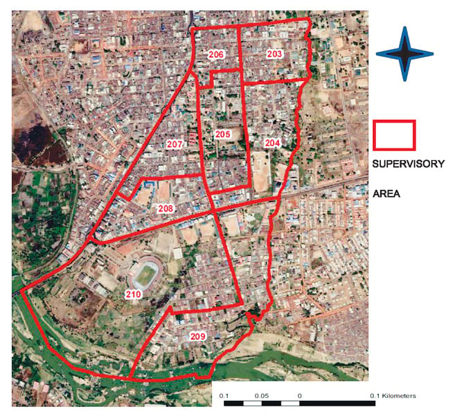
The NPC’s GIS analysis team used ArcGIS Pro—and ArcPy in particular—to clean the dataset, identify and correct spatial topology errors, create thematic maps, and geocode.
In ArcGIS Enterprise, the commission used ArcGIS Server, ArcGIS Data Store, and ArcGIS Enterprise portal for tests and the trial census. So far, ArcGIS Enterprise has managed the results of field data collection, including household listing datasets. The NPC has also used ArcGIS Enterprise to create census dashboards for data visualization within a secure organizational environment. Eventually, ArcGIS Enterprise will play a vital role in managing and visualizing the resultant census data, Adebayo said.
Once the census is underway, the data collected by field enumerators will be cross-referenced with initial mapping data. This comparison helps identify any significant changes or discrepancies between the two datasets. The validation process will be automated using custom scripts in ArcGIS Enterprise. The scripts are designed to evaluate whether the observed level of change in the data falls within the expected range or if it exceeds the predetermined threshold, which prompts further review.
The commission plans to use a hybrid census mapping methodology to count people living in remote locations and areas of conflict. Aided by high-resolution satellite imagery and neighborhood analysis theory, the NPC demarcated all conflict areas that may be inaccessible. If the areas ultimately can’t be accessed by enumerators during the census, the NPC plans to estimate populations by using modeling techniques developed by spatial data solutions company GRID3.
Looking Beyond the Census
Using the maps created for the census, the Nigerian Postal Service is developing a modern, digital postal code system. The NPC created custom tools in ArcGIS Pro to apply a set of well-defined rules and a coding system to meet the unique requirements of the project. “Its core function is to delineate the entire country into postcode areas, each of which was restricted to a size not exceeding two hectares [nearly five acres] and limited to containing no more than 99 postcode units,” Adebayo said.
In the future, the commission hopes to use geospatial artificial intelligence tools to assist in updating maps, processes, and estimates. “This will significantly enhance the accuracy, efficiency, and automation of geospatial data management and reduce the resources required to update the data,” Adebayo said.
The NPC also expects to develop more GIS tools and models for analysis. It won a Special Achievement in GIS Award at the 2022 Esri User Conference for its use of GIS technology in preparing for the census. By basing the census on a well-planned geospatial platform, the country will be able to standardize its procedures and more easily extract critical demographic data.

