Built to get fleets where they need to go, Navigator for ArcGIS is a voice-guided, turn-by-turn navigation app that works hand in hand with organizations’ GIS data.
A recent update to the app, available for iOS and Android devices, now brings more location intelligence from the ArcGIS platform directly to drivers and field crews. With easier access to routes, greater route control, and increased interaction with maps, field staff can confidently travel from one destination to the next and easily pause navigation or skip stops when necessary.

It’s Easier to Follow Optimized Routes
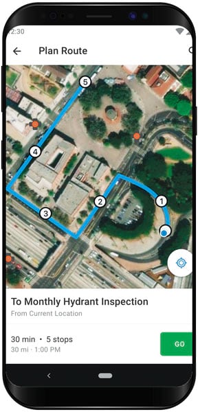
One of the most significant updates to Navigator is that operations managers and GIS specialists can now share route layers from ArcGIS Online and/or ArcGIS Enterprise directly with drivers in the app.
Previously, Navigator would take a list of stops and create an optimized route, which drivers would receive as a link in an email or a text. Before they could get going, they had to tap the link to open the route in Navigator. Now, however, the person who makes the route has more control over it and can specify the order of stops in a variety of ways. And drivers receive their fully optimized routes right in Navigator.
So how does this help? Let’s say a delivery service company has to make 100 stops in a day, and it employs five drivers. Which drivers should take which stops? What’s the most efficient and cost-effective way to make these deliveries? And how will the company tell the drivers where to go?
For starters, an operations manager or a GIS specialist can use routing tools in ArcGIS Online, ArcGIS Enterprise, or ArcGIS Pro to break those 100 stops into five optimized routes that allow each driver to complete his or her work in the most logical sequence. That person can then share those routes with the company’s drivers using ArcGIS Online or ArcGIS Enterprise, since Navigator users are connected to ArcGIS just like employees back in the office are.

Once a route is shared with a driver, it automatically loads to his or her device—no need to wait for a download. The driver can then select the route, which opens in Navigator, and get moving without having to worry about connectivity. Additionally, if a driver ends up in an area with no cell service, he or she can continue to follow the directions using Navigator because the app stores the route locally on the device.
Drivers Gain More Control over Assignments
Many Navigator users have been asking for the ability to pause multistop routes in the middle of the day without having their routes canceled and losing the rest of their stops. Now that’s possible! With the recent update, users can pause and resume routes in Navigator at any time, giving drivers the flexibility to manage unplanned disruptions.
Since drivers sometimes need to adjust their day on the fly, they can also now skip stops in Navigator by marking them as visited. That way, they can easily proceed to the following stop without risking that the remainder of the route will be canceled.
Users Can View More Information
With this release of Navigator, users can see and wield the GIS assets on their maps in ways they’ve never been able to before.
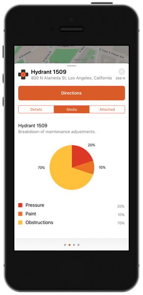
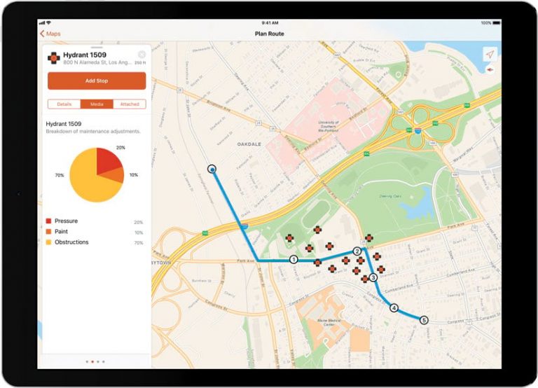
The app now allows full interaction with GIS features and assets. Users can see all the attribute information—including any media or attachments, like PDFs, photos, charts, or graphs—associated with individual features. This enables field crews to verify that they are at the right work site, and they can easily find the assets they were sent there to work on.

Esri has also rethought the Navigator interface to make it more consistent with other ArcGIS field operations apps. Now, it takes fewer taps to work with routes and route layers and, overall, is easier for drivers to use.
Get Started with Navigator for ArcGIS
Navigator is available for phones and tablets in the Google Play Store and Apple’s App Store. Using the app requires an ArcGIS account (any license level works, including the low-cost Viewer user type) and an assigned Navigator license.
To get a free trial or find out more information about pricing and licensing, visit the Navigator for ArcGIS home page.

