From the 1800s to the first half of the 20th century, passenger and freight trains along the New York, Ontario, and Western Railway (O&W) served as a great regional connector, linking New York’s Hudson Valley cities of Port Jervis and Kingston and countless communities along the way. Originally established as an industrial route to transport coal, this line traversed the region’s open fields, dense woods, and mountainous terrain, bringing people and goods to areas including the region’s famous Catskills resorts before it was discontinued in the late 1950s.
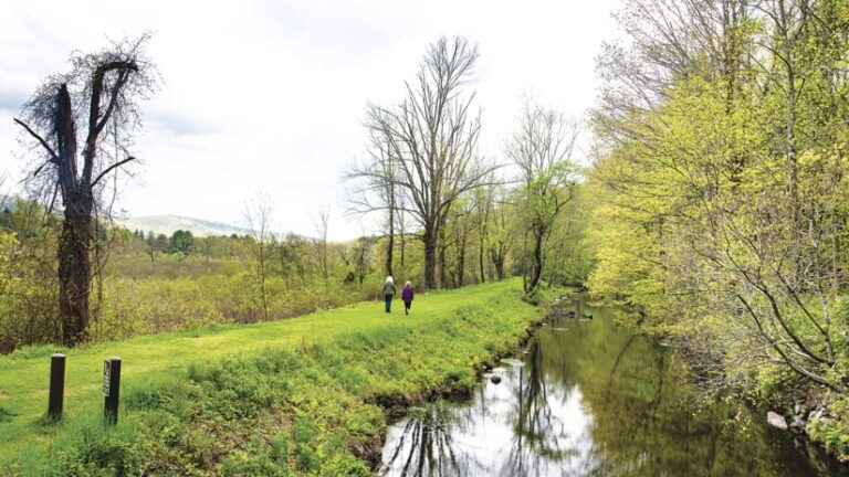
The Delaware and Hudson (D&H) Canal—spanning 108 miles, much of it alongside the O&W line—was hand-dug by workers in the 1820s to ship coal from Pennsylvania to markets along the Hudson River and in New York City. The D&H Canal was decommissioned when the O&W line was constructed, and as transportation infrastructure in the United States evolved toward more efficient railroads and trucking, the O&W rail line was also decommissioned. It ultimately fell into disrepair, leaving a fragmented footprint through the heart of the western Hudson Valley.
In recent years, however, the Open Space Institute (OSI), a national conservation nonprofit organization, and its partners have breathed new life into the lands that were once crossed by the O&W and the D&H Canal. OSI’s Growing Greenways plan aims to create, revitalize, and link over 250 miles of greenways, trails, and abandoned rail lines to form an interconnected network of public-use, off-road recreational trails. This trail system will connect cities and people, conserve local landscapes, and create new access to green space. The former O&W and D&H corridor, which extends through three counties and dozens of towns, will serve as the backbone of the entire Growing Greenways network.
“This is an exciting project for OSI and for the entire region. We heard from the majority of people that trails are something that the community really wants to have,” said Annie Bergelin, design and capital projects manager at OSI. “But for this project to succeed and truly benefit the region, it was critical to engage the community from the beginning and allow their input to inform the process.”
About half of the corridor is already in recreational use, but there are gaps spanning many municipalities. With a desire to involve local residents and groups in the planning process, OSI knew they could not solely rely on traditional methods of community engagement such as distributing flyers, hosting open houses, and attending events like fairs and festivals.
Instead, OSI used ArcGIS Experience Builder, ArcGIS Instant Apps, and ArcGIS Survey123 to modernize its outreach efforts to connect with as many people as possible. Staff at the organization created maps and surveys to coordinate with residents, local communities, businesses, government agencies, and environmental experts across the Hudson Valley.
Using GIS to Modernize Community Engagement Efforts
“At the start of this [project], we knew there was going to be a public survey, we knew there would be direct community input on the routing alternatives, and all of it would need to be put on a map,” said Julia Feller, senior GIS associate at OSI. “We wanted something easy to build, maintain, and update.”
With Esri partner Greenman-Pedersen, Inc. (GPI), an engineering consulting firm, OSI staff initiated a feasibility study, known as the O&W Rail Trail Corridor Study. Their aim was to fully involve local communities in developing a plan for the entire trail corridor, including ways to improve existing trail conditions, site access routes and trailheads, and connect to amenities like restaurants, museums, farmer’s markets, and historical locations.
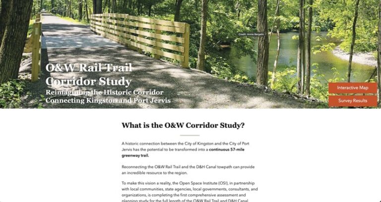
OSI’s GIS staff started with ArcGIS Experience Builder—a no-code, customizable app builder—to create a website featuring details about open houses and community events, frequently asked questions, information about the trails, and project resources. The site also contains interactive maps that show historical trail conditions and encourage public input.
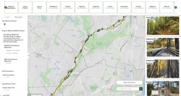
“Experience Builder was a central part of this project,” said Feller. “We wanted something simple and user-friendly for people accessing this at home or on their phone.”
As the project progressed, OSI and GPI staff developed trail routing alternatives as shapefiles, which the OSI team then integrated into ArcGIS Instant Apps. This intuitive mapping app—which has easy-to-use templates and configuration options for web app development—makes it easier for audiences to engage with interactive maps and data and provide input by reading about trail alternatives and entering a thumbs-up or thumbs-down.
“We have something that is living and breathing,” continued Feller. “We were able to split [the map] up by where people live, because people know their own neighborhood and are able to provide feedback on their own community.”
Mapping Apps Will Help Shape a Connected Trail System
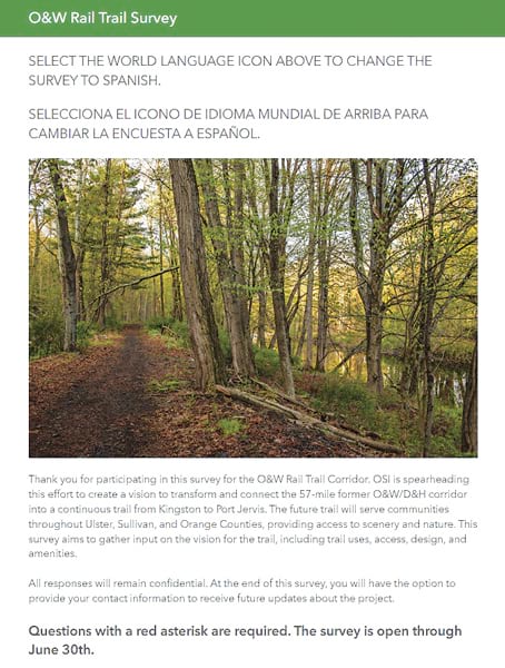
The first phase of the community engagement process used ArcGIS Survey123 to build and circulate a survey regarding the trail corridor. During OSI’s community survey, the app let residents and other stakeholders answer questions about how they use the current trail system and what they would like to see from a potential connected trail.
“Our team members were able to go in and look at the survey results as they came in,” said Feller. “We also translated the whole survey into Spanish using the beta translation feature, which saved a lot of time and made the survey accessible to a wider range of people.”
The OSI team found success in leveraging GIS to modernize its approach to community engagement. The online survey was live for three months during summer 2024 and was completed by more than 1,100 respondents. Happily, OSI learned that more than 98 percent of survey takers supported the O&W trail revitalization.
OSI knows that the trail build-out won’t happen quickly; a greenway corridor conversion is a multiyear project. But with GIS, staff have the tools in place to gather input and provide updates to the community.
“Experience Builder allows us to gather, maintain, and share data—both spatial and nonspatial—in a single, easily accessible online space,” said Neil Jordan, director of geospatial strategy at OSI. “We’ve found this to be an effective tool for efficiently communicating a significant amount of information, both internally and externally.”
In the future, OSI staff plan to use GIS to support their efforts in maintaining a strong network of community leaders along the O&W corridor and to generate donations for greenway projects. Feller emphasized the value of the organization’s new website as a powerful tool for building engagement and educating people about the work they are doing.
“We will continue to share the website in our communities so that people can see active projects and stay up to date as the Growing Greenways initiative progresses,” she said.
