GIS Hero
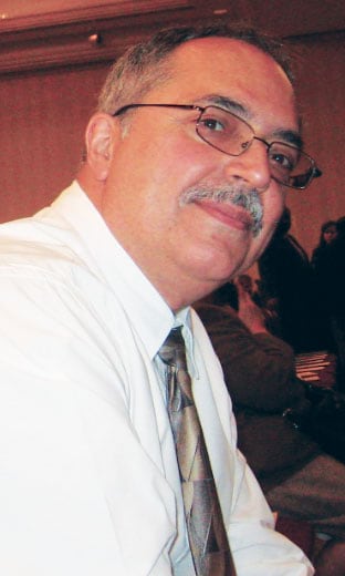
No piece of geography is too insignificant for Rudy Lopez. Nor is any person, project, problem, or city department, it seems.
The former director of geographic systems for the New York City Department of City Planning, who retired in December, didn’t ever let a known error go unfixed and strove to let no detail go unnoticed. Which is no small feat in a city with 8.5 million residents and 6,000 miles of streets.
“He cares about the geographic anomalies,” said Michele McInnes, senior adviser of IT strategic planning and administration at City Planning.
“We have a lot of very difficult geography in New York City,” said Thomas Costa, the manager of geographic research for City Planning. This includes a large number of duplicate and hyphenated addresses; stand-alone places, like the Empire State Building, that don’t require an address number; complexes with multiple nonaddressed places inside—such as Lincoln Center, which contains the Metropolitan Opera House; and an abundance of streets known by multiple names.

“Rudy’s perspective is, I know it’s only one street, but so what? It’s just as important as every other street,” added Costa.
Here’s why: If a man having a heart attack calls 911 from a new housing development and the dispatched emergency responders can’t find him because they don’t have that address, he could die. Or if that new supermarket’s opening gets delayed because of a discrepancy in the building’s address and it loses its funding, then the elderly woman down the street has to walk a dozen blocks instead of two to get her groceries.
“That was a big thing for me: the satisfaction that I was, in my own way, without any big fanfare, making a difference—that I was helping people,” said Lopez.

Born and raised in New York, Lopez dropped out of high school at 17 years old and joined the United States Air Force, where he got his GED. After being stationed in Wyoming, Lopez returned to the Bronx to attend Lehman College on the GI Bill. He started off as a math major, but then he took a required geography class.
“It was geography of the New York metropolitan area, […] and I thought, this is really interesting, finding out why all these people live here and why New York became what it is,” said Lopez.
He ended up taking another geography class, and before he knew it, he was halfway through the requirements to get a degree in geography. So he went for it, minoring in math instead.
Lopez figured he would teach—maybe social studies in a junior high or high school environment.
“But as I was ready to graduate, New York City was in a slight fiscal crisis, and they were not hiring any teachers. So what was I going to do with this degree?” he recalled. “One of the up-and-coming fields was city planning. So I thought, maybe I could use my geography skills in this.”
He ended up getting funded by the Comprehensive Employment and Training Act (CETA), a federal job training program that paid him minimum wage to work full time in public service for six months, to see what urban planning was about.
“They were able to place me at New York City Planning,” Lopez said. “This was in 1980, just after the April 1980 Census, and the department had a population group that was in the process of reviewing the initial results of the census here in New York. They needed some geographers.”
The department was trying to make sure that everyone in the city had been counted in the census, and in the correct location. Under the tutelage of more experienced colleagues, Lopez learned to analyze the census data—all without using GIS.
“There was no GIS in my department,” he said. “The GIS was really us making hand-colored maps of all the different datasets.”
Lopez reviewed the data on printouts and mapped it.
“As we were mapping the data, we would see, This doesn’t make sense. There’s no way that this particular block can only have three people when the city just built 100 units of housing and they’re occupied,” he said. “It was sort of like trying to put puzzle pieces in the right place. That’s what really turned me on to this field.”
Although Lopez’s federal funding dried up, City Planning kept him on. And he began working on geocoding.
“We had some very crude geocoding tools that were developed in the 1970s,” he recalled. “The IT director said…it would be good for the city if we could develop a geocoding tool that’s maintained by one agency but used by other agencies in the city.”
Little did Lopez know that this would become part of his legacy.
He was pulled into the project to look at the US Census Bureau’s Dual Independent Map Encoding (DIME) files, correct the geometry, and ensure that data from other city agencies matched those files.
Shortly after the project started, the State of New York audited the New York City Department of Education over student transportation subsidies. The audit found that the subsidies, distributed by the state, weren’t getting allocated fairly. Students who lived in the same building and went to the same school weren’t receiving the same transportation reimbursements. Part of the problem was that the Department of Education was using paper maps and rulers to determine the allocations.
The department had to figure out how to distribute these subsidies fairly. Lopez and his team ended up using the DIME file to do routing and determine which addresses, in relation to certain schools, were eligible for transportation subsidies. It took a year, but City Planning figured out how to calculate the shortest distance between each address and school, and subsequent subsidy allocations were based on these measurements.
Other city agencies soon got wind of this GIS thing and started requesting help. The Department of Transportation needed assistance geocoding its asset locations. The Department of Finance benefited from a 10-year project that Lopez led to digitize all one million tax lots in New York City. Under Lopez’s direction, City Planning digitized the New York City Board of Elections’ 5,000 or so electoral districts.
“I went from doing maps in pen and ink to doing this digitizing thing,” said Lopez. “The technology was interesting. […] I sort of got caught up in the field.”
His first 5 years at City Planning turned into 7. Then 15. Then 20. Finally, he’d had a full, 37-year career at the department.
In that time, Lopez extended his passion for GIS by bringing hundreds of geography and GIS students through his department as interns. Many of them got jobs at other city agencies or now run their own GIS shops.
“One of the things I really enjoyed was the interactions with young people,” he said. “It was sort of like I was doing teaching again.”
Lopez was also the driving force behind Geosupport, a highly customized geocoding system that allows users to process their inputs (addresses, intersections, tax lot identifiers, and more) and retrieve an array of related information from geographic files that City Planning maintains. And he was at the helm of modifying the city’s centerline files so they represented roadbeds in both single and double lines. These centerline files were so well put together, in fact, that the city chose City Planning’s map to be the primary map of New York City.
“That was a big win for City Planning in the GIS world of New York City,” said Costa. “Rudy was responsible for making sure we got that win.”
He was also instrumental in getting the city’s emergency services to use one system instead of maintaining their own maps.
“It took a while, but we were able to convince the agencies that it was best to use one system that could feed all the dispatching systems,” Lopez recalled.
Now, Lopez’s former department focuses more on maintaining the city’s geographic datasets rather than mapping them, since city agencies, educational institutions, and even the public have become savvier with the technology.
Which means that Lopez has essentially united New York City’s departments and agencies via GIS. That’s no small feat.
Read other articles in the GIS Heroes series.

