Confronted by the effects of a changing climate, there is renewed interest in boosting conservation and biodiversity efforts. Global endeavors, such as the 30×30 target of the Kunming-Montreal Global Biodiversity Framework to protect 30 percent of the planet by 2030, are part of this.
While targets like 30×30 receive widespread support, many countries fail to achieve their goals. This is, in part, because there is insufficient support for GIS and spatial planning at local levels. There is also often a disconnect between the geographic data that scientists produce and the information that is required to make on-the-ground decisions about conservation. Compounding these challenges is that fragmented administrative agencies are trying to achieve multiple planning goals simultaneously, such as improving biodiversity, reducing carbon emissions, and restoring habitats.
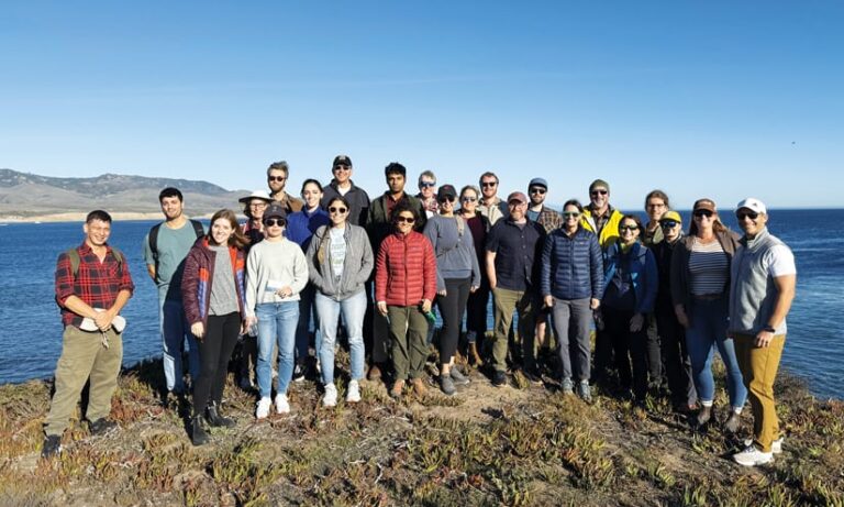
Over the past year, the Center for Spatial Studies and Data Science at the University of California, Santa Barbara (UCSB), has been collaborating with conservation organizations around the world to identify how the geographic approach can better support conservation goals. Based on these discussions, the center invited experts in conservation science and geographic information science (GIScience) to a two-day workshop in December in Santa Barbara, California, to identify research priorities and develop new programs.
During the workshop, a key theme emerged: Academics, conservationists, and GIS practitioners have a strong desire to expand partnerships and collaboration. This will decrease gaps in data and improve on-the-ground decision-making. But building sustainable relationships can be difficult, so the group came up with some ideas for how to foster more cooperation across disciplines.

Priorities for Building Strong Partnerships
On the one hand, GIScientists continually create the spatial data and methods that conservation organizations need to fill information gaps and support on-the-ground decision-making. On the other hand, conservationists have the nuanced, field-based understanding of human-environment interactions that GIScientists need to create beneficial technical innovations.
While the benefits of collaboration may be apparent, creating and sustaining partnerships requires resources and a shared understanding of problems. The GIS community has an established history of leading and supporting such collaborative efforts and is well positioned to serve as the catalyst for change.
Many GIS practitioners are already familiar with conservation issues because they work in fields that are deeply tied to environmental resource management, land-use planning, and marine science. This familiarity lowers barriers to collaboration. Similarly, many of the organizations that GIS professionals work for have the financial, computational, and human resources needed to overcome cost barriers. The longevity of these partnerships and, ultimately, the success of conservation efforts will also depend on training the next generation of GIScientists and conservationists in collaborative science.
Working together, participants at the two-day workshop identified the following three priorities for building strong partnerships that encourage collaboration in conservation science:
Teach Co-Design Principles Within GIScience Curriculum
For experts at the meeting, intentionally building co-design principles into GIScience is a top priority. Co-design is the process of collaboratively identifying research questions, data, methods, and solutions for addressing problems. In this context, co-design can ensure that the information and knowledge that academic work generates is both useful and usable by conservation decision-makers.
Successfully implementing co-design requires that all groups involved are intentionally engaged and that the project is iterative to facilitate feedback. Co-design is also typically best practiced when facilitated by someone trained in co-design. Unfortunately, all these requirements are often beyond the scope of traditional GIS curricula. The principles of co-design should not be taught as an additional skill; rather, they should be infused into the learning aims of GIS classes.
Capstone courses, for example, could have students partner with community groups to implement a co-design process to solve a real-world problem—iteratively defining questions and interpreting results. This type of integration would align GIScience curricula with modern problem-based pedagogies. It could also bring ethics into the foreground by giving students a chance to hear from the people and communities that are affected by the analysis and decisions made based on their findings.
Build Standard Protocols for Sharing Models and Data
Meeting participants said that a key barrier to knowledge exchange between the GIS and conservation communities is the lack of shared platforms. Conservationists don’t know where to look for accessible information about recent advances in geographic data collection, analytical techniques, and spatial modeling. Similarly, GIS practitioners and researchers have a hard time identifying meaningful advances in conservation practice and don’t know how to find partner organizations for collaborative work.
A top priority, then, needs to be establishing widely known platforms where GIScientists and conservationists can match up on project needs, exchange ideas, and share recent advances. Critically, these platforms will need to set up protocols for data and models. Standard protocols make models more transparent and comparable and can help inform decision-making on what methodologies to employ and how to use them appropriately. Meeting participants also stressed the need to develop dynamic decision-support models that can reliably predict how conservation decisions will impact outcomes.
Create a GIS Conservation Corps
In the Center for Spatial Studies and Data Science’s ongoing discussions with conservation organizations, every group has said that GIS staffing shortages have made it harder to meet and evaluate conservation goals. Shortages occur in spatial data collection, management, analysis, and visualization, as well as in local or organizational geospatial training. This usually happens because of limited funding—particularly when there is only funding for one GIS position. Lack of GIS staff is particularly acute in low-income areas, where smaller organizations often conduct important conservation work despite limited staffing, budgets, and access to GIS software or expertise. That said, even large conservation organizations need more support.
GIS companies and higher education institutions can address this problem. In colleges and universities around the world, students are eager to use their growing GIS skill sets to solve real-world problems and impact global issues. Working with conservation organizations, students can gain skills in co-design and GIS-based communication. Similarly, GIS companies are filled with technical and subject matter experts who are capable of supporting conservation efforts. The challenge is connecting and mobilizing these individuals. A programmatic effort to link these groups—with conservationists and community members working together to solve pressing problems—is needed.
What Can You Offer?
To make this exchange happen, partnerships and programs must be created to develop and implement co-design curriculum, build conservation-based protocols for GIS data and models, and produce programs that connect students and interns with conservation organizations.
While our team at UCSB is already working on this, now is a great time to think about what you and your organization can offer—and whether there are programs in your purview that could help apply the geographic approach to conservation. For more information or to share ideas, email spatial-admin@ucsb.edu.


