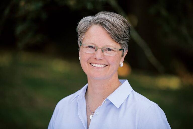
Whether, as a child, she was constructing stick forts or scaling trees while wearing her Sunday best, the natural forest around Breece Robertson’s hometown of Hamlet, North Carolina, kindled her early love for the sciences and ignited a lifelong curiosity to understand how the world works.
Robertson—the creator of the ParkScore database, which scores park accessibility, amenities, and quality—has helped countless people discover the natural beauty of their surroundings and inspired city officials to create more of those spaces.
Robertson’s adoration of science led her to pursue an undergraduate degree in exercise physiology and math at Lenoir-Rhyne University, in North Carolina, with the goal of becoming a doctor. Before plunging into medical school, she and her dog, Maggie, set out on a yearlong trip across the western United States. While traveling through various national parks and camping in different communities, Robertson observed the impacts of urban growth and development as well as oil and gas exploration on natural spaces. This inspired Robertson to redirect her career path toward conserving natural areas. “I thought there had to be a better way to balance growth and sustainability that was more resilient for communities and nature,” she said.

Eager to combine her passion for nature and people, Robertson returned to North Carolina to get a master’s degree in geography and planning from Appalachian State University. During her master’s studies, she learned about GIS with ArcInfo 6.0. She found it difficult to make maps at first because everything had to be coded. “But once I got the hang of it, it was incredible to see what information I could get by overlaying data layers and running a simple buffer analysis,” said Robertson. “I got hooked and just never looked back.”
After graduating, Robertson began her GIS career as an instructor for Allpoints GIS, teaching US Forest Service employees how to use the company’s technology. She also taught local governments how to use scenario-planning software to make better decisions about people and conservation. Though she enjoyed teaching others to use GIS, she wanted to do more. During this time, she taught staff from the Trust for Public Land to use GIS for public planning.
This was when Robertson found her calling. “I thought it was interesting at the time that an organization whose business was land conservation didn’t have GIS at that point,” she said. “I saw an opportunity to grow a geospatial program for [the organization].”
A year later, Robertson said, she found herself working as a consultant for the Trust for Public Land as the “lone girl in the back room making maps.” During the next 18 years, she built out the Trust for Public Land’s geospatial program to include research, planning, and geospatial capabilities to support the organization’s mission. Robertson grew her team to 20 people plus consultants scattered across the United States, all working together to help communities site parks and develop comprehensive plans with conservation in mind.
One key project for Robertson was working with New York City school districts and communities to convert parking lots into green schoolyards and public parks. These parks can absorb storm water and were designed to include local gardens to teach children about planting food, along with providing playground structures and other recreation amenities. “Green schoolyards are really inspiring to me because the schoolkids and the community came together to design them,” Robertson said.
Robertson received a Special Achievement in GIS Award from Esri in 2006 and the Esri Making a Difference Award in 2012 for her work at the Trust for Public Land. But she is proudest of building ParkScore, an index that compares US park systems and ranks parks in the largest 100 US cities. Launched in 2012, ParkScore uses GIS to map parks’ pedestrian access, acreage, and facilities, along with cities’ average spending on parks per year. It then identifies where people have good access to a park and where they don’t.
Robertson recalled that, while attending a recent National Recreation and Park Association conference, the mayor of Dallas, Texas, shared in his keynote presentation how ParkScore enabled the city to improve each year based on the metrics provided. “That made me feel so good, knowing that ParkScore is still inspiring communities to really care about their ranking and improving access to parks,” Robertson said.
After working for the Trust for Public Land, Robertson joined the Lincoln Institute of Land Policy in 2020. The organization studies and teaches about how land is used, managed, and governed, with the goal of promoting fairness and sustainability in land policies. There, Robertson helped the organization launch the Center for Geospatial Solutions. The center aims to use geospatial data and technologies to inform land, water, and climate policy.
In 2022, Robertson took on a new challenge as chief impact officer at One Tree Planted, a global reforestation organization. There, she helped improve that organization’s monitoring, reporting, and verification systems and develop GIS-based impact assessment tools.
More recently, Robertson has been volunteering for boards and committees. She currently serves on the National Park Service’s Advisory Board and the National Recreation and Park Association Board, and she was recently appointed to the National Geospatial Advisory Committee. “It’s been exciting to do this work through appointments to bring GIS data and technology to the table where a lot of these organizations haven’t had someone from our sector who brings geospatial thinking before,” Robertson said.
With a career spanning more than 25 years, Robertson has seen firsthand the creative ways that communities have used GIS to advance conservation goals. “It’s been gratifying to me throughout my career to see people using geospatial data and applications to make good decisions that balance the needs of people and nature,” she said.
Robertson has found her career to be incredibly rewarding, leading to expanded opportunities as a leader and innovator. In 2019, her first book, Protecting the Places We Love: Conservation Strategies for Entrusted Lands and Parks, was published by Esri Press. In the book, Robertson shares her experiences, case studies, and resources and offers step-by-step guidance for conservation leaders who want to use GIS to create meaningful change.
“I was really excited to hear from people that this book helped make GIS more accessible to them,” Robertson said, adding that the book was a great opportunity to “reflect on my career in GIS and sort through those touchpoints that catapulted the work that we are collectively doing in conservation.” In that spirit, the book reflects conservation efforts around the globe.
Robertson is optimistic about conservation, believing that advancements in ArcGIS Hub, ArcGIS Experience Builder, remote sensing, artificial intelligence, and machine learning are making GIS more accessible to communities. This provides the opportunity for people to share their stories and use innovation to protect the places they cherish. “While there’s been trepidation with these technologies, I feel like the storytelling and visualization aspects in GIS have leveled the playing field for everyone to use technology to do something about the complex issues we face today,” Robertson said. “It’s inspiring.”

