Across the United States, city planners are looking for ways to create more housing. This is particularly true in Houston, Texas. At 665 square miles (1,722 kilometers), Houston is the ninth-most expansive city in the United States. For land development, that’s a lot of area to manage.

Houston has taken a different approach to land development from the traditional zoning ordinances that many other US cities use. Typically, cities divide their land into zones that dictate how each area can be developed. But Houston—the United States’ fourth-most populous city, according to the 2020 census—relies on codes that address how property can be subdivided. This provides greater flexibility for managing housing and urban growth in this large, progressive city. It is also one of the reasons that the City of Houston became an avid user of geospatial technology in the early 1990s. In fact, Houston’s Housing and Community Development Department (HCD) was one of the first departments at the city to implement it.
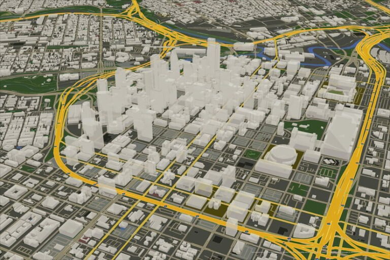
Now, city staff members, residents, and other stakeholders are demanding more immersive experiences related to urban planning and development. Moving from 2D GIS to 3D GIS is one way to accomplish this. So the HCD GIS team has implemented ArcGIS Urban—3D scenario-planning software that merges a digital copy of the built environment with web-based interactive zoning analysis and planning tools—to create models and scenarios where large-tract developments are proposed.
Analyzing the Potential Impacts of Proposed Developments
In 2017, the City of Houston created the Houston Complete Communities program, which focuses on uplifting 10 historically underserved and underresourced neighborhoods. The program promotes and facilitates community-identified projects that address service needs for residents and businesses.
HCD’s role in this initiative is to record any new housing being constructed and any community development activities that are being implemented, according to HCD’s former GIS supervisor Arturo Tovar, who worked on the project.
“[HCD uses] ArcGIS Urban to help the city analyze and visualize the housing scenarios that are under consideration,” Tovar said.

Using Urban, HCD GIS staff help inform decision-makers at the City of Houston about how proposed tract housing will impact nearby communities and other parts of the city. For example, Houston’s Affordable Home Development Program employs the data to analyze the social and financial effects of proposed developments. By using the Housing Affordability Index layer, analysts can identify where housing is most or least affordable in Houston, based on US Census Bureau data. This helps HCD because, for eligible projects, the initiative can provide funding to developers to make it possible for them to sell homes at relatively low prices.
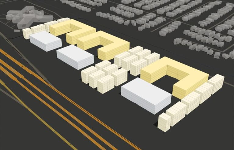
“ArcGIS Urban is used to examine viable options for low-cost housing development by applying different housing types and urban design principles to proposed locations,” Tovar said. “[The team] first [performs] a suitability analysis using ArcGIS Pro to identify the best locations for a large-tract development. Once these areas are identified, AutoCAD is used for the site plan design based on the city’s ordinances and regulations, such as flood management and planning and design.”
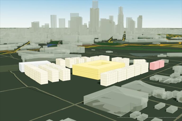
Next, the team designs different housing scenarios and related landscapes, such as various mixes of single-family townhouses, commercial buildings, and multifamily apartment complexes. Staff then export these design scenarios to ArcGIS Pro and a 3D visualization rendering engine that uses SketchUp and V-Ray. Attributes are identified in the resultant GIS layers, which are then published to ArcGIS Online.
“Finally, the scenarios are evaluated with ArcGIS Urban using different metrics, including a demographic analysis, to select the one that best fits the city’s criteria for community engagement and economic viability,” Tovar said.
Once a housing location and scenario have been selected, the city can acquire the land if it hasn’t already been purchased. Then the city begins accepting applications from developers that meet Houston’s Affordable Home Development Program requirements.

More ArcGIS Projects in Houston
The HCD GIS team plans to increase the number of housing metrics in Urban so that the department can perform more detailed feasibility analyses. The team also plans to expand the use of Urban to other city departments, such as planning.
Additionally, HCD has developed a digital twin of Houston. This has helped the GIS team communicate the details of complex projects to those who are unfamiliar with GIS and have difficulty visualizing specific scenarios.
“As soon as our projects were introduced in the context of the city’s digital twin, the nontechnical audience’s perspective and engagement changed dramatically from previous presentations,” Tovar said. “They were more involved with what was being presented, and they had greater clarity on the project’s location, scope, and impact. The digital twin and ArcGIS Urban are huge milestones in [HCD’s] portfolio.”

