Race and place come together in various ways that generate different outcomes for different people. Too often, this results in racial inequity and social injustice. And none of this happens solely at one moment in time. These outcomes are a consequence of decades, generations, and centuries of policies, practices, assumptions, and actions.
Understanding entrenched inequities and injustices is complex, and figuring out what to do is a daunting endeavor. But GIS is technology that, at its fundamental level, breaks down complexities and reveals patterns over space and time, which can go a long way toward guiding action. To help users leverage the full power of location intelligence to address issues that revolve around race, Esri has launched a new racial equity initiative.
“We have users in every sector that have expressed interest in using GIS to tackle racial equity and social justice—and that’s not to mention our users who have already been doing this work,” said Clinton Johnson, a solution architect at Esri and the racial equity team lead. “Though our efforts in this space really started about two years ago, formalizing this racial equity initiative demonstrates that Esri is stepping into those conversations more intentionally, building solutions and providing resources to help users in the United States and around the world take on long-persisting racial disparities.”
“Similar to how GIS is synonymous with environmentalism and conservation and how the technology is critical to that movement, we want GIS to be synonymous with social justice,” said Margot Bordne, an account manager at Esri who is part of the racial equity team. “There are so many examples of this already. Many of our users, from governments to nonprofits, are doing pioneering work when it comes to addressing systemic racism and the myriad problems that stem from that. So we’re listening to their needs, learning, and working with them to make sure everything we do is grounded in best practices for racial equity.”
Much of the initiative has so far focused on looking at the range of tools Esri already has available and developing a racial equity workflow that fuses well-established best practices with GIS and location intelligence.
“The four major elements of the workflow are to automate and spatially enhance community engagement, map and analyze inequities, operationalize racial equity best practices, and manage the performance of racial justice initiatives to achieve more equitable outcomes,” said Johnson. “And this cycle revolves around engaging with various stakeholders, from those who experience inequities to community organizations, partners, and leaders who are rallying together and helping to address these challenges.”
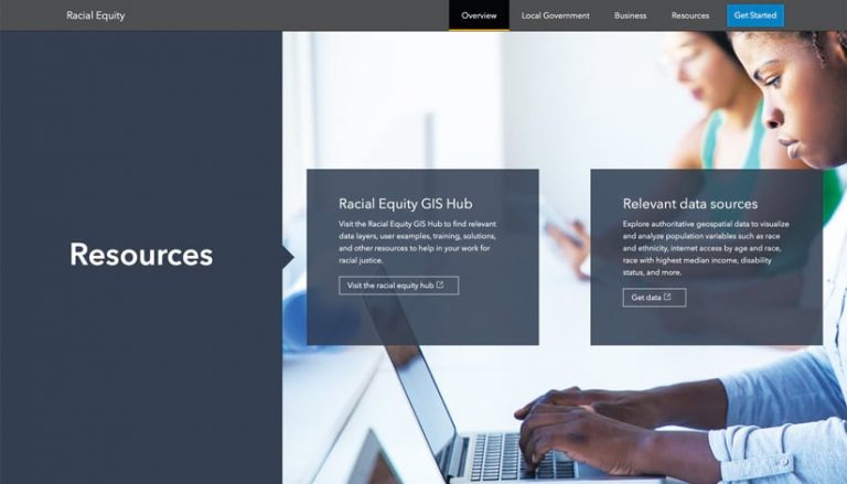
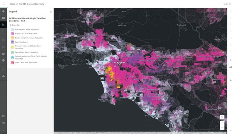
Esri’s core technology, such as ArcGIS Pro and ArcGIS Online, is key to visualizing racial disparities. Organizations can use their own data or curated datasets that Esri is making easily accessible through its Racial Equity GIS Hub. When combined with other apps and extensions, such as ArcGIS Insights, ArcGIS Hub, ArcGIS Dashboards, and ArcGIS StoryMaps, users can explore practical ways to create more equitable opportunities and services for people.
“If you’re trying to figure out where to place a new hospital or grocery store, you can use Esri tools to apply a racial equity lens to the site selection process,” Johnson explained. “This can help you ask questions like, Will this create benefits for communities of color or more barriers?”
Using ArcGIS Survey123, for example, an organization can better understand the needs of the community it serves. With ArcGIS Hub, it can more easily engage with both internal and external stakeholders. ArcGIS Mission and other workforce enablement tools from Esri can help the organization automate and track teams that are gathering information or taking action out in the community. ArcGIS Dashboards enables the organization to show, very clearly, where inequities are and how it is actually working to enact change in those places. And ArcGIS StoryMaps is a great way for the organization to formulate and share narratives that revolve around racial equity and social justice.
Esri has been adding other capabilities to its technology as well. The Racial Equity Community Outreach solution leverages ArcGIS Online, Hub, Survey123, and Dashboards to help government agencies communicate their progress on defined racial equity initiatives. The solution makes it easy to set up a hub site to promote racial equity programs, build surveys to collect information about community sentiments, and create a dashboard that shows workforce diversity metrics. The new Police Transparency solution is geared toward helping law enforcement agencies rebuild the trust of the communities they serve and increase transparency. It includes a crime stats dashboard and a public crime map; use-of-force dashboards that can be broken down into categories such as race and ethnicity, neighborhood, or officer; a police interaction survey; and a community safety and policing satisfaction form.
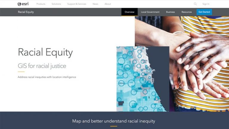
Additionally, Esri is making learn lessons available on the Racial Equity GIS Hub to help users build GIS skills aimed specifically at strengthening racial equity and social justice.
“These learn lessons can help people get familiar with different workflows and racial equity topics that GIS can have an impact on,” said Bordne.
Several lessons are rooted in health topics, such as mapping breast cancer cases by ethnicity and showing which US counties need to improve newborns’ health outcomes. Forthcoming learn lessons will likely explore activism, police reform, the digital divide, and food access.
Esri’s racial equity team is also looking to develop solutions that help organizations build a pipeline of new job candidates by connecting them with institutions that serve underrepresented populations, including historically Black colleges and universities (HBCUs); tribal colleges and universities (TCUs), and women’s colleges. And because businesses that are owned by Black, Indigenous, and People of Color (BIPOC) face additional challenges from systemic and structural racism that can make it difficult to thrive, Esri plans to eventually release some tools to help promote and support BIPOC-owned ventures.
While in most cases, racial inequities are weaved into long-standing systems and structures, there are moments when people’s awareness of these social injustices peaks and public outcry demands swift action.
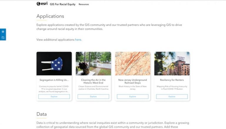
“In these moments, we want our users to be able to act without having to figure out all the logistics,” said Johnson. “So we are tapping into a mechanism that we already have available—the Esri Disaster Response Program (DRP)—to support customers when they need to respond to a situation quickly.”
That is not to say that racial inequity is separate from other disasters, such as the coronavirus disease 2019 (COVID-19) pandemic, hurricanes, or wildfires, because crises like those repeatedly underscore the disparities that communities of color often face. It’s just another example of how applying a racial equity lens to a geographically based emergency can help organizations respond more effectively.
“This work that we’re doing is important in a different way than anything else we’ve ever focused on at Esri,” said Johnson. “We are responding to a disaster, really, and it’s one that’s entwined with so many other issues, from climate change and public health to education and the workplace. Racial equity and social justice are central to so much of what we do, so we want to provide solutions to help Esri customers around the world who are stepping in and taking action.”
