Esri Technology Helps Colorado Ski Resort Conduct Searches
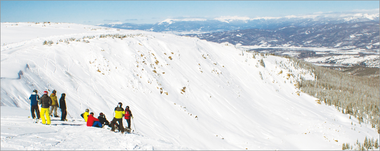
A frantic cell phone call from a snowboarder came into Colorado’s Winter Park Ski Resort in the Rocky Mountains northwest of Denver at 4:00 p.m. on Valentine’s Day, 2012. The 20-year-old man left the boundary of the ski resort and went into an area known as the side country—ungroomed terrain with deep powder, fallen trees, and other hazards. He was disoriented and uncertain of his location, so he called for help.
The first two ski patrol teams dispatched to find him came up empty-handed. The area he was lost in covered more than 250 acres, and with night looming and temperatures falling, time was of the essence.

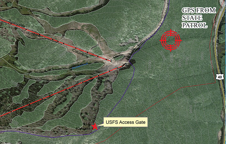
While a larger-scale search was organized with 40 members of the Winter Park Professional Ski Patrol, Grand County law enforcement agencies ascertained the lost man’s GPS location. Law enforcement officers determined the phone’s latitude and longitude via GPS and then sent the coordinates to the GIS analysts at Winter Park. The snowboarder’s location was then mapped using ArcGIS for Desktop software.
Once Winter Park staff members could see the area where the snowboarder was located on the map, Lloyd Lochridge, a GIS technician and ski patrol member at Winter Park, dispatched his rescue crew to the exact spot where the snowboarder was lost. By 6:30 p.m., the rescue team had found the snowboarder. The man was cold, but hypothermia hadn’t set in, and he was healthy enough to be guided out under his own power instead of being airlifted. Lochridge continued to track his team’s progress via ArcGIS Tracking Analyst software and lead them out of the area safely.

“Watching them move in real time on the map, I could tell them, ‘head east and south, or you’ll end up in the creek again,'” says Lochridge. “This is nasty terrain—downed timber and steep drops. Using GPS and GIS technology, we were able to find this man in only 25 minutes, instead of five or six hours. Lost in these types of conditions, this was truly a lifesaving situation.”
Real-Time Tracking Makes the Slopes Safer
Ski patrol members literally operate in the dark: they are sent into woods wearing headlamps, with nothing more than radios for communication. Given the circumstances, even the savviest outdoorsmen might have trouble knowing where they are when they are on the slopes or in the woods.
Today the whereabouts of Winter Park employees, such as ski patrol members and trail groomers, are tracked through the resort’s Motorola radio system. Signals from the vehicles’ radios provide their locations, and these are mapped as dots in ArcGIS for Desktop using the ArcGIS Tracking Analyst extension. This improves operational safety, providing an up-to-date view of where members of the ski patrol members are located at any given time.
The dispatcher now can look at a map and watch in real time as patrol search teams deploy. The dispatcher can use the map to help guide the ski patrol members to various locations and ensure they return safely.
The ability to track the staff out on the mountainside has improved operations, especially during night searches for lost skiers and snowboarders. Being able to map the locations of either people being rescued or the team rescuing them has significantly reduced the amount of time spent on these operations.
“This is a reduction in manpower [of about] 150 percent,” says Lochridge. “But most importantly, it means we can get to people more quickly and ensure they are brought off the mountain to safety.”
Tracking helps during the daytime as well. If the resort is short-handed, the dispatcher can see what staff members are out in the field and guide them accordingly to make sure the mountain is adequately covered (ski patrol members do not find themselves bunched up in only one area of the resort) in case of an emergency.
Real-time tracking has helped the resort open up more of its extreme terrain to skiers and snowboarders. “This is very valuable information to us,” saya Lochridge. “Not all [ski] patrol members are well acquainted with the newly opened areas. Tracking where ski patrol and resort visitors are means we can open up the area and ensure everyone’s safety because the dispatcher can keep an eye on them.”
For more information, contact Lloyd Lochridge.
See also “Delivering an Alpine High“.

