Climate change, population growth, and infrastructure limitations are some of the factors that pose challenges in the water sector. Maynilad Water Services, Inc., the largest private water concessionaire in the Philippines in terms of customer base, is no stranger to these kinds of hurdles.
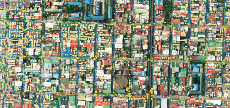
Since it was reprivatized under new owners in 2007, the company has invested heavily in infrastructure enhancements that have dramatically improved water and wastewater services for millions of customers. It continues to keep pace with the demands of the industry through innovation and technology.
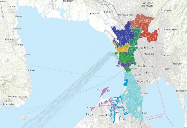
Now serving almost 10 million customers in the west zone of Metro Manila and portions of Cavite province, Maynilad’s dramatic transformation from what its lead GIS engineer, Juan Paulo De Leon, called a “financially crippled, bureaucratic utility” to a “dynamic, customer-focused organization” is due in great part to enhanced operational efficiency generated by the full utilization of its GIS.
Among the GIS-related initiatives of Maynilad is the development of a custom web map for its Anti-Illegal Unit, which investigates illegal water connections. With the help of this tool, the unit’s overall efficiency increased by 300 percent, enabling the company to recover the equivalent of US$410,000 in commercial losses.
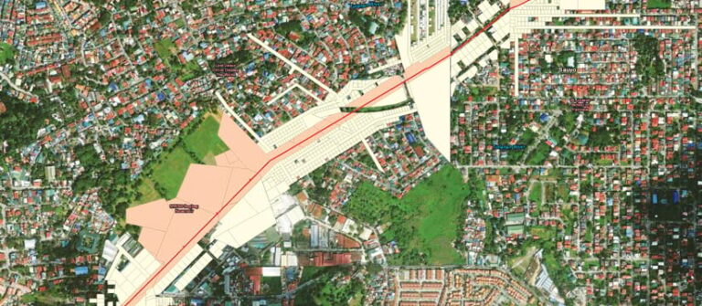
“The dynamic digital maps, dashboards, and data analysis capabilities that GIS provides are still mostly unfamiliar in the Philippines,” said De Leon. “Since we expanded the Maynilad enterprise-wide use of GIS in 2011, we have generated major improvements in our service delivery, prompting us to share the benefits of this technology for other water utilities.”
Enhancing Water Security
When the new Maynilad owners took over, the goal was to improve water security overall and enhance customer satisfaction. To help accomplish this, the GIS team needed a more accurate and up-to-date record of its network.
Improving the record included identifying the location of waterlines and other components, as well as verifying that only paying customers were connected. Having a better understanding of the network improved the company’s efficiency in responding to service calls from customers and performing system maintenance. Reliable data also helped reduce significant commercial losses from fraud.
Internally, Maynilad’s GIS team consolidated records from multiple databases to make it easier for response teams to investigate and resolve problems that disrupt services. Further, Maynilad’s team sees automation as the most efficient way to create standard, repeatable processes for collecting and organizing network data and making it available to stakeholders.
Technology Brings a Turning Point
ArcGIS Pro and complementary Esri products gave Maynilad’s GIS team the solutions needed to continually monitor the network while also investigating and resolving problems more quickly. Early on, the team got started integrating network information from multiple databases into ArcGIS Pro. This created a single system of record and updated network maps for daily operations. The maps, enhanced with ArcGIS Experience Builder, show the location of waterlines and other network components above- and belowground. This eliminated the time-consuming processes of requesting maps, plotting and printing the documents, and carrying them into the field to validate information.
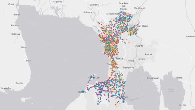
With an accurate inventory of assets, planners can investigate the source of problems more often, and they can do it from the office rather than send someone to the field. Reliable and up-to-date customer information also makes it easier to spot unauthorized water connections.
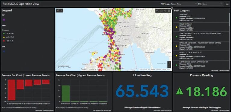
Moreover, a dashboard built with ArcGIS Dashboards integrates service indicator maps to give workers near real-time awareness of field operations. The dashboard lets internal teams see the location and status of service requests and outages, making it easier to prioritize responses.
“GIS is becoming the backbone of our operation,” De Leon said.
Modernization Opens the Door to a Different Future
A single, up-to-date system of record gave the Maynilad GIS team a greater understanding of the existing network and more dependable data for doing maintenance and upgrades. This has helped the utility improve the reliability of the water system. As a result, new customers get connected faster, and existing customers get repairs done more quickly. Additionally, the GIS team can easily evaluate and report on network performance.
Moving from data on spreadsheets to digital maps and dashboards that offer up-to-date information about network status has helped stakeholders understand the power of GIS. The utility’s asset management team is now using data generated by the GIS team to help identify deteriorating pipes to include in future maintenance plans. Teams focused on hydraulic modeling and water pressure also now rely on GIS data as they make decisions about water distribution.
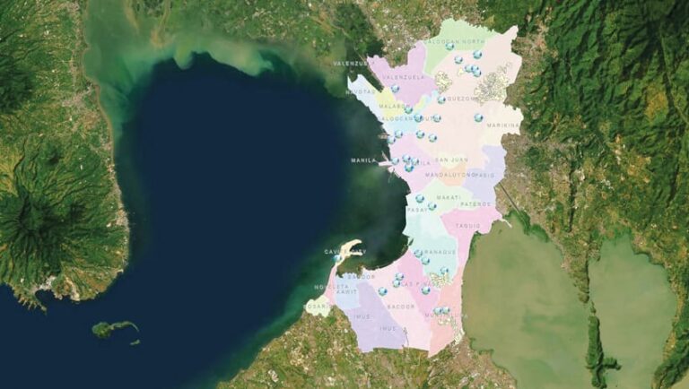
An unexpected benefit of GIS-based automations is that De Leon’s team has gained time to focus on system improvements. Programmers are optimizing GIS apps, while others are mining network data to identify patterns that point to risks and opportunities that other teams should know about. As the scope of work of the GIS team evolves, its influence grows within the organization and the GIS industry.
“The work of the GIS team saves lives and sustains citizens and businesses in and around Metro Manila,” said De Leon. “It’s really part of nation building. That’s why it’s important that we plan and do it well.”

