This article is part of an ongoing series honoring individuals who have made a difference in the world by applying a GIS solution to conservation or community challenges. Since these unique individuals have been selected for their innovations or special achievements, the series is appropriately named GIS Heroes. Esri recognizes Tom McConnell as a GIS hero.

In 1987, Tom McConnell, Operations Research manager with the Ford Motor Company, was in Los Angeles, California, on a business trip. Late one Sunday evening, he was reading a local newspaper and noticed an article about Esri and the User Conference it would soon be staging. McConnell impulsively called the company telephone number, hoping to get a recorded message providing details about the conference. It was 11:00 p.m., and Jack Dangermond, Esri president, answered the telephone and immediately urged McConnell to attend the conference, which he did. Thus began McConnell’s second career—GIS evangelist.
Shortly thereafter, McConnell encouraged fellow Detroit resident and high school science teacher Randy Raymond to apply for an Esri education license for his school. Later, they worked together to find paid internship opportunities for Raymond’s urban environmental studies class, convincing the marketing research manager at Ford to fund a class project analyzing the future automotive market potential in India, China, and Brazil.
After nearly 25 years at Ford, McConnell began looking for new challenges. “I moved to Tucson and joined a GIS consulting firm, Global Systems Modeling Ltd., and worked as a consultant and marketing manager for several years,” says McConnell. “When I decided to reduce my work hours, I switched to teaching GIS as an Esri authorized instructor.”
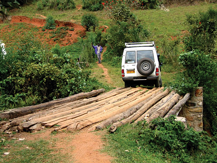
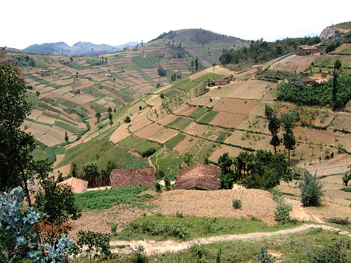
As a GIS educator, McConnell’s interests soon turned to volunteer work, particularly in Africa. In 2003, the International Executive Service Corps (IESC) supported his trip to Rwanda, where McConnell worked with others to create a site selection model for coffee washing stations. Ninety percent of Rwanda’s population is involved in agriculture, and coffee is one of its primary crops. The next year, he returned to Rwanda under IESC sponsorship to develop a cluster analysis exploring regional marketing designations for coffee branding.
In 2007, Dangermond was invited to visit Rwanda and subsequently awarded the nation a countrywide education site license from Esri. McConnell returned to Rwanda once again, this time joining Stefan Kappeler and Martina Forster of Esri Deutschland GmbH to negotiate a memorandum of understanding with the country’s Ministry of Education to establish a GIS program for all 1,500 secondary schools in the country. He also worked with staff at the Centre for GIS and Remote Sensing at the National University of Rwanda (CGIS-NUR) to develop an implementation plan for the site license. CGIS-NUR later received a Special Achievement in GIS Award for this work, which was presented at the Esri International User Conference.
“I believe there is a great need for educational research to support the use of GIS in schools,” says McConnell. “This is a substantial challenge because few teachers have the resources to even begin using GIS, much less the opportunity and skills to conduct the kind of randomized controlled experiments that can quantify the value of GIS. This is an area where our universities should be investing, but that means funding is needed, and the only likely source is federal, which is currently focused elsewhere.”
McConnell believes that GIS can enhance K–12 science education by helping teachers explain concepts that are challenging for their students. “The exploration should be left to the student as much as possible so inquiry-based learning is enabled,” says McConnell. “Experimentation should be encouraged, but sound science is essential. There should be an emphasis on data exploration, hypothesis formation, prediction, testing, and analysis.”
McConnell sees many applications in biology in which GIS could play a critical part of K–12 instruction, including habitat studies, species distribution, and conservation planning. “It would be fun to look at evolutionary biodiversity in terms of spatial isolating mechanisms such as sky islands, seas, and mountain ranges,” says McConnell. “I think neglected subjects that would benefit from including GIS as part of the instruction are in sociology and history. The availability of good online data and geospatial statistical tools looks highly promising as a way to change that. Story maps provide an excellent template for structuring student work.”
Looking to the future, McConnell indicates that GIS will play an important role in preparing students for a new and different world. “The key skills needed for success will increasingly depend on problem definition, problem solving, and the ability to manage these two,” says McConnell. “GIS is superbly suited to aid in developing and honing these skills. A major impediment to this development is the current political focus on testing, which has caused a narrowing of curriculum and a restriction in the flexibility good teachers need.”
For more information, contact Tom McConnell.

