Less than one month from now, the international GIS community will kick off an annual celebration that has captured untold imaginations since 1999: GIS Day.
Scheduled for Wednesday, November 20, this worldwide grassroots ritual is expected to draw thousands to a festival of learning and fun like no other. GIS showcases, training workshops, map gallery tours, geocaching treasure hunts, and civic or corporate open houses will educate and enthrall participants seeking to understand, capture, and leverage the power of GIS at nearly 1,000 venues across the planet.

Most look forward to attending a local event in their community, workplace, or school, where they can get some GIS technology training or even take in an expo on educational and career opportunities. Others may want to volunteer or to host an event. GIS Day events will take place on college and high school campuses and in public libraries, corporate offices, and government agencies. Last year’s GIS Day was one of the biggest yet, with more than 950 hosts and thousands of participants worldwide.
As popular as the event is, it’s up to you—the GIS community—to make this year’s celebration bigger and better than ever. We encourage you to attend, volunteer, or host a GIS Day event—or to ask your customers, colleagues, friends, and other GIS users in your field to share their passion and be part of the celebration. This is an opportunity for everyone to demonstrate how GIS is used in daily work and how this powerful technology plays a role in making our world a better place.
Here are two planned events that typify the worldwide spirit of GIS Day:
Democratic Republic of the Congo
The United Nations uses GIS to provide humanitarian assistance to people in need. The Democratic Republic of the Congo (DRC) is planning 2013 GIS Day events in Kinshasa, Goma, Bunia, and Bukavu—four cities where UN Missions for Stabilization of DRC are installed, says Philippe Musumba Teso, GIS assistant at the Bukavu mission. “I would like to propose a theme, such as ‘GIS Can Help Save Lives,’ in a peacekeeping mission that we shall develop together with our colleagues,” Musumba Teso says.
Bowling Green State University
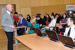
Last year at Bowling Green State University in Bowling Green, Ohio, about 150 undergraduate students attended GIS Day, which included an introduction to GIS, ArcGIS demonstration, and GIS quiz, says Dr. Yu Zhou, associate professor of geography. This year, Zhou plans to invite undergrads to a large classroom and give them a 30-minute GIS demonstration. “After that, I’ll give them a 5-minute pop quiz about GIS and a GIS demonstration, which will include some of my students’ class projects and some graduates’ work,” he says.
New GIS Day Materials
On gisday.com, you’ll find an interactive map of events near you as well as how to register your GIS Day event. Plus, you’ll have access to free resources and activities that you can use at your event to teach others about GIS. For example:
- New this year is The Amazing Mapman coloring/comic book. Show kids, teens, or adults how GIS can save the day.
- View videos, such as Beautiful Maps, GIS/Geography Trivia, and Map for Every Story.
- Read e-books, including What Is GIS, Understanding Earth, Climate Change Is a Geographic Problem, Renewable Energy, GIS in Africa, GIS for the Oceans, and Polar Regions.
- Hosts can use free National Geographic Geography Awareness Week (November 17–23) materials for their events, such as the GIS MapMaker Interactive Map, Investigating Your World with My World GIS Teacher Guide, and the Exploring Ecosystems Using GIS Activity.

