The Charlottesville Fire Department, which provides fire response, hazmat, and emergency medical services to residents of Charlottesville, Virginia, is a top-rated fire department. Accredited through the Commission on Fire Accreditation International, it has a Class 1 rating from the Insurance Services Office, meaning it is well-equipped to put out fires throughout the community.
One requirement for upholding this rating is that fire departments have to inspect all the fire hydrants in their jurisdictions. For Charlottesville, this means inspecting about 1,500 fire hydrants throughout the city and on the University of Virginia grounds.
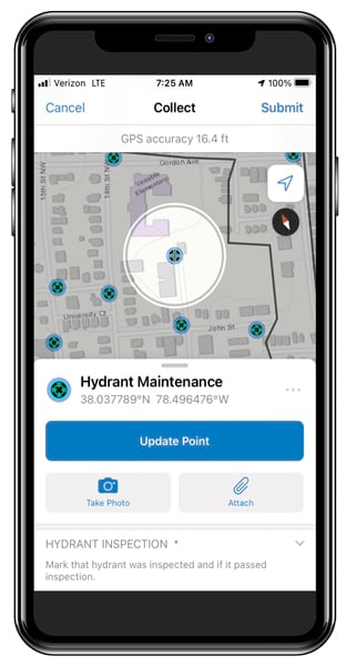
For years, Charlottesville firefighters performed these inspections using a time-consuming paper-based workflow. To make this process more efficient, the Charlottesville Fire Department implemented ArcGIS Field Maps, a new all-in-one app from Esri that enables mobile workers to easily find assets and information, collect and edit data on the go, and report their real-time locations.
“We had the opportunity, through Field Maps, to refine our entire process and make it firefighter friendly,” said Joe Powers, the deputy chief of community risk reduction for the City of Charlottesville.
Inefficient Inspections
Prior to implementing a digital solution for fire hydrant inspections, Charlottesville firefighters had to slog through an inefficient manual process.
Using printed-out spreadsheets to locate each fire hydrant, the firefighters recorded their findings on pieces of paper. Back at the station, they transferred their notes to a form and emailed that to the Charlottesville Department of Public Works, which maintains the fire hydrants. If repairs were needed, the firefighters would follow up with a phone call to the department to ensure that a work order was created.
To move away from this, Lucas Lyons, a system performance analyst for the Charlottesville Fire Department, created a digital hydrant inspection process in 2018 using a mobile data collection app. The app had limitations, though.
“Users in the field were asking for developer-level requests,” Lyons said. “I found we quickly hit walls, and I became somewhat frustrated by the [app’s] limited features.”
In addition, the City of Charlottesville organizes all the city’s data in a spatial database, but, according to Lyons, it was largely inaccessible to the fire department.
“I had no ability to edit that, and neither did the firefighters,” he said.
Lyons lobbied to get access to the database, but even then, it wasn’t very open. In the end, it actually made collaboration difficult.
After two years of trying to make this digital process work, Powers began looking into more efficient ways to have firefighters inspect hydrants.
An All-In-One App
Powers not only wanted to completely move away from a paper-based process, he also wanted each inspection to be tied to that hydrant’s record. He and Lyons were cognizant that some users weren’t familiar with GIS, so they needed the digital solution to be user-friendly as well. Field Maps—with its data collection and editing capabilities, digital maps, and ability to capture location tracks—ended up fitting the bill.
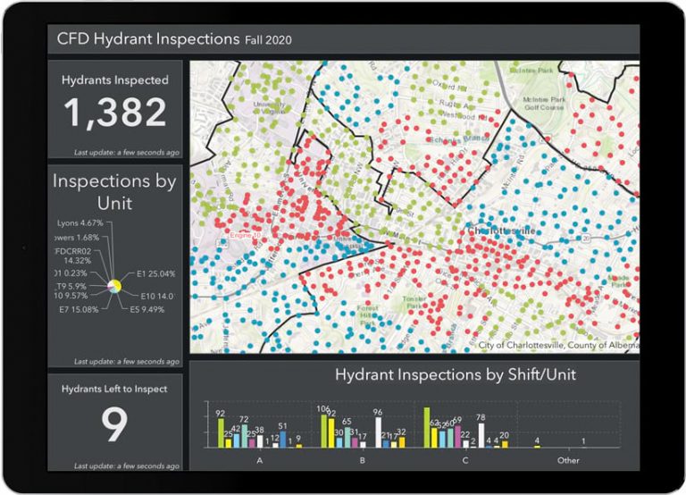
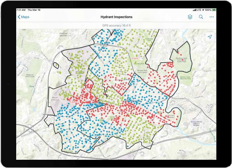
Using just a feature layer of the hydrants, Lyons created the fire department’s Field Maps solution. The app groups inspections first by firefighting unit and then into three different shifts, which ensures that the work is divided up equitably and enables firefighters to see which inspections have been completed by people on other shifts. Additionally, Lyons color-coded the inspections (for example, a green dot means that the hydrant has already been inspected) to provide at-a-glance information.
“With Field Maps, you have a way to collect data without having to go through this whole process of [asking], Where should this data live? You just need to set up a feature layer, and you’re good to go,” said Lyons. “I like that.”
After Powers and Lyons received some training on Field Maps from Esri, they created a three-minute training video to educate firefighters on how to use the new app. The video showed Lyons using Field Maps to do a hydrant inspection.
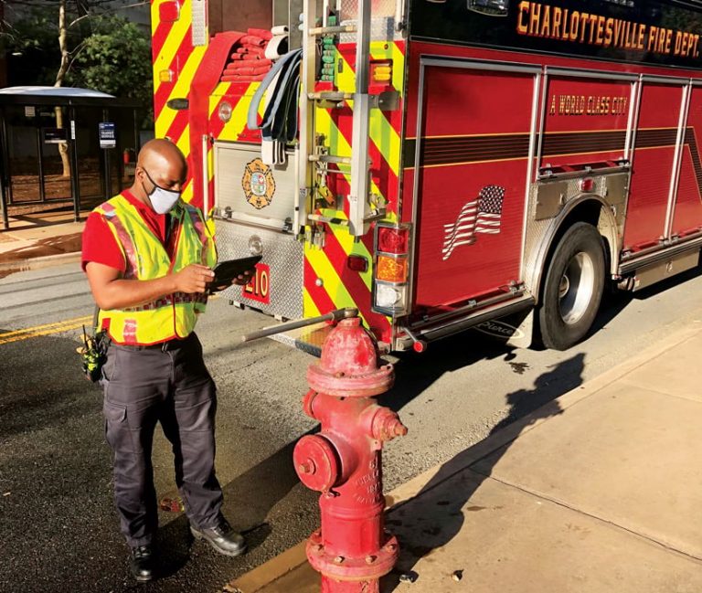
“We made a few little tweaks to [the app] once we were out on the street testing hydrants,” said Lyons. “Then we deployed it to our firefighters.”
Powers said the app was so straightforward that several firefighters went out with their iPads and other mobile devices the day it was released to inspect hydrants. And according to Lyons, the firefighters asked very few questions.
“I think [the app is] a game changer for the fire services,” Powers said. “It allows firefighters to record information and collect data [using one app], and it’s what the fire department needs to be successful in collecting data.”
“I think we’ll have more and better data in the future [by] having an application like this in users’ hands,” Lyons added.
Quick and Collaborative
Since implementing Field Maps in November 2020, the Charlottesville Fire Department has expediently completed two inspection cycles for its 1,500 fire hydrants. According to Powers, the new, streamlined process has helped decrease the workload while increasing productivity.
“From a staffing perspective, [firefighters] are not spending as much time on the street doing hydrant inspections because they’re not writing it all down,” said Powers. “They’re doing it one time, and it’s done.”
Rather than having to write emails, make phone calls, and scan paper work related to hydrant inspections, Charlottesville’s firefighters can complete other tasks, such as taking hazmat or online training and keeping up their physical fitness—all of which is part of a firefighter’s job, according to Powers.
Increased collaboration was also an important outcome of the Charlottesville Fire Department’s Field Maps implementation. Being able to visualize all hydrant inspection data in real time and see who is doing what has eliminated a lot of duplicate work. And Lyons built the dashboard to track all this in an hour—something he attributes to having reliable data.
“In the past, administrators and the crews didn’t have that kind of insight,” Lyons said. “When the last hydrant was inspected and that form was turned in, then the whole process was done. But now we can track, in real time, how that’s happening using dashboards.”
The real-time updates from Field Maps have also improved the fire department’s communication with Charlottesville Department of Public Works. Having the data and documentation for hydrant inspections as soon as it’s ready allows staff members there to create work orders for repairs more quickly.
Technology That Works
Powers believes that, from an administrative perspective, team members have gained a huge amount of organizational equity because they seized an opportunity to improve an inefficient process.
“One of the big benefits is the goodwill of our workforce, who now believe in technology and see [that] it can work,” said Powers. “Whenever we can show a win and show that life is easier with technology, that’s good, because that hasn’t always been the case.”
Following such a favorable deployment of Field Maps, the Charlottesville Fire Department plans to use the app for hydrant inspections every year as well as broaden its use. One project will be to use the app to track the installation of free, city-provided smoke alarms.
“When you say, ‘We’re going to increase your productivity and save you time,’ it’s almost a pipe dream,” said Powers. “But with Field Maps…that’s exactly what we did.”
