With Collector for ArcGIS, Survey123 for ArcGIS, and Navigator for ArcGIS, Missouri’s Central Electric Power Cooperative Is Now More Efficient
Over the 70 years that Central Electric Power Cooperative (CEPC) has provided electric transmission services across central Missouri, it has amassed volumes of paper maps and asset data forms to document its electrical system. Today, CEPC’s service area consists of 22,000 square miles with 1,555 miles of line. Eight separate power distribution cooperatives collectively own CEPC.
For the system to run smoothly, all its poles, rights-of-way, and equipment must be maintained, serviced, and annually inspected. But due to outdated and sometimes inaccurate system maps, the office staff and linemen in the field were often working with different information. While some of CEPC’s asset data was recorded electronically, all its maps were on paper.
To service assets, linemen had to rely on paper records or access information from an office computer before heading into the field. Since paper records did not always get returned to the office, office records were not always accurate. The paper maps tended to become outdated quickly. And as workers retired, it was difficult to capture their electrical system knowledge and retain it for use by new staff.

To streamline processes and make information more accessible, timely, and accurate, CEPC chose to implement ArcGIS field mobility apps. The CEPC team tested Collector for ArcGIS, Survey123 for ArcGIS, and Navigator for ArcGIS—and quickly realized that ArcGIS apps could serve as a unified system, allowing everyone to work from the same data, whether they were in the field or in the office. CEPC decision-makers were also attracted to ArcGIS apps because of how well they work together in connected and disconnected environments, since the utility’s electrical system covers mostly rural areas where Internet connectivity is not widely available. In addition, they liked how the apps function on multiple popular operating platforms.
The utility’s goal was to achieve accurate and thorough asset data collection for service, maintenance, and inspections. CEPC also wanted to be able to navigate to and from the many assets that span its entire service area. Together, ArcGIS field apps are supporting much greater efficiency—providing precise asset record keeping while helping linemen easily get to and from their assignments.
An Accurate Basemap
To build a complete solution, the CEPC team first needed to make an accurate basemap of its entire service area. This proved challenging, however, because of the massive size of the high-resolution satellite imagery data that had to be fed into a map tile package from ArcGIS Online.
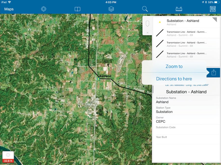
Using ArcGIS Pro, CEPC ultimately built a map tile package that could be side loaded onto a mobile device for use offline, anywhere across the utility’s service area. Working with Esri partner Ptarmigan Software, Stacey Dudenhoeffer, an IT specialist II at CEPC, used Collector to record the existing paper and electronic data for all assets and make it available as a feature layer to display on the map. Then, using Survey123, Dudenhoeffer built a smart form to record asset inspections. Finally, with Navigator, field employees would be able to navigate from asset to asset across CEPC’s road network.
With the promise that these apps would work together seamlessly, CEPC was ready to begin testing.
“Our goal was to have apps in place for the linemen for the annual winter inspections project,” said Dudenhoeffer.

Training and Implementation
Following a three-month testing period, CEPC was convinced that moving forward with the ArcGIS apps was the right solution. Many employees in the information technology department were familiar with Apple products, and CEPC was pleased with how they performed in the field, so it chose to use iPads for field data collection.
Prior to this, many of the linemen had very little computer experience—some limited to completing time sheets only. A number of linemen had cell phones, but for others, this was their first introduction to a smart device.
Given the varying degrees of comfort staff had with mobile technology, CEPC created a detailed, paper-based manual that documented how to use the apps with step-by-step notes and pictures. The IT and line design departments also conducted a training session for the entire field workforce, demonstrating various scenarios while linemen followed along on their iPads.
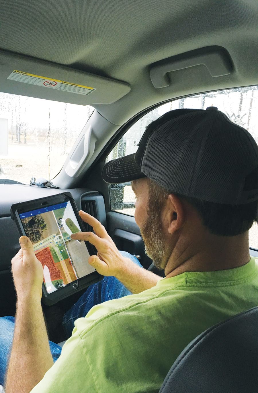
The linemen reported positive feedback, saying how using the ArcGIS field apps on their CEPC-issued iPads helped them get their jobs done. Because the mobile devices had side-loaded satellite imagery basemaps for the entire service area, field crews could retrieve the information on-demand—whether they had Internet access or not—and see the details for any asset of interest, including its service records.
For the first time, staff had all the information for each asset at their fingertips. In addition, they could easily jump between Collector and Navigator to navigate to any asset in the system. Linemen in the field now had everything they needed to complete their daily work assignments without calling back to the office or referring to paper maps.
The Apps in Action
Using both Collector and Survey123 has made CEPC’s data more complete, consistent, and conformant with regulatory requirements.

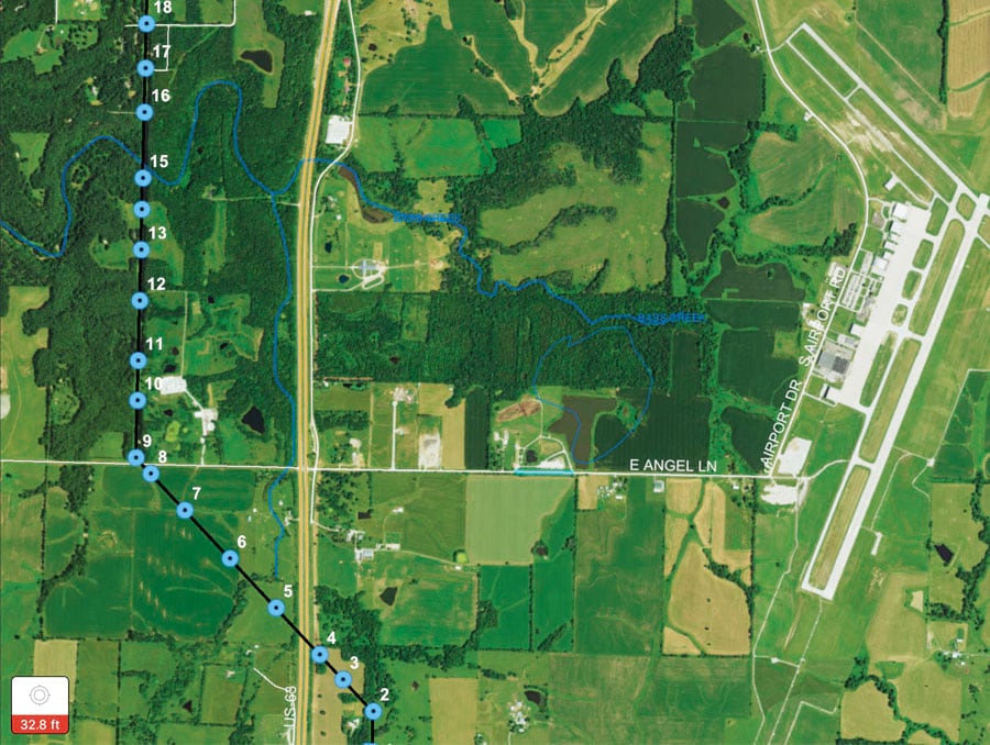
For last year’s annual winter inspection of poles and lines in the transmission system, crews used Survey123 to create fully documented inspections of each structure. A glance at the interactive map clearly reveals red dots that indicate hot spots where problems exist, making it easy to see where to focus repairs.
“By streamlining the inspection process, more people can do queries to see where attention is most critically needed and the full scope of what’s needed in an area,” said Andy Adrian, a right-of-way coordinator at CEPC. “This helps to focus on and prioritize the serious problems.”
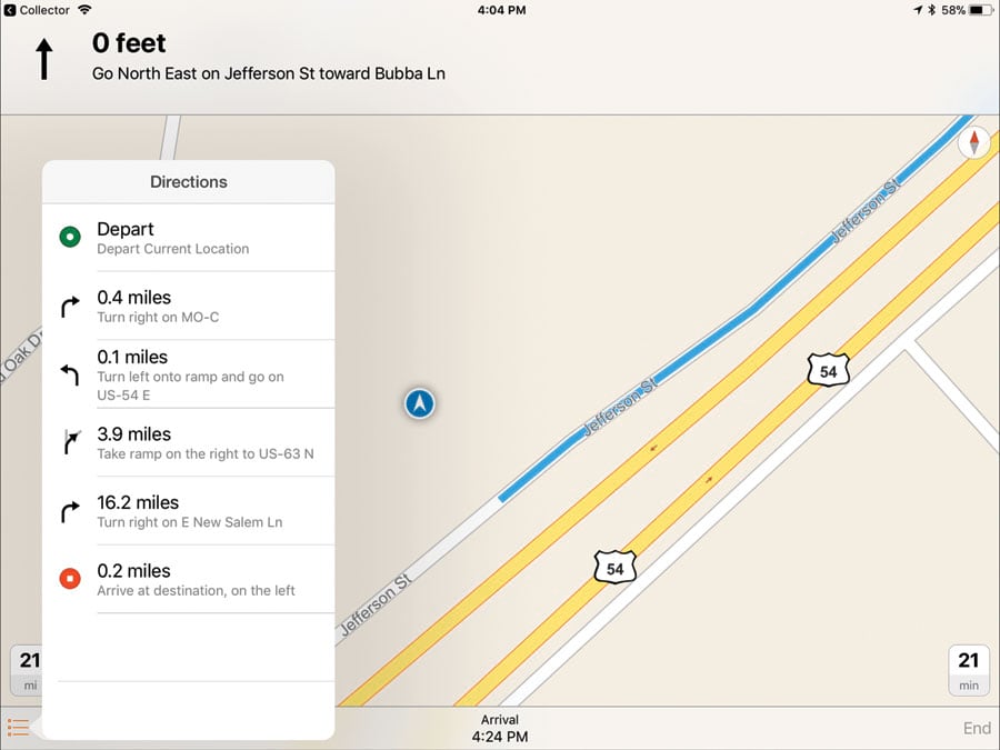
Additionally, CEPC reports that using Navigator has dramatically improved how its field crews get around its expansive electric system. Having the location of each asset on the Collector map makes it easy for linemen and right-of-way coordinators to obtain driving directions to assets across the network from their current locations. This is especially beneficial to those who visit some areas of the system relatively infrequently. And having different “car” or “truck” modes within Navigator allows employees and contractors who drive various vehicles to jobsites to receive specialized driving directions for their vehicle types.
“Navigator for ArcGIS has been a great tool for the newer employees,” added Adrian. “They are able to efficiently get to our assets without having years of experience navigating through our service area. The Navigator app guides them efficiently and safely to where they need to go.”

Departmental Collaboration
For CEPC, using ArcGIS field apps has opened up communication among departments and generated a lot of new ideas.
Having the ability to see every asset and its related information empowers crew members to plan what they need to bring into the field each day to get their jobs done. This helps them avoid unnecessary trips back to the office to retrieve additional equipment. The apps have also made it easier to train new hires, since all the information about the system is available digitally, negating the need to have them memorize aspects of the electrical system from the get-go. Linemen also report that communication with landowners for right-of-way issues is greatly enhanced by having an accurate map to lead the discussion and show proposed changes.
From the office or the field, CEPC staff members now have a common view of the utility’s network. And that has made all the difference for streamlining operations and increasing the efficiency of field activities.
“The initial reluctance of the crew to move to a digital solution was quickly overcome, as they found the apps were easy to use and made work more efficient,” said Adrian. “Now, crews rely on their iPads as a single source of truth for an accurate picture of the electric system while they’re in the field.”
For more information on how CEPC is continuing to employ ArcGIS apps for the field, contact Dudenhoeffer or engineering technician Lori Bartlett at 573-634-2454.

