Tackling the immense challenge of climate change will require enormous investments in renewable energy sources, such as wind and solar power. But building out utility-scale wind parks and solar farms requires land—and a lot of it. A recent study from Princeton University estimated that for the United States to reach net-zero greenhouse gas emissions by 2050, it will require 228,000 square miles of land. That’s an area larger than the states of Colorado and New Mexico combined!
So where can all these wind and solar facilities go? And how can they be installed without harming wildlife habitats and other treasured places?
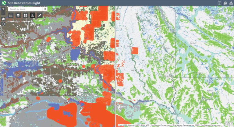
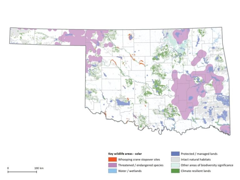
Geospatial science and Esri technology provide a good place to start. The Nature Conservancy (TNC) has created a mapping tool with ArcGIS Pro called Site Renewables Right. The online resource is designed to help companies and communities identify the most promising places in the central United States to develop renewable energy while preserving wildlife and habitats.
Site Renewables Right combines more than 100 geospatial layers of wildlife habitat and land-use data to show areas where renewable energy development is most likely to avoid important natural areas, permitting delays, and cost overruns. The map spans 19 central US states, from Ohio to Montana. Because of the growing need for this kind of data, TNC is looking to expand the mapping tool so it covers the entire country.
“To tackle climate change, we need to transition to renewable energy—and fast,” said Nathan Cummins, director of renewable energy programs for TNC’s Great Plains Division. “Site Renewables Right finds there is huge opportunity to do this at a large scale across the central United States without [having] significant impacts [on] habitat and wildlife. Like any type of development, solar and wind facilities can harm wildlife and habitat if not sited properly. Site Renewables Right provides a way for companies and communities to assess those [effects]. It encourages the right conversations to avoid project delays and impacts to the very same wildlife and natural areas we are trying to protect from climate change.”
Siting Renewable Energy Developments in Low-Impact Areas
To reduce the effects of climate change and decarbonize the US electricity grid, renewable energy development is essential. And the transition is coming quickly. Changing market conditions, improved technology, and ramped-up state and federal actions are all galvanizing the move to alternative energy sources at an unprecedented scale. New solar development alone is expected to generate almost half of all the electricity produced by renewable energy sources in the United States by 2040.
Not surprisingly, energy development is one of the largest drivers of land-use change in North America. But poorly sited renewable energy projects can severely harm wildlife and high-priority habitats. Renewable energy projects that are sited in areas with significant wildlife and habitat can lead to conflict, costly overruns, and delays. One study from TNC and consulting firm ECONorthwest found that permitting was three times faster and costs were 7 to 14 percent lower when solar projects were sited in areas of low biodiversity, compared to highly biodiverse sites.
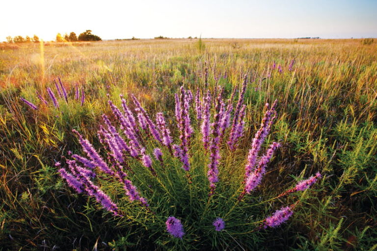
In the temperate grasslands of the Great Plains, when wind and solar facilities are put in intact native prairies, like the Sandhills region of Nebraska, they can pose serious concern for the sandhill and whooping cranes and other grassland birds. This is because the projects can fragment their habitats and cause the birds to stay away from otherwise suitable environments.
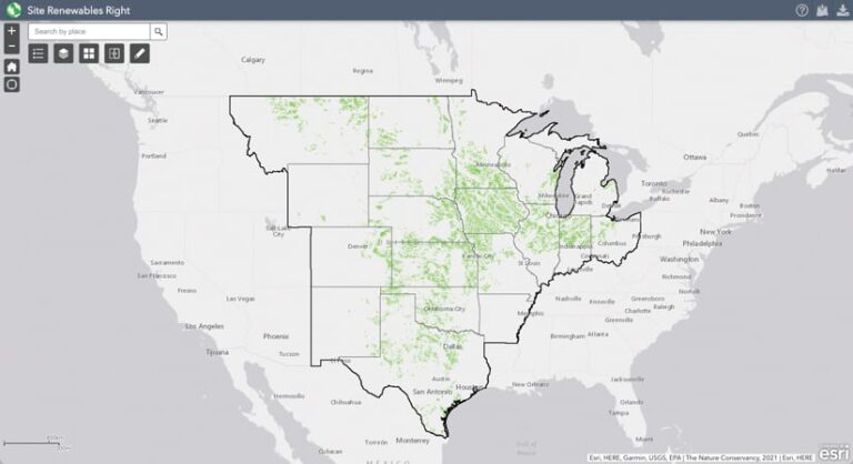
The Site Renewables Right map was originally launched in 2020 as Site Wind Right. That map aimed to show places in the central United States—America’s “wind belt”—where new, utility-scale wind energy projects are most likely to avoid critical natural areas. Now, Site Renewables Right incorporates data to also identify areas where solar development, which is rapidly expanding in this region, can occur while keeping wildlife habitats intact. The updated map also reflects new science on wind.
One of the first challenges in creating the online map was assembling and organizing a significant number of data layers from a variety of state, federal, and industry sources. ArcMap was key to organizing the data when developing Site Wind Right a few years ago, and ArcGIS Pro was vital for incorporating the solar and updated wind data for Site Renewables Right. Using these core technologies plus ModelBuilder, the team determined where large-scale wind and solar projects could be established across the central United States and then removed areas designated as wildlife hot spots and habitats. Once the analysis was finished, the team used ArcGIS Web AppBuilder to create Site Renewables Right as an easy-to-use online tool that people of all GIS skill levels can explore.
The Site Renewables Right map is designed to serve as an important source of information for early screening of potential wind and solar energy sites. It follows state and federal guidelines for renewable energy development but is not intended to serve as a substitute for those guidelines. The map shouldn’t be the only source of site screening, and it doesn’t replace the need to consult with state, federal, and tribal governments or conduct detailed, site-level analyses.

Appealing to a Wide Range of Users
Site Renewables Right estimates that at least 120,000 square miles—an area nearly the size of New Mexico—hold the potential for low-conflict renewable energy development in the central United States. The analysis demonstrates that these areas could support roughly 1,000 gigawatts of wind capacity, which is nearly 10 times what the United States currently generates in wind energy. It also indicates that the potential for low-impact solar development is significantly greater than that for wind. Solar has a much higher average power density and smaller projected land-use requirements than wind, suggesting that solar build-outs in the central United States would be less geographically constrained.
Among those who will find Site Renewables Right useful in planning renewable energy projects are utilities, large energy-consuming companies, utility regulators, energy buyers, and wind and solar developers. Moreover, demand is growing among corporate power purchasers for renewable energy that maximizes climate contributions and minimizes biodiversity impacts.
One such energy buyer that seeks these standards is multinational beverage and food corporation PepsiCo.
“The Nature Conservancy’s Site Renewables Right map is an excellent example of data capture that helps organizations make informed business decisions when evaluating renewable energy projects,” said Roberta Barbieri, vice president of global water and environmental solutions at PepsiCo. “Projects that are properly sited and developed support a sustainable and equitable clean energy transition—a critical lever in achieving our net-zero-by-2040 goal and broader pep+ (PepsiCo Positive) ambitions.”
Energy companies like Xcel Energy are also embracing Site Renewables Right’s analysis to help them achieve their climate targets.
“Renewable energy plays a critical role in Xcel Energy’s vision to deliver at least 80 percent emissions reduction by 2030, and we’re responsibly developing wind and solar resources to protect the environment,” said Jeff West, senior director of environmental services at Xcel Energy. “We’re committed to working with organizations such as The Nature Conservancy and its Site Renewables Right initiative that researches and supports protecting wildlife and other natural resources as we provide a clean energy future for our customers.”
Researchers are interested in using the Site Renewables Right tool as well.

“The Nature Conservancy is a recognized and trusted advocate for natural resources and biodiversity,” said Brian Ross, vice president for renewable energy at the Great Plains Institute. “The Site Renewables Right map enables multibenefit solutions for the critical renewable energy investment needed to address the climate crisis. Site Renewables Right demonstrates that developers, communities, and natural resource advocates can work in partnership to create a new energy future.”
Ranchers, farmers, and other landowners can also use Site Renewables Right to inform their engagement around renew-able energy.
“I am a strong supporter of Site Renewables Right,” said Ford Drummond, an Oklahoma-based rancher and TNC board member. “It will help us be better stewards of the land by protecting wildlife and the wide-open spaces of the Great Plains while also advancing opportunities for a cleaner energy future.”
For inquiries about Site Renewables Right or to partner with TNC, email SiteRenewablesRight@nature.org.
