When water pipes age and deteriorate, they can fail catastrophically—an outcome that’s much more expensive for water utility companies than replacing pipes before they burst. But deciding when to replace pipes and other water assets can be a difficult and complicated process, partly due to the many factors involved.

This was an issue facing the Metropolitan Utilities District, which serves more than 620,000 customers across the Omaha, Nebraska, area. With more than 3,000 miles (4,828 kilometers) of water mains and natural gas infrastructure, the district’s goals of achieving resilience and reliability are continually challenged by aging pipes, environmental factors, and increasing demand. The district needed a step-by-step improvement plan to replace infrastructure that was worn out.
In the past, staff at the district made infrastructure renewal decisions by conducting spreadsheet assessments that provided limited details and were based on historical pipe-break data recorded on paper maps. To help mitigate pipe failure risk in the most cost-effective way, the district turned to Esri startup partner Aquanuity and its AquaTwin products for ArcGIS Pro.
A Safer, More Reliable Risk Model
The district’s digital transformation began in 2008, when staff converted its legacy infrastructure data from MicroStation-based CAD files into an Esri geodatabase. They then added to the database characteristics such as job numbers, installation dates, and material properties—including diameter, thickness, and what an asset is made of—for pumps, valves, and other equipment. In 2019, when the district’s asset management division was formed, staff digitized more than 15,000 paper-based water main leak reports, which were later analyzed to create the risk model.
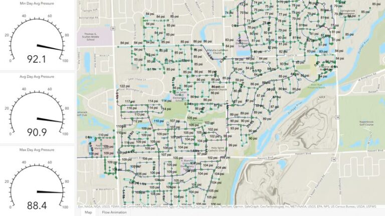
Staff worked with Esri partner HDR to develop a data-driven linear asset management plan (LAMP), a water system simulation that includes all of the district’s linear assets such as pipes and related equipment, including valves and taps. The LAMP contains details related to each asset’s material properties; how it was installed; and its condition based on the number of leaks or breaks recorded, the average pressure and water velocity, and other criteria. These factors help generate comprehensive risk models that leverage several GIS datasets and data from the new hydraulic model, also completed by HDR.
The district and HDR developed likelihood-of-failure and consequence-of-failure factors based on various pipeline attributes. A main’s likelihood of failure is affected by the pipe break rate (the number of pipe breaks during a given period), the material the pipes are made from and when they were installed, the diameter, the water pressure, and the number of service connections involved. Consequence-of-failure factors are determined by using the number of customers who would be affected by a disruption and how badly a disruption would impact them, as well as nearby roadway types, zoning, and other factors.

District staff and the HDR team then applied the dataset to each of the district’s approximately 80,000 pipe segments. To further improve the model’s accuracy and adaptability, the team reached out to Aquanuity for its AquaTwin products—all ArcGIS Pro add-ins.
Smarter and More Sustainable Water Infrastructure
Aquanuity is a civil engineering company that creates software to help water utilities and engineering firms manage water infrastructure. Its AquaTwin Asset Pro software, which allows users to create asset condition computer simulations for what-if scenarios in water systems, powers the LAMP. AquaTwin Asset Pro integrates with the Environmental Protection Agency’s industry-standard Storm Water Management Model engine, adding hydraulic, hydrologic, and water quality simulation capabilities and allowing sewer infrastructure capacity analysis results to be incorporated into risk and criticality assessments.
“The district knew that the software solution supporting the LAMP had to be user-friendly and versatile enough to effectively translate any nuances in the factors that were developed,” said Metropolitan Utilities District director of infrastructure integrity Jared Svagera, explaining why the district chose AquaTwin solutions.
The district also uses Aquanuity’s AquaTwin Water Pro, which enables the creation of what-if scenarios as well but focuses on water systems’ hydraulic and water quality computer simulations.
One of the reasons district staff chose AquaTwin Water Pro is its complete integration with the district’s ArcGIS Pro environment, Svagera said. He also noted other advantages, such as that all data is kept natively in ArcGIS Pro geodatabases, bypassing the need for file conversion, and that AquaTwin Water Pro supports ArcGIS Utility Network functionality out of the box.
Risk Mitigation for a Safer Water System
Using ModelBuilder, district staff can combine several GIS features to create a single, comprehensive table that they can use to easily update the risk models generated by AquaTwin. These models combine service taps (smaller pipes that run from water pipelines to houses), break rates, and break counts (the number of individual breaks in a pipe), and normalize the data based on water main age. Staff then add the results to the AquaTwin products’ models.

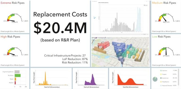
The consequence-of-failure factors make use of a powerful AquaTwin tool called Saved Selections, which allows AquaTwin users to select pipe features, such as line features representing water mains. Users then save those selections and assign risk scores. AquaTwin Asset Pro quickly combines likelihood-of-failure and consequence-of-failure data into risk-priority scores, which staff can then display in dashboards.
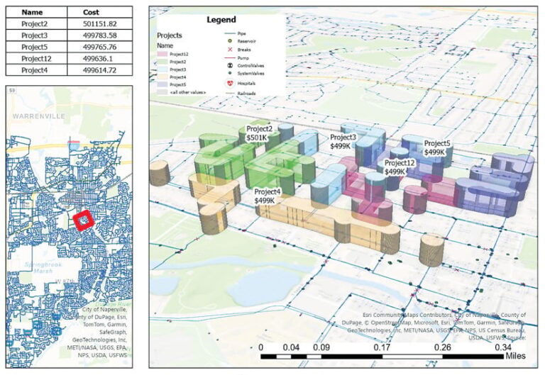
This linear asset risk model helps the district prioritize water main renewal and condition assessment projects. It also assists in monitoring areas of highest consequence for active water leaks. Since it’s not always economically feasible to replace just one high-risk block of water mains, engineers can choose to also replace surrounding medium-risk mains to create a more efficient and economical project.
Powered by ArcGIS Pro, the LAMP and AquaTwin products revolutionized the district’s previous approach, employing system-wide data to prioritize essential maintenance and mitigate as much risk as possible.
“Our work with Aquanuity is helping us plan a future where we can provide the safest, most reliable services possible to our customers—making their lives easier,” Svagera said.

