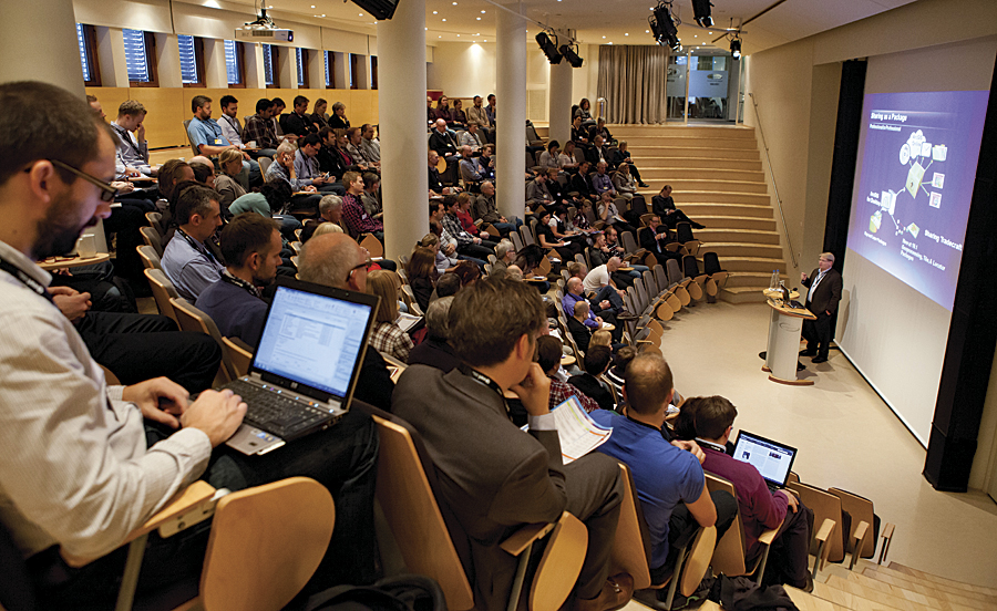
More than 4,700 regional Esri software users, partners, and exhibitors converged on Abu Dhabi, Buenos Aires, Oslo, and Auckland last fall for several days of training, inspiration, and networking focused on ArcGIS.

“We are storytelling through an environment based on maps,” said Esri founder and president Jack Dangermond of the current role GIS plays in people’s lives. “GIS now is moving to a new level. It is moving into a different age that is characterized by science and design.”
It was again time for Esri’s annual regional gatherings—the Middle East and Africa User Conference (MEAUC), the Latin America User Conference (LAUC), the European User Conference (EUC), and the Asia Pacific User Conference (APUC)—all with a single goal: raise the bar on professional GIS skills and on community awareness of the technology’s vast potential.
Esri Middle East and Africa User Conference
The 2012 MEAUC was held in December in Abu Dhabi, United Arab Emirates. More than 2,000 registered attendees converged on the Abu Dhabi National Exhibitions Company for the regional forum, while 24 exhibitors showcased their services at the GIS EXPO.
Dangermond and the Abu Dhabi government welcomed the region’s GIS community at the Monday morning Plenary Session with a demonstration of how GIS opens up the world. They encouraged attendees to explore the evolving role of geography as a platform, which will support the advancement of their organizations, communities, and nations.
After the ceremonial opening of the EXPO, attendees rejoined the session for technical demonstrations highlighting the enhanced capabilities of ArcGIS 10.1.
For the plenary finale, speakers from public and private organizations from Abu Dhabi, Kuwait, and Saudi Arabia presented vignettes of GIS success that ignited and inspired passion for the technology. The speakers described how the power of GIS has transformed their regions’ municipal management, education, oil production, urban planning, utilities, and environmental planning.
On days two and three, approximately 100 workshops focused on the use of GIS in government, education, business, utilities, petroleum, and other industries. Presentations were designed for a wide array of attendees, from teachers and students to government leaders, and featured local and regional presenters. Additionally, there were more than 20 technical workshops, including “What’s New in ArcGIS 10.1 for Server,” “ArcGIS Online—An Introduction,” and “Planning Enterprise Geodatabase Solutions.”
Attendees had an opportunity to network at Monday’s GIS EXPO welcome reception and Tuesday evening’s event social at Ferrari World in Abu Dhabi.
Heralded by preconference seminars on Sunday, December 9, MEAUC was hosted by Esri in partnership with the Abu Dhabi Systems & Information Centre (ADSIC), which managed the preparation and coordination of contributions from various governmental bodies representing the Abu Dhabi Spatial Data Infrastructure program.
“All over the world, we can observe how GIS and other geospatial tools have become an integral part of municipal planning, resource management, and other vital government activities,” said H. E. Rashed Lahej Al Mansoori, director general of ADSIC. “The Abu Dhabi government’s partnership with Esri, courtesy of ADSIC, represents a major step in modernizing government services in keeping with global trends and the region-wide focus on creating genuinely digital societies. Esri’s MEAUC is an important platform for affirming Abu Dhabi’s commitment to spatially enabled development and for encouraging other governments across the region to follow suit.”
In 2013, MEAUC will be combined with the European User Conference (EUC) to create a superregional user conference—the Esri Europe, Middle East, and Africa User Conference (EMEAUC). Esri Deutschland GmbH will host users from across the two regions October 23–25 in Munich, Germany. For more information about the 2013 EMEAUC, visit esri.com/emeauc.

Esri Latin America User Conference
The 2012 Esri Latin America User Conference was held in Buenos Aires, Argentina, October 4–5 at the Catholic University of Argentina Convention Centre. More than 1,000 attendees from 13 countries attended the event, with 14 exhibitors from 3 nations exhibiting at the GIS EXPO.
Hosted by Aeroterra S.A., Esri’s official distributor in Argentina and Uruguay, the LAUC was preceded by three days of preconference seminars. The two-day conference agenda kicked off with a plenary welcome and vision presentation by Eduardo Viola, CEO of Aeroterra.
Keynote speaker Sergio Massa, mayor of the city of Tigre in the province of Buenos Aires, talked about implementation of a new technology platform as a basis for municipal management. Experts from Esri and Aeroterra then discussed the present and future of spatial technology, such as ArcGIS as a platform.
During the Plenary Session, the 2012 Latin America Special Achievement Awards in GIS were presented to AngloGold Ashanti (Colombia), Ciampagna y Asociados (GDSIG) (Argentina), ESSBIO S.A. (Chile), Ministerio de Ganadería Agricultura y Pesca (Uruguay), and Sancor Seguros (Argentina).
Much of the conference’s focus was on ArcGIS 10.1 and ArcGIS Online. The LAUC provided a forum for attendees to nurture ideas, collaborate, connect, and inspire each other with their GIS skills.
“Thanks to the organizers for allowing me to learn important tools and make contacts for working on sustainable development in our local region,” said Jorge Romero, a geographer in the province of La Rioja, northwestern Argentina.
At the close of the conference, Viola observed that the LAUC remains the most successful event his company has hosted in its 40 years of existence.
“This was because of support from Esri and regional distributors, but especially because of everyone who encouraged and helped us achieve success,” Viola said.
The 2013 LAUC will be held October 16–18 in Lima, Peru, and will be hosted by Esri’s distributor in Peru, TELEMATICA. More information will be available soon.
Esri European User Conference
The 2012 Esri European User Conference was held October 15–17 in Oslo, Norway. The event attracted 940 GIS users, educators, researchers, and businesspeople from 34 countries to the Kongressenter in central Oslo and showcased 27 exhibitors from nine nations.
Geir Hansen, CEO of Geodata AS, Esri’s official distributor in Norway, opened the event by welcoming guests from the host country and other European nations, as well as attendees from outside the region. A packed plenary audience heard Dangermond deliver the Keynote Address, “GIS—Opening Our World.”
The EUC offered 24 technical workshops and 85 breakout sessions in 15 industry areas ranging from environment and forestry to utilities, energy, telecom, and water/wastewater.
Tobias Litherland, University of Oslo, and Kristin Madsen Klokkeide, University of Bergen, Norway, won the Student Awards and a trip to the 2013 Esri International User Conference in San Diego, California.
Bård Hansen of Statskog, a state-owned forest and mountain real estate agency, won the Norwegian Lighthouse Award for his contribution to GIS and impact on his organization and society. At the event’s conclusion, Hansen told attendees, “I would like to thank everyone in the GIS community for a fantastic EUC 2012. The conference has been a great success with respect to participation, content, as well as atmosphere.”
Jens Knudsk Jensen, from Geodata Denmark, echoed Hansen’s comments, saying, “The conference was very well organized, with valuable content and excellent presentations. Thank you to Geodata Norway for a well-prepared event.”
Esri Deutschland GmbH will host the 2013 Europe, Middle East, and Africa User Conference, October 23–25, in Munich, Germany. Visit esri.com/emeauc for more information about the event.
Esri Asia Pacific User Conference
The SKYCITY Convention Centre in scenic Auckland, New Zealand, was the site of the 2012 Asia Pacific User Conference, held November 5–7 and hosted by Esri official distributor Eagle Technology Group, Ltd. More than 220 organizations and 530 attendees from 20 countries were on hand for the city’s first APUC.
From day one, when Dangermond invited members of the audience to introduce themselves to their neighbor, the enthusiasm of the plenary assembly carried the conference forward. Dangermond and the large Esri team excited attendees when each spoke to the region, with many personally introducing themselves during social events.
Tonkin & Taylor (Kate Burns, James Lyth, and Kate Williams) won the Eagle Technology Excellence in GIS Award for its application, Canterbury Earthquake Residential Land Damage. Honorable mentions included Afaf Abbas, Opus International Consultants, for the Auckland-Manukau Eastern Transport Initiative, and Manas Chakraborty, Horizons Regional Council, for an integrated spatial dataset representing significant freshwater values (ecological, social, and economic) across the region. In addition, Ryan Clements of the Queenstown Lakes District Council won the WebMap Award.
Delegate Norm Thornley, geospatial services manager for information systems and services, Department of Conservation, New Zealand, observed that the APUC had “a good mix” of technical and business-applied GIS. “It was good to see that Esri’s direction is well aligned with where the Department of Conservation wants to go with facilitating more community-based conservation activities,” Thornley said.
“This was a fantastic conference,” said sponsor Andrew Fox, New Zealand’s Global Technology Services (GTS) executive for IBM. “It was great to see everyone collaborating and sharing their best practices.”
Gary Langford, CEO of Eagle Technology Group, termed the event “the culmination of a year of planning and collaboration” between his team and Esri. “As hosts, we are delighted with a very successful outcome,” he said. “Our feedback from sponsors and exhibitors has been that it was one of the most vibrant events they have attended.”
The 2013 Asia Pacific User Conference will be held in Singapore. More information is forthcoming.

