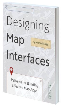
Designing Map Interfaces: Patterns for Building Effective Map Apps

By Michael Gaigg
Designing Map Interfaces: Patterns for Building Effective Map Apps is the essential guide to creating geospatial app interfaces that are usable, efficient, and stunning. Whether configuring an out-of-the-box solution, building an app with an app builder, or working on a custom app project, readers can rely on the book’s practical tips to assemble a meaningful user interface (UI). Intended for GIS professionals, solution engineers, developers, and designers, Designing Map Interfaces identifies several recurring problems in UI design and outlines specific UI patterns to employ to fix them.
- December 2022/March 2023, 173 pp.
- Ebook ISBN: 9781589487260
- Paperback ISBN: 9781589487253
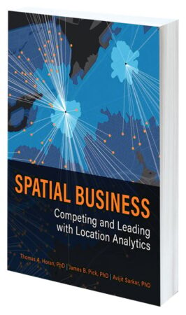
Spatial Business: Competing and Leading with Location Analytics

By Thomas A. Horan, James B. Pick, and Avijit Sarkar
In today’s global economy, business leaders need to know where to source materials, operate, and grow their customer bases. Spatial Business: Competing and Leading with Location Analytics shows how real organizations have designed, deployed, and managed GIS solutions to improve decision-making and add value in both strategic and operational ways. Written by experts in spatial business, the book provides managers, professionals, and students with a road map for realizing the potential of geospatial data across the entire business value chain.
- August/December 2022, 264 pp.
- Ebook ISBN: 9781589485341
- Paperback ISBN: 9781589485334
Preserving Our Planet: GIS for Conservation

Edited by David Gadsden and Matt Artz
By employing maps and apps, conservation professionals can more easily observe what’s happening on the ground, analyze and organize their data, and collaborate with other organizations and members of the public to harness opportunities and address threats. Preserving Our Planet: GIS for Conservation showcases how several conservation organizations have successfully used GIS to help preserve biodiversity. The book provides ideas, strategies, and tools to help readers jump-start their own uses of GIS for conservation. It also comes with a collection of online resources, including stories, videos, and downloadable content.
- September 2022/January 2023, 130 pp.
- Ebook ISBN: 9781589487222
- Paperback ISBN: 9781589487215
Creating a Smarter Campus: GIS for Education

Edited by Joseph Kerski and Matt Artz
GIS has a wide range of uses in the educational sphere. It provides educators with novel ways to teach problem-solving to tech-savvy learners. Researchers can employ GIS for data visualization and integration. IT professionals can use it to improve their cloud-based platform offerings. And administrators can wield the technology to visualize and manage everything from campus facilities to expansion opportunities. Creating a Smarter Campus: GIS for Education shows how educational institutions are actively integrating spatial reasoning and GIS technology into teaching, research, and management.
- August/December 2022, 170 pp.
- Ebook ISBN: 9781589487383
- Paperback ISBN: 9781589487376
Protecting the People: GIS for Law Enforcement

Edited by John Beck and Matt Artz
Protecting the People: GIS for Law Enforcement is a collection of real-life stories about how law enforcement agencies have used GIS to improve crime analysis, streamline operations, practice open policing, and enhance field mobility. Through these accounts, the book illustrates how police departments and law enforcement organizations employ GIS to drive decision-making in everyday operations.
- August/November 2022, 114 pp.
- Ebook ISBN: 9781589487307
- Paperback ISBN: 9781589487291

