At the 2023 Esri Partner Conference, held in March in Palm Springs, California, Esri acknowledged 27 partners with awards for their innovation and excellence in helping customers succeed with ArcGIS technology. Find out about these noteworthy partners and what they can do for myriad organizations and projects.
Provides analytics and insight to users through location intelligence
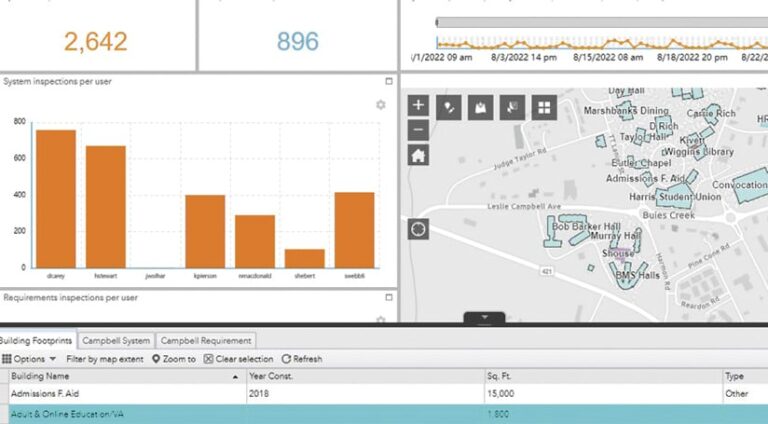
Dewberry
DimensionalView, Dewberry’s GIS platform for delivering projects, makes it easy to share spatial data and removes the burden of having to purchase software. The company’s clients have immediate access to this software as a service (SaaS) and can use its maps, charts, media, and custom reports on demand.
StreetLight Data
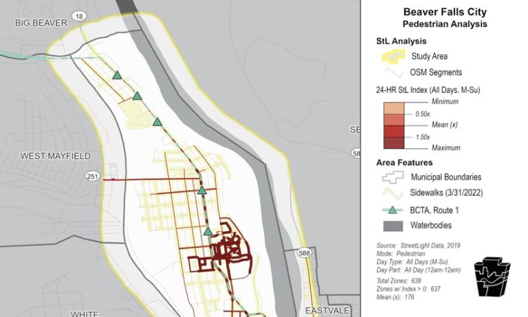
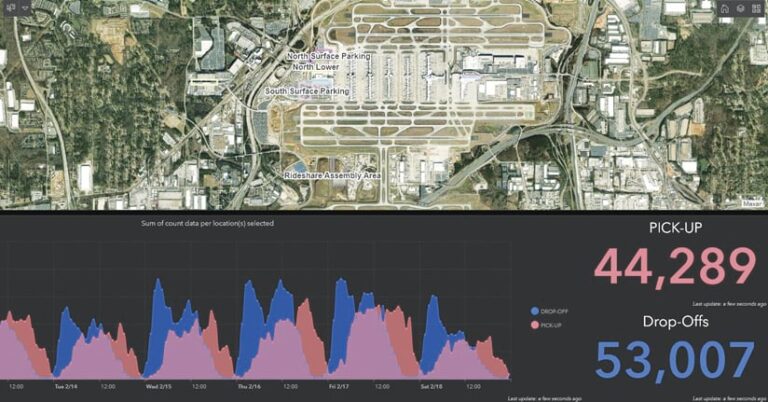
Clients leverage StreetLight Data’s industry-leading transportation metrics with ArcGIS technology to understand how roads, sidewalks, and transit interact. The Southwestern Pennsylvania Commission employed these mobility metrics to visualize pedestrian activity and infrastructure in Beaver Falls, Pennsylvania.
Employs GIS in service of diversity, equity, inclusion, and belonging
GISetc, a division of Critical Think
GISetc’s innovative work leverages maps and ArcGIS StoryMaps stories to teach communities and classrooms about the effects of systemic racism around the United States. The organization provides materials to teachers, students, and community members to help them grapple with issues of diversity, inclusion, and belonging.

Timmons Group
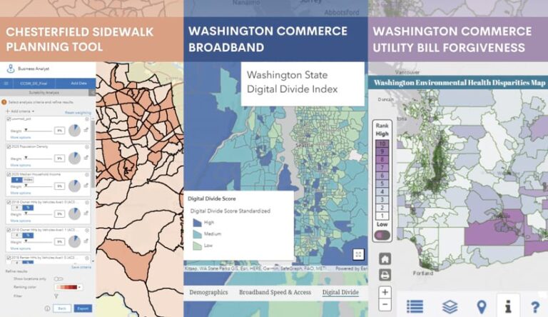
Timmons Group leverages Esri technology, including ArcGIS Pro and ArcGIS Online, to help clients create inclusive experiences for their communities. The firm provides solutions that improve transportation equity, address the digital divide, and tackle other systemic barriers that have marginalized groups of people.
Has an outstanding presence on ArcGIS Marketplace
VertiGIS North America
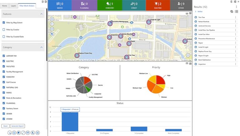
VertiGIS North America works across industries to help organizations that rely on ArcGIS technology accomplish even more by going beyond the out-of-the-box capabilities. With VertiGIS Studio, users can build powerful, purpose-driven apps at a fraction of the cost and development time that are normally required.
Develops highly aligned solutions built with ArcGIS products
Arora Engineers
GEO DATA AG
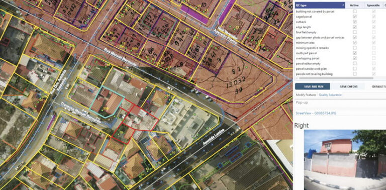
To revolutionize land planning and management, GEO DATA AG empowers governments with innovative geospatial solutions. The team recently worked with Angola’s ministry of urbanization and environment to establish the Angolan National Cadaster system by using ArcGIS Pro and ArcGIS Enterprise to map 450,000 urban parcels.
Uses software as a service to bring customers and solutions to ArcGIS
Pandell
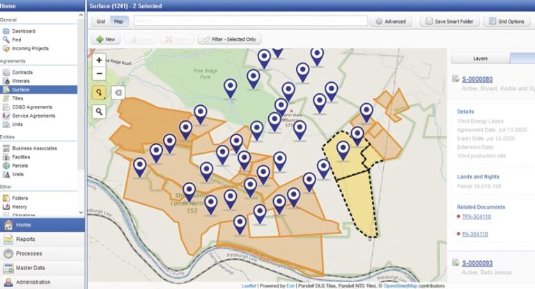
Pandell’s GIS solutions for land help pipeline, utility, renewable energy, and oil and gas companies make faster, more informed decisions. They enable teams to better manage acquisition and land asset data in concert with corporate GIS layers from ArcGIS Enterprise, ArcGIS Online, and ArcGIS Platform.
Pro-West & Associates
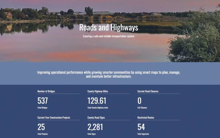
Pro-West & Associates empowers governments and businesses to get started with GIS and leverage the technology to improve efficiency and better serve their customers. Supporting land records, utilities, public engagement, and more, Pro-West staff use ArcGIS Online to collaborate with organizations and meet their needs.
Employs the ArcGIS system in an innovative or disruptive way
vGIS
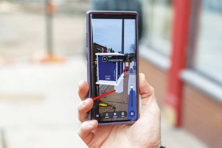
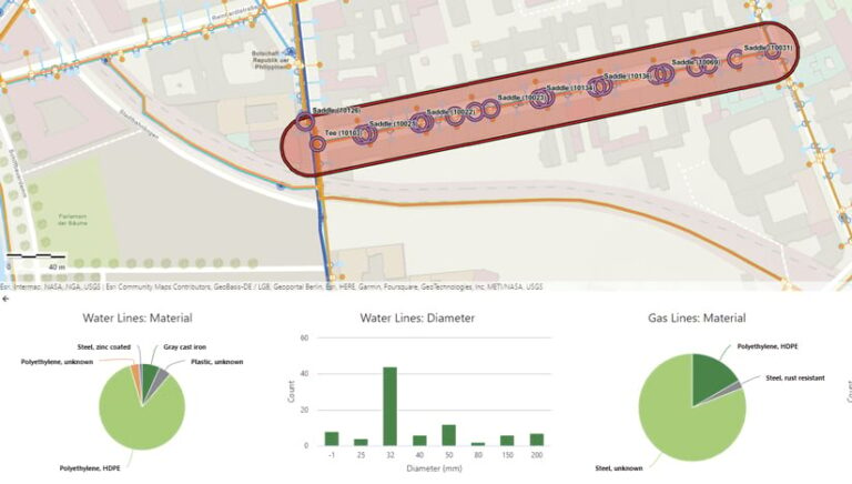
vGIS is a high-accuracy, augmented reality-based visualization platform that powers digital twins. The system, which is built for utilities and infrastructure projects, brings spatial data from a construction site into a unified, always up-to-date 3D view that stakeholders can access at any time, on any device.
Houseal Lavigne
Houseal Lavigne is a leading urban planning and geospatial firm that provides innovative solutions for public and private sector clients. The company’s experts employ Esri technology to develop comprehensive plans, zoning codes, GIS-enabled apps, and digital twins that facilitate evidence-based decision-making.

Demonstrates substantial opportunities for growth with Esri
ICEYE
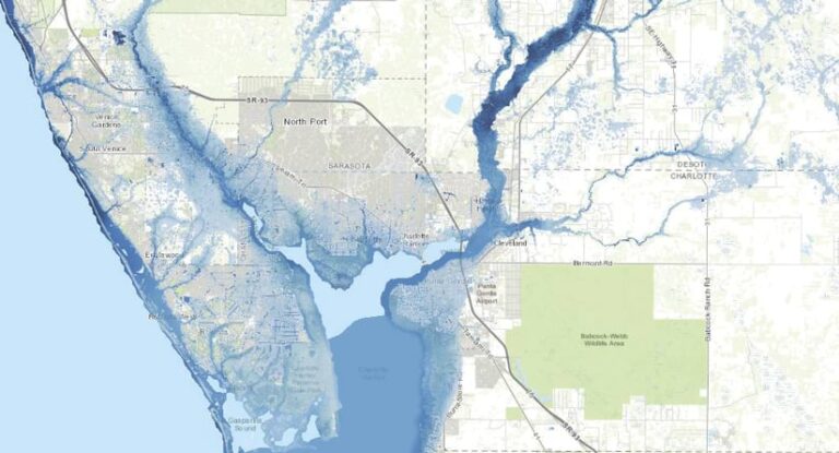
ICEYE provides building-level natural catastrophe data, including flood extent and depth measurements, via ArcGIS Enterprise and ArcGIS Online in near real time. This helps public sector organizations and insurers execute spatial analyses that improve critical decision-making during disaster events, such as hurricanes, wildfires, and earthquakes.
Drives increased use of Esri technology through commercial solution sales
Motorola Solutions
VertiGIS GmbH
VertiGIS offers spatial technology and Web GIS-based solutions to help organizations manage their spatial assets. The company’s enterprise-wide spatial management solutions are centered on use cases, empowering customers across industries to overcome complex business challenges and build their own geospatial deliverables that make a difference.
Helps customers meet their targets for the Sustainable Development Goals
Blue Raster
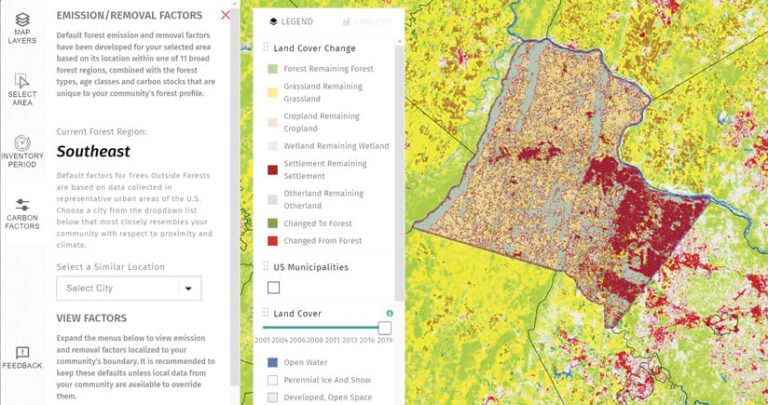
Blue Raster develops innovative geospatial solutions to help organizations achieve their Sustainable Development Goals (SDGs). The company recently collaborated with the World Resources Institute to use ArcGIS to build the Land Emissions and Removals Navigator (LEARN) Tool, which aids communities in reducing their greenhouse gas emissions.
Codex Remote
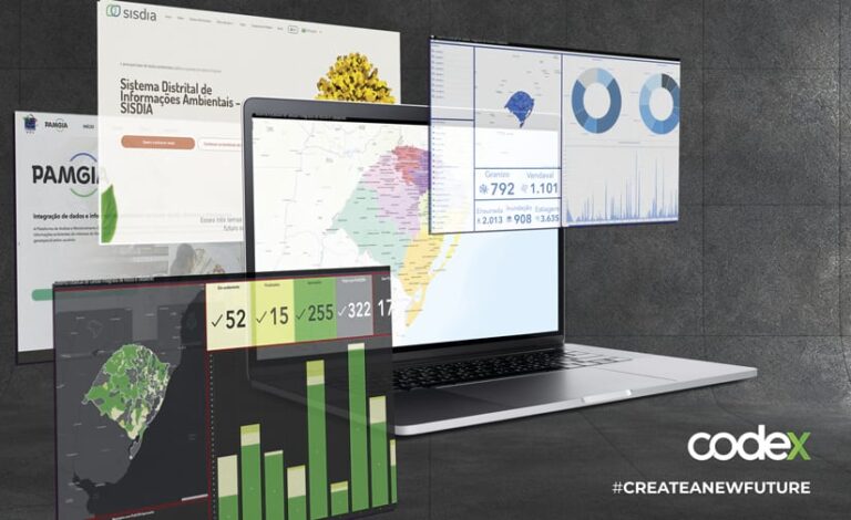
Staff at Codex employ Esri technology and data intelligence to develop solutions that foster data-driven governance on environmental issues, climate change, and sustainability. Clients include the Brazilian Institute of Environment and Renewable Natural Resources, the Brazil Ministry of Finance, the Inter-American Development Bank, and private companies.
Ensures customer success by comprehensively implementing the ArcGIS system in the cloud
Axim Geospatial
Axim Geospatial, an NV5 company, makes the world a smarter, safer place by putting clients’ GIS in the cloud and managing it long term to support digital twins. The company’s global customers include intelligence and defense organizations; federal, state, and local governments; and commercial entities.
ROK Technologies
ROK Technologies helps organizations scale and modernize their GIS by architecting, migrating, and managing ArcGIS Enterprise and ArcGIS Desktop solutions in Amazon Web Services (AWS), Microsoft Azure, and Google Cloud Platform (GCP) environments. This reduces project risk and downtime.
Delivers creative content to ArcGIS users
Nearmap
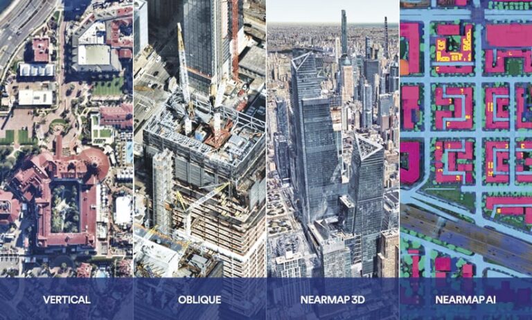
By conducting proactive captures up to three times a year, Nearmap delivers current, clear, high-resolution aerial imagery and comprehensive location intelligence that fuel digital innovation and sophisticated analysis. Nearmap’s vertical and oblique imagery, city-scale 3D data, and artificial intelligence (AI) content seamlessly integrate with ArcGIS.
Vexcel Imaging
Vexcel collects high-resolution aerial imagery and geospatial data in 30 countries. It publishes, on average, 100,000 images per day—including orthomosaics, oblique imagery, and digital surface models—to help insurers, government organizations, and other entities get instant access to accurate imagery within ArcGIS products.

Influences the adoption of Esri technology through solution sales, software implementation, and/or consulting engagements
GEOGRAPH Technologies
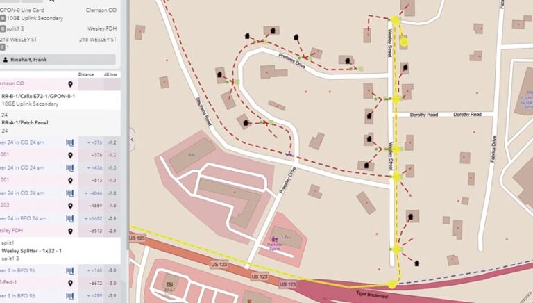
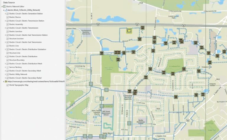
CrescentLink, by GEOGRAPH Technologies, is a fiber management software system that puts GIS managers in control of their networks. An extension for ArcGIS Desktop, CrescentLink creates a digital twin from network data, becoming the single source of truth—a proven way to improve operational efficiency.
SSP Innovations
SSP Innovations delivers solutions for ArcGIS Pro to electric and gas utilities, telecommunications providers, and pipeline operators around the world. Staff have deep technology expertise and comprehensive knowledge of industry best practices, enabling them to design solutions that help customers meet their unique business challenges.
Generates compelling use of Esri technology to impact global current events
dymaptic
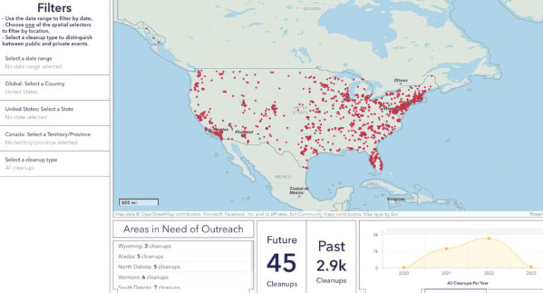
With a customer return rate of 92 percent, women-owned dymaptic provides GIS-centric software development and administration services across industries. To help EarthDay.org prepare for World Cleanup Day, dymaptic used Python scripts to automate data processing and map creation, plus ArcGIS Hub to display results.
Nelson Intelligence Solutions, LLC
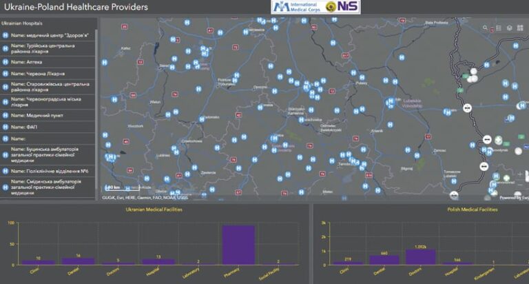
Nelson Intelligence Solutions (NiS) provides geospatial services to International Medical Corps to support its aid efforts in Ukraine. NiS used several Esri products to develop a location intelligence solution to help the organization provide effective humanitarian assistance.
Fosters innovative technical or business collaborations among partners
Datastory
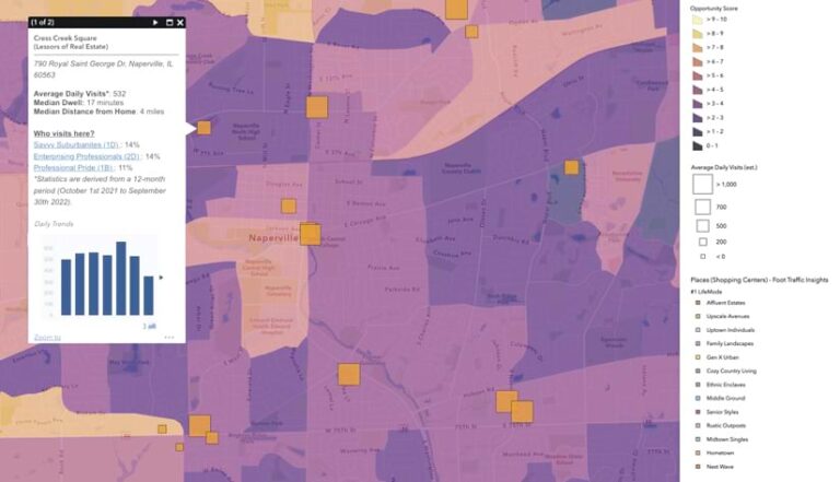
MapDash, Datastory’s turnkey market and consumer insight solution, combines best-in-class data from Esri partners with powerful analytics grounded in industry expertise. As business leaders use MapDash to see location-based connections, they enter the Esri ecosystem and typically begin an accelerated journey toward location intelligence maturity.
GeoMarvel
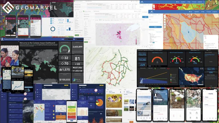
GeoMarvel is a geospatial software development company specializing in GIS managed services, cloud infrastructure, data analysis and computation, and custom app development. With more than 30 years of experience in both the public and private sectors, GeoMarvel can confidently build scalable infrastructure and software solutions.
SymGEO
SymGEO provides GIS solutions for state and local governments across the United States. The company leverages ArcGIS technology for data analysis and visualization and app configuration and deployment. SymGEO’s mission is to engage with communities and inform diverse audiences by telling memorable stories with data.

