At the 2022 Esri Partner Conference, held in March in Palm Springs, California, Esri acknowledged 26 partners that are doing remarkable work with ArcGIS technology by presenting them with awards in 11 categories. Read on to find out more about the innovative solutions, services, and content these partners offer.
Demonstrating Highly Aligned Solutions
Khatib & Alami
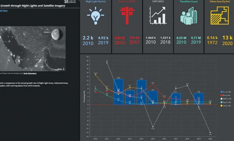
To help clients across multiple industries and environments improve their business processes, save time, cut costs, and make informed decisions, Khatib & Alami uses ArcGIS technology to integrate location intelligence with e-government services, ArcGIS GeoBIM, geospatial artificial intelligence (GeoAI), augmented reality (AR), virtual reality (VR), and more.
GP One Consulting
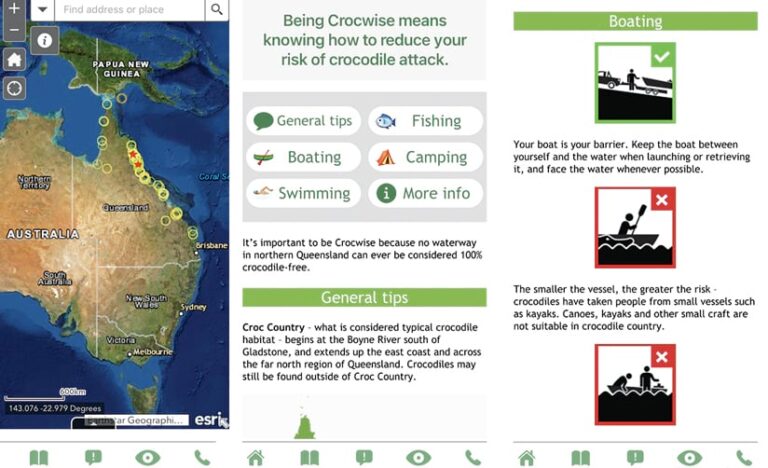
GP One Consulting brings advanced, practical programming skills to its clients’ spatial data challenges. The QWildlife crocodile sightings platform, developed for the Queensland Government in Australia, leverages ArcGIS Enterprise, ArcGIS AppStudio, and ArcGIS Survey123 to improve job tasking, increase public safety, and better protect crocodiles.
GEO Jobe
The ABC’s of GIS from GEO Jobe is a powerful combination of solutions that ArcGIS administrators can use to improve their workflows and increase productivity. Nearly 9,000 organizations worldwide use these apps. As the scale of an organization’s offerings increases, so does the power of the ABC’s of GIS.
Showing Substantial Opportunities for Growth with Esri
Antea Group
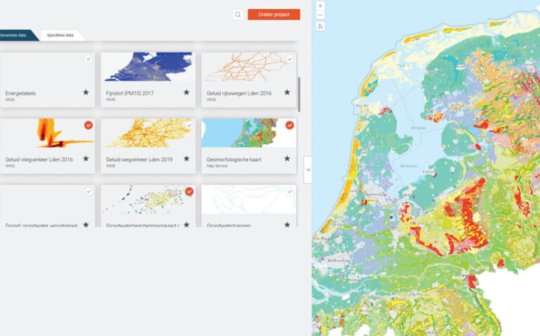
Antea Group combines multidisciplinary perspectives and technical expertise to deliver solutions for a better future. Using Antea World, a solution based on ArcGIS Enterprise, Antea employees can explore datasets and apps. Eventually, this will become a digital twin of the Netherlands that integrates with all the company’s products.
Berntsen International
Radio-frequency identification (RFID) is a rapidly growing technology. Berntsen International’s InfraMarker app for Survey123 and ArcGIS Field Maps connects RFID-marked field assets with the associated asset data in ArcGIS. This results in faster and more accurate workflows in both the field and the office.

Innovate!, Inc.
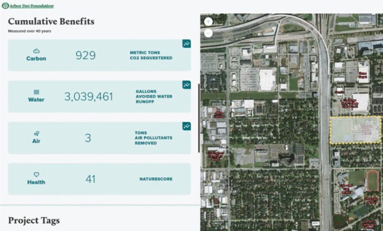
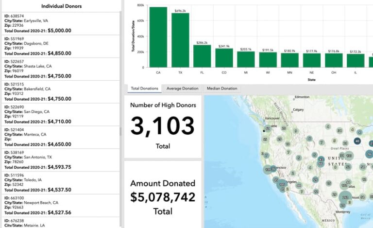
To help clients optimize their investments in Esri technology, Innovate! does everything from modernizing legacy systems to building scalable enterprise solutions. For the Arbor Day Foundation, the Innovate! team used ArcGIS Enterprise to integrate donor investment data into a dynamic dashboard in a way that increases engagement.
Delivering Creative Content to ArcGIS Users
Beans.ai
Geospatial data as a service provider Beans.ai creates highly accurate subaddress-level geocodes for multiunit dwellings and complexes. The startup’s proprietary location data helps customers in the transportation, logistics, delivery, public safety, and emergency response realms solve what’s known as the last-mile problem so they get to the correct destination.

IHS Markit
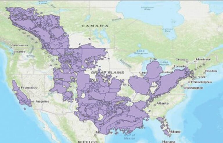
IHS Markit provides expertise and solutions to help organizations expeditiously visualize and analyze critical and ever-changing information about global commodities. The company leverages the power of cloud data warehouses to deliver spatially enabled data models directly to ArcGIS Pro and ArcGIS Insights.
Nexiga
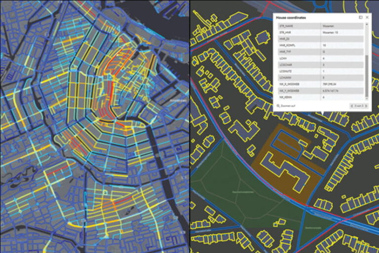
A full-service provider of GIS and geocoding solutions, Nexiga offers high-quality, geospatial market data down to the household level. Subjects covered include pedestrian frequency, building information, and broadband availability—all of which enable customers to glean cross-industry insight so they can design sophisticated marketing and sales strategies.
Evolving Customers and Solutions to the Web GIS Pattern with SaaS
DVG
DVG builds enterprise GIS solutions to help customers solve mission-critical business problems across industries, from law enforcement and public safety to health and transportation. The company’s GIS experts make use of Esri’s full stack of technology for web, desktop, and mobile and specialize in rapid, cloud-based deployments.
Dawood Engineering
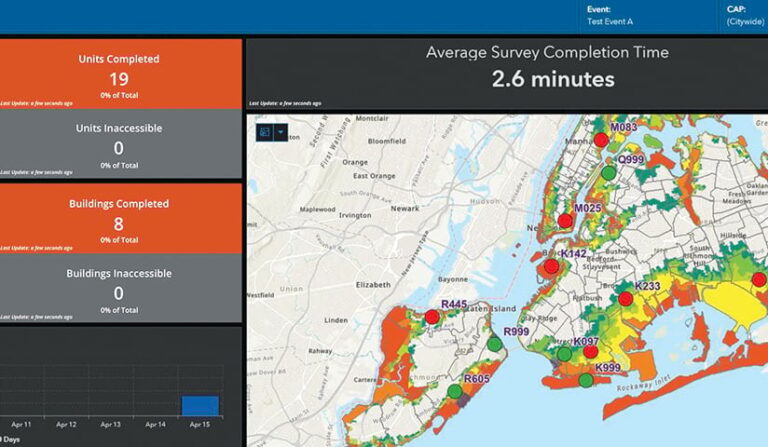
Dawood provides project management tools that geospatially enable asset management and utility workflows. When Southern Company Gas required an optimal land management solution for a pipeline project in Illinois, Dawood developed a custom portal using the AEC Project Delivery subscription service, ArcGIS Dashboards, Survey123, and ArcGIS StoryMaps.
VertiGIS
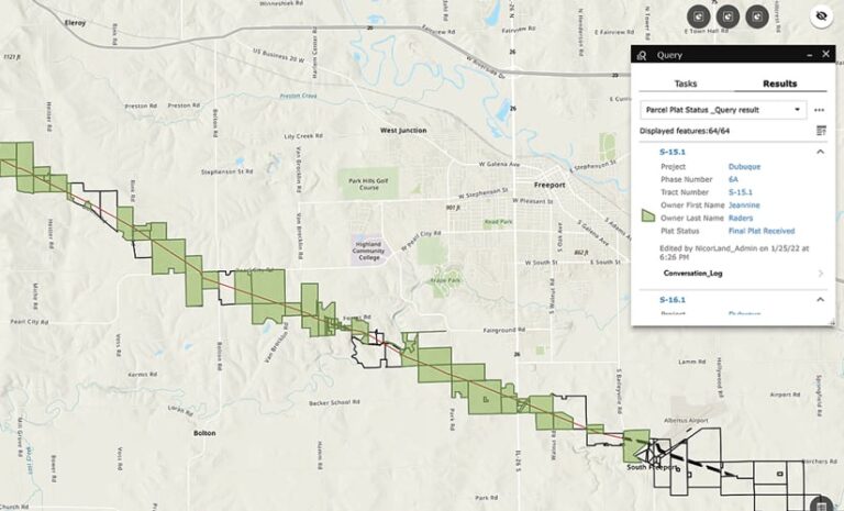
VertiGIS works across industries to help organizations that deploy Esri technology accomplish even more and go beyond the out-of-the-box capabilities of ArcGIS software. Using VertiGIS Studio, ArcGIS users can build powerful, purpose-driven apps at a fraction of the cost and development time that are normally required.

Delivering Analytics and Insight to Users
Airspace Link
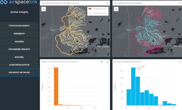
Drone operators have described AirHub, from Airspace Link, as smart maps for drones. Because roads in the air don’t exist yet, AirHub leverages the ArcGIS system, authoritative local data, Federal Aviation Administration (FAA) regulations, and third-party datasets to build compliant and efficient flight routes.
Environmental Science Services, Inc. (Es2)
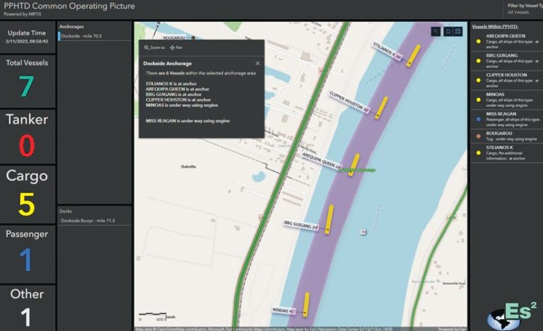
In partnership with the Mississippi River Traffic Information Service, Es² and the Plaquemines Port Harbor and Terminal District ingested raw automatic identification system (AIS) vessel traffic feeds into ArcGIS GeoEvent Server. Geofences around the port’s facilities allow staff to monitor vessel movement and track tariff-eligible events.
Compelling Use of Esri Technology to Make an Impact
Alcis
By accessing unique data, harnessing emerging technologies, and continually innovating, Alcis helps its clients in the international development realm use GIS to better understand complex situations, make sound decisions, and generate advantageous outcomes for people in some of the world’s most fragile and war-torn environments.

The FaithX Project
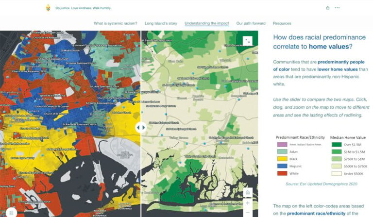
FaithX’s groundbreaking work employs geospatial data (supplied via MapDash from another Esri partner, Datastory) and ArcGIS StoryMaps narratives to help congregations identify the effects of systemic racism on their surrounding communities so they can mitigate those impacts and better engage with the people they serve.
Helping Customers Meet the Sustainable Development Goals
ARC-GREENLAB
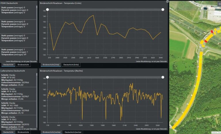
German company ARC-GREENLAB provides surveying, GIS, and building information modeling (BIM) services and software to government and commercial customers. To help digital construction firm VIA IMC and its parent company Eurovia reduce CO2 emissions during road construction, ARC-GREENLAB developed AVUS.ONLINE, a digital twin based on ArcGIS technology.
Cadasta
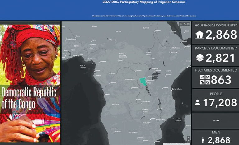
Using Survey123, Field Maps, ArcGIS Online, and ArcGIS Living Atlas of the World, Cadasta helps local residents and government staff members map and document land rights and build their technical capacity so they can create a more secure and sustainable future for their communities.
Outstanding Presence on ArcGIS Marketplace
North Point Geographic Solutions (NPGS)
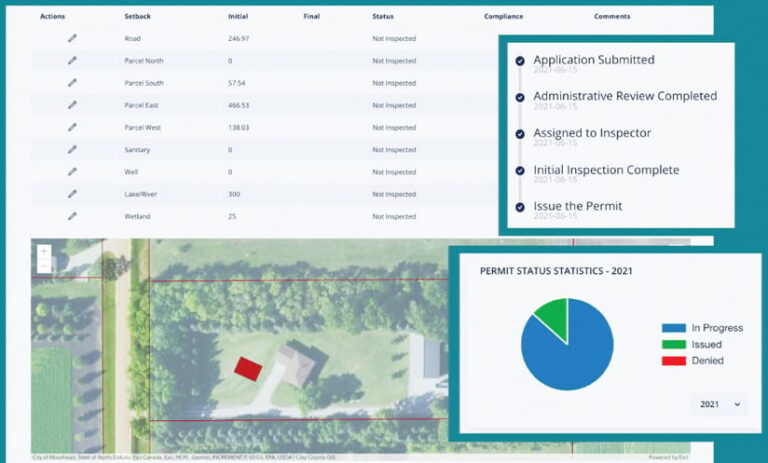
NPGS, which supports state and local governments and the forestry industry, specializes in developing unique, GIS-integrated web apps that help users streamline workflows and increase efficiency. For example, NPGS worked with Bayfield County, Wisconsin, to build SmartPermit, a paperless, GIS-based land-use and permit process.
Wejo
Wejo provides feature layers of its Journey Intelligence and Traffic Intelligence data for use with ArcGIS Pro and ArcGIS Online. As a result, real estate, construction, retail, and government organizations have access to millions of connected vehicle data points sourced directly from offices of emergency management.

Collaborating Innovatively with Esri and Partners
Bay Park Data Solutions
Harnessing the power of spatial analytics and data integration, Bay Park helps nonprofit organizations gain actionable insight into fundraising activities, donor retention initiatives, marketing objectives, and development outcomes. The Bay Park team builds these custom solutions primarily using ArcGIS Online, Survey123, ArcGIS Experience Builder, and Dashboards.
GeoComm
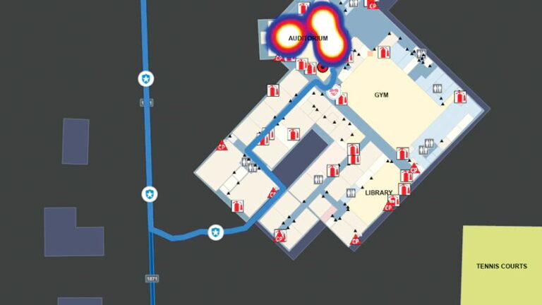
GeoComm, which provides its Public Safety Location Intelligence service, works with local, regional, state, and military agencies in 49 US states. Through extensive collaboration with Esri, GeoComm ensures that its indoor maps empower public safety agencies to improve situational awareness during emergencies and reduce response times.
Ensuring Customer Success with ArcGIS
CyberTech Systems and Software
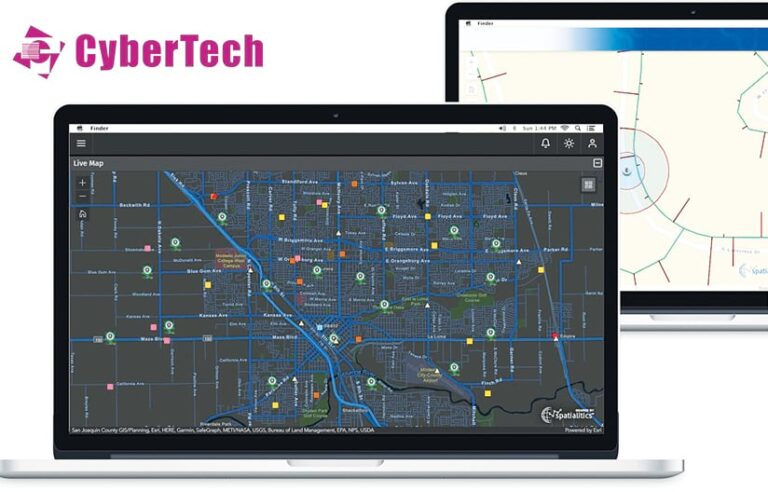
CyberTech staff members are experts at implementing ArcGIS Enterprise. Their depth and breadth of knowledge, along with the company’s extensive resources, ensure project success regardless of scope. Specializing in cloud transformation, they deliver large and complex geoenabled business solutions that fully integrate with critical enterprise systems.
geoConvergence
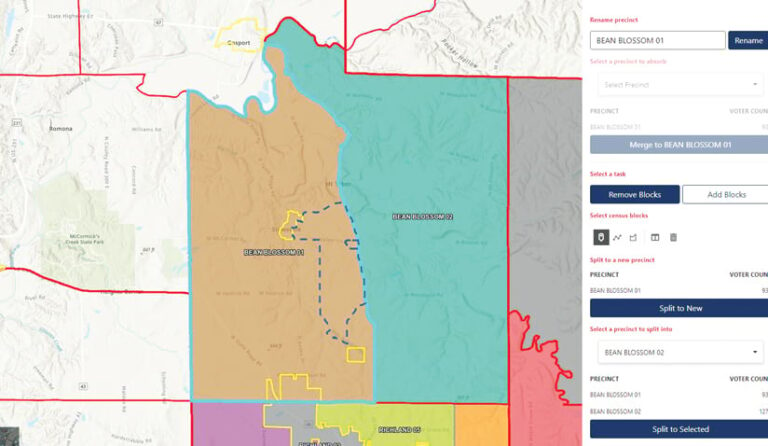
Since 2004, geoConvergence has specialized in implementing, integrating, and extending core Esri technology. The award-winning Small Business Administration (SBA) 8(a)-certified organization provides best-in-class solutions to commercial and government customers. geoConvergence has earned four specialties from Esri, including ArcGIS System Ready, ArcGIS Indoors, and Federal Small Business.
Influencing the Adoption of Esri Technology at a Strategic Level
Cityworks
Cityworks, a Trimble Company, provides Web GIS-centric asset management and permitting solutions powered by ArcGIS technology to help organizations streamline asset management and community development. Cityworks combines ArcGIS geodatabase technology with business apps to better coordinate workflows, schedule resources, and prioritize public works activities.
SSP Innovations
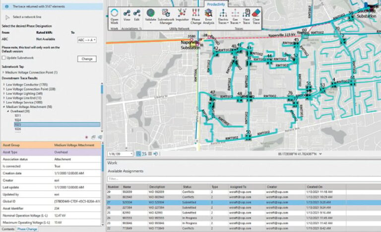
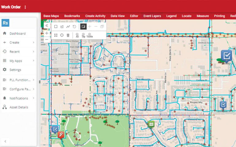
SSP Innovations delivers ArcGIS Pro solutions to electric and gas utilities, telecommunications providers, and pipeline operators around the world. Solutions are designed to help customers meet their unique business challenges through a combination of deep technology expertise and comprehensive familiarity with industry best practices.
