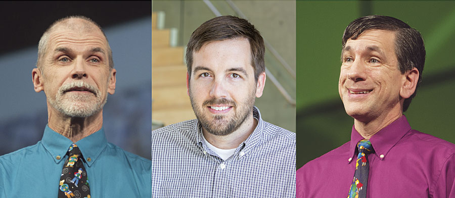
During the last 25 years, the Esri education team has established itself as a valuable member of the geospatial education community. In recent months, the team’s stature was recognized four times over when three of its education managers received prestigious awards.
Charlie Fitzpatrick was presented with the National Council for Geographic Education’s (NCGE) highest honor in July when he received the George J. Miller Award for Unwavering Support of Geography Education. The NCGE also selected a paper written by Tom Baker and a research group of seven others as the Best Article for Geography Program Development. And Joseph Kerski was awarded the National Geospatial Technology Center of Excellence’s Lifetime Achievement in Geospatial Two-Year College Education Award in June. This followed closely on the heels of Texas State University’s Department of Geography presenting Kerski with its Outstanding Support from the Business Community Award in May.
Reflecting on this streak of honors, Kerski noted that although the Esri education team is not seeking accolades, “it’s very gratifying to know that we are thought of highly and that we are considered to be a key part of the community.”
“It means that some people recognize that this all makes a difference,” echoed Fitzpatrick.

Teaching K–12 Teachers to Use GIS
When Fitzpatrick joined Esri in 1992, it was difficult to get K–12 schools to use computers, much less GIS. But the first time he saw the technology, he said, “Holy cow! This is what I need in my classroom.”
Fitzpatrick never returned to the classroom as a full-time teacher, though. Instead, he took a job with Esri doing what he had already started to love: teaching teachers to use computers in their lessons—particularly ones that involved geography.
“I thought, foolishly, that I would have the job for four years,” Fitzpatrick recalled. “By that time, [I figured GIS]would have swept the countryside.”
Almost 25 years later, Fitzpatrick still manages K–12 education at Esri, working with students, teachers, administrators, education policy makers, geography alliance coordinators, and math and science alliance leaders. He develops materials, creates and licenses procedures and policies, establishes contracts, instructs teachers, and organizes networks of people to help others learn how to use GIS. And he’s still as passionate as ever about it.
“He is very technically competent as well as a good educator,” lauded Kerski, who, when he spoke at the NCGE awards ceremony, asked who in the room had ever been in one of Fitzpatrick’s workshops. Almost everyone raised their hand.
“We’ve directly touched thousands of teachers, who have then influenced millions of kids,” said Fitzpatrick. “And all I had to do was do what I love to do for a long time.”
Researching GST Education
Baker’s work, while more academic in nature, has a similar trickle-down effect. The paper he helped write, entitled A Research Agenda for Geospatial Technologies and Learning, is intended to guide future research on precollegiate education in geospatial technologies (GST) and should eventually help to develop instructional materials for teachers.
“For two decades we’ve had academics and graduate students…do research that is oftentimes poorly connected to the larger body of work,” said Baker. “Frequently, the research conducted doesn’t have sufficient scale and very, very seldom has research in that space ever been replicated.”
The paper is meant to help formalize the GST education community and create a framework for best practices. It encourages focusing GST education research on four main issues: exploring the connections between GST and geospatial thinking, figuring out how students learn GST, investigating how teachers learn GST through professional development, and designing coherent curriculum for learning GST.
Baker believes that receiving this award from NCGE will increase the agenda’s visibility—ideally among people in fields similar to GST, such as science, technology, engineering, and math.
“If we can bring their eyes onto the agenda and have them internalize and act on what we’re advising, that’s the real win,” said Baker.
Connecting with Colleges and Universities
As that begins to happen, it will continue an evolution in GIS education that is already taking place at the college level.
For years, said Kerski, he worked with trailblazers who spent long hours learning and exploring GIS on their own time. Now, however, he is seeing the technology spread to an early majority of adopters.
“At the university level, GIS is now starting to be viewed as something not just for the geographers, environmental scientists, and urban designers but as something that other instructors in fields such as health and history can use to teach or do research with,” said Kerski.
Receiving a lifetime achievement award from the National Geospatial Technology Center of Excellence (known as the GeoTech Center) means a lot to Kerski because the center is a leader in GIS at the community college level.
“For years, they’ve been on the cutting edge of why geospatial education matters,” said Kerski. “That they actually consider me and our work to be a big part of their community is really special.”
He gives similar accolades to Texas State, which has the largest geography department in the country in terms of enrollment.
“They’ve got [GIS] embedded in a lot of different courses,” said Kerski, including health, urban geography, and water resources. “They’re teaching GIS in teacher education programs too. That’s a big deal!”
More Work to Do
According to all three award recipients, school should be a place of engagement where students are encouraged to be creative, understand information, and learn to make valuable decisions. That’s what geospatial thinking and GIS education help students do. And that’s what Fitzpatrick, Baker, and Kerski will continue to champion.

