Ski Resort’s Trails Stay in Top Shape with GIS
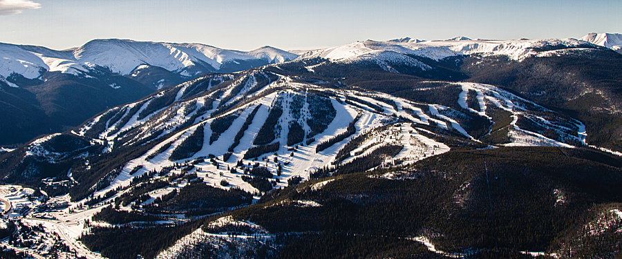
How does Winter Park, Colorado’s longest continually running ski resort, keep more than 3,000 acres of skiable terrain groomed and ready for visitors each day? With GIS—and snowcats too, of course.
With ArcGIS software and the ArcGIS Tracking Analyst extension from Esri running on their computers, supervisors can track the 20 trail groomers and 20 snowmakers working each night. They can see which trails were groomed and which weren’t before the resort opens daily. This is important information that will help visitors decide where they will ski and snowboard each day.

GIS helps trail groomers be more efficient. The locations of the snowcats can be viewed as lines on the map as they move along the mountain. Snowcat operators receive warnings via radio in real time if they are overlapping tracks or covering up previously groomed trails.
ArcGIS has also helped them train new grooming machine operators. Staff can pinpoint which trails were well groomed and use them as examples to teach new operators good trail-grooming techniques.
“Grooming is a big deal,” said Lloyd Lochridge, the ski resort’s GIS technician. “Sometimes plans change and groomers don’t go where you think they did. If we tell the public the wrong information about the trails—whether you are looking for groomed or powder trails—everyone will be disappointed. We take great pride in being able to publish our maps each morning, confident that we will meet their expectations.”
Best of all, supervisors can continue to monitor the operators at night from home using ArcGIS on their laptops. This ensures that the information is as up-to-date as possible and that any problems occurring during the night can be dealt with immediately.
At first, the thought of others keeping tabs on them in the field didn’t sit well with some employees, especially the groomers.
“That’s human nature, right?” said Lochridge. “But once they need help and you can give them real-time support because you know exactly where they are—like, ‘Go left to dodge that cliff that is right in front of you’—feelings change. And it only takes one time. Safety is a good thing.”
For more information, contact Lloyd Lochridge.
See also “GIS to the Rescue“.

