Geoportal Expedites Permit Requests for Staff and Customers
In the Czech Republic, most electric wires, telecom lines, and gas pipes are buried in the ground. Therefore, the law requires landowners to obtain construction permits before building. When a landowner needs a construction permit, he or she must first go to the utility company to obtain an appraisal form—an explanation of the type and location of buried wires and pipes.

CEZ, the largest electricity producer in the Czech Republic, recently used ArcGIS technology from Esri to implement the online Appraisal Request Form Portal, also known as the CEZ Geoportal, to quickly deliver appraisal forms to customers. CEZ processes 160,000 requests per year, an average of 13,000 per month. CEZ operates the CEZ Group, which delivers electricity to nearly 3.5 million customer supply points in the Czech Republic.
Before CEZ Geoportal, staff members had to manually process about 120,000 appraisal request forms per year on the location and parameters of its networks, work that had to be done within 30 days of the request. Those tasks were handled by expertly and technically skilled GIS operators.
“In the past, it was quite difficult for customers to request an appraisal form,” says Frantisek Fiala, an expert consulting specialist at CEZ. “The process involved a lot of paper work and usually took more than half a day for the common citizen to make the request properly and to send it through mail. The web portal simplified the process to minutes.”
The CEZ Geoportal was designed to significantly increase internal efficiency by delivering data to staff at the CEZ Group, as well as to customers. The main benefit of the solution is that it facilitates faster delivery of appraisal forms to customers. It is estimated that at least 30 percent of the appraisal forms can be processed fully automatically. Similarly, in many cases in which there is an actual interference with the network, the forms can be processed without needing an operator’s intervention.
Another important benefit lies in expected savings for the public—an estimated 84,000 workdays will be saved each year. Furthermore, the implementation of automatic electronic communication aids the environment by reducing the use of paper.

During the first year of operation, 88 percent of the 160,000 requests required were submitted electronically through the geoportal. CEZ customer service staff then needed to handle only the remaining 12 percent of the requests. In addition, 96 percent of customers requested a response via e-mail instead of regular mail.
The main reasons for building the Appraisal Request Form Portal included the need to reduce expenses for internal processes and to respond to growing customer requests for online communication.
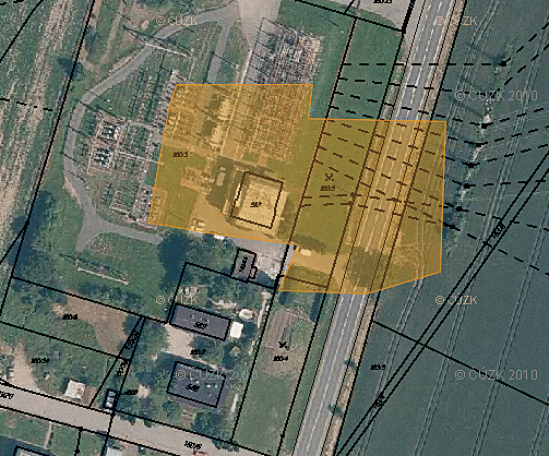
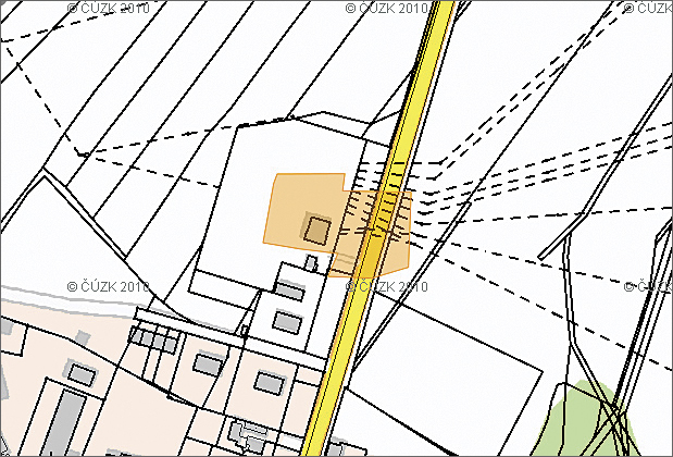
The CEZ Geoportal is also used to facilitate online data sharing and communication with government officials and emergency management centers and other stakeholders. Users enter their requests via the portal in several steps. At their disposal they have advanced locating functions for looking up the area of interest and tools for drawing request polygons and submitting necessary information for follow-up communication.
Submitted requests are consequently handled by a set of tools that, via e-mail, confirm to requesters the enrollment of their requests into processing. Thanks to the use of ArcGIS for Server, it is possible to automatically generate reports on interference (or noninterference) with the network and produce output prints or digital data. After comparison with records from SAP databases, the resultant appraisal form gets finalized as a digital document, or a printout is forwarded to the courier service in cases where the user requires paper.
The process is fully automatic and provides users, by means of a web application or a thick client, instant access to up-to-date information on the current state of the processing of their requests.
CEZ is implementing GIS as a core enterprise system. The CEZ Geoportal is one of the results of the synergy of GIS and enterprise resource planning systems. It performs geoprocessing tasks that were formerly carried out by a large group of operators, dramatically saving operating costs and time. Data sharing is essential for enterprise and government cooperation, and the CEZ Geoportal is a solution designed to distribute spatial information to support the government decision-making process.
For more information, contact Jan Soucek, ARCDATA PRAHA, s.r.o..

