Lake County is located in the central part of the state, just northwest of Orlando. It maintains a population of approximately 295,000 people. With more than 1,000 lakes and rivers, the county landscape is known for its diverse terrain and rolling hills and orange groves.
The county’s Department of Information Technology, the Geographic Information Services Division, deploys geospatial technologies to share and display data in an easy-to-use format. Its services and applications have proved to be integral in a variety of public and private decision-making processes. From selecting the location of a new fire station to plotting out future land uses, up-to-date geographic data is an invaluable tool.

In 2011, the Lake County Sheriff’s Office’s Sexual Offender and Sexual Predator Tracking Unit approached Sue Carroll, GIS project coordinator, with a mapping request. The unit is mandated by law to track sexual offenders living in the county who have been released from the Department of Corrections and wanted a more effective method to approve an address ahead of time if offenders needed to relocate. Specifically, it was interested in a method for measuring distances between selected addresses and public features.
No Purchase Necessary
Carroll outlined a strategy for producing a computer application that would meet unit needs without purchasing additional software and requiring extensive training. The application would be user-friendly and supply the map layers needed—both locally maintained in county GIS and available from other agencies. Carroll suggested the use of cloud-based GIS—Esri’s ArcGIS Online. The county then created a map administrator account and built a digital interactive map.
Once developed, IT staff held a two-hour training class to familiarize approximately 12 law enforcement professionals in the unit with its use. Specifically, they learned how to look up addresses, identify public facilities, and measure distances. An additional short training class was given to the designated map administrator to show how to add map layers as needs increased, as well as basic map housekeeping, such as assigning permissions and sharing data with others.

“They have since taken complete ownership of the map,” says Carroll.
Interactive Map
The Lake County Sheriff’s Office now uses the interactive map to locate potential home locations for sexual offenders prior to allowing them to move into the county or relocate to a new residence.
“One of the limitations of creating and sharing online mapping is that the servers and web development are managed by our IT department, and there is only one developer,” explains Carroll. “It makes it difficult to get on the agenda for developing new GIS maps and apps if other departments have priority projects.”
How It Works
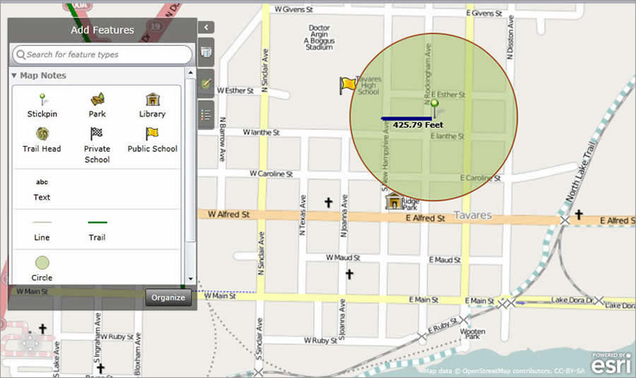
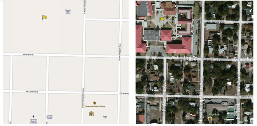
Using ArcGIS Online, which is hosted by Esri in the cloud, unit staff can quickly make assessments regarding possible addresses for released sex offenders to live. Existing county GIS data was uploaded into the application and mapped. The datasets included parks, trails, public schools, and libraries. Additional data for private schools was obtained in spreadsheet format containing addresses and converted, uploaded, and symbolized.
Certain offenders are required to live beyond predefined distances from public facilities, such as schools, parks, and day care facilities. The current residences are recorded at the state level, but if an offender wishes to move, he or she must get prior approval from the Sheriff’s Office to ensure that he or she will not be within restricted areas.
The new application allows deputies to quickly locate a proposed address, draw a buffering ring around it at a specified radius, and visually inspect whether there are any restricted facilities within that radius. While currently, this is the application’s primary use,

“What makes the application particularly useful is its intuitive nature,” says Carroll. “The end users, and even the map administrator, are not GIS professionals. Most of them had never heard of GIS, shapefiles, etc. Yet the users are quickly able to navigate to a zipped file or spreadsheet file and easily upload it into the map.”
Unit personnel can maintain, update, and even improve the map without depending on the county GIS division. They now have access to much more data that resides in spreadsheet form and that has never been mapped before.
Previously, the unit entered the proposed address to see its location using simple software but then had to rely on local knowledge and an assortment of other sources to identify the public facilities that the offender must avoid. This resulted in lots of manual research and many field visits to verify the information.
“The new program has assisted us by being able to add large amounts of data, such as playgrounds or parks, into a simple spreadsheet and then to the map,” says Mike Goss, Lake County Sheriff’s Office, Intel Unit. “The flexibility of the system really assists in the unit’s mission to track the registered sex offenders/predators.”
In the future, the interactive map may be used to track known gang territories, as well as to assist in missing-person cases, death investigations, and robberies.
For more information, contact Sue Carroll, GIS project coordinator, Lake County.

