Six years ago, the Center for Geo-Education at National Geographic launched a project with a simple premise: Public participation in scientific research, commonly known as “citizen science,” shouldn’t end with collecting data. It should include data analysis, as well.
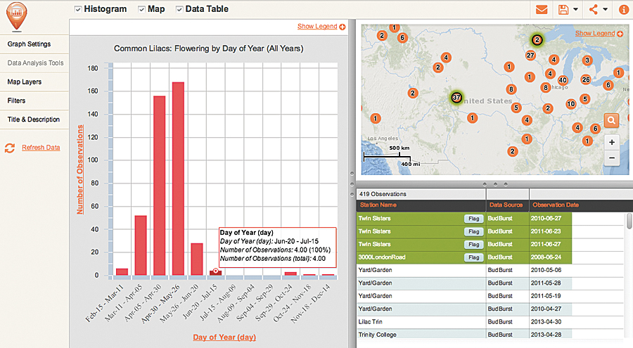
Using the ArcGIS suite of developer tools, we began to build National Geographic FieldScope, a platform for citizen geography (citizen science projects focusing on geospatial data). FieldScope’s goal is to put geospatial data visualization and analysis into the hands of ordinary people who participate in citizen geography projects.

We’ve developed FieldScope by working with three test bed projects, whose goals and audiences informed the software’s design. The three test bed projects are
- Project BudBurst (National Ecological Observatory Network), a plant phenology project in which members of the general public report their observations of seasonal changes in plants.
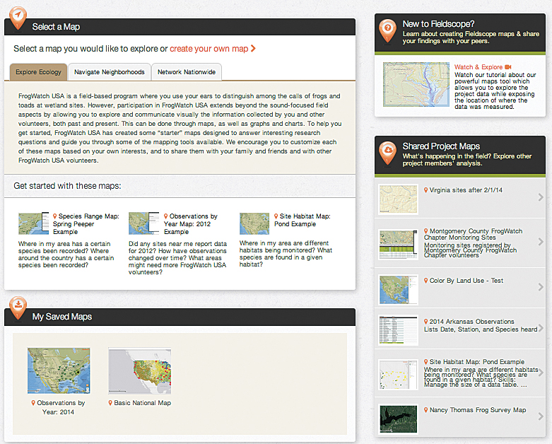
- FrogWatch USA (American Zoos and Aquariums), an amphibian population study in which volunteers who are trained to identify frog and toad calls report on the distribution of different species.
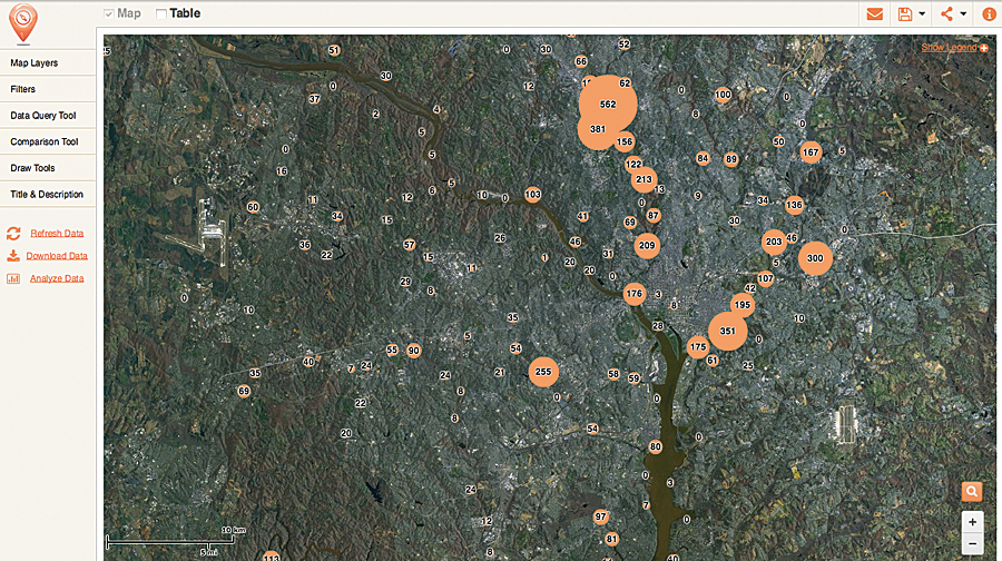
- Trash-Free Potomac (Alice Ferguson Foundation), a regional conservation initiative in which volunteers participating in trash removal from natural areas report on the quantity and types of waste removed.

In each of these long-standing projects, the organizers had a preexisting interest in providing their participants with the opportunity to view and work with the datasets they were contributing to. However, none of them had the resources or expertise to provide that functionality to their participants. In this respect, they were typical of citizen geography projects. Most citizen geography projects are only able to provide participants and visitors with a static map or a simple interactive map of their data. Only a very few, unusually well-funded projects are able to provide maps with thematic layers, customizable symbolization, or geospatial analysis.
With FieldScope, we have allowed the organizers of these projects to provide their participants with access to GIS functionality for exploring their data through a novice-friendly user interface. Through our work with these test beds, we have developed an architecture for rapidly constructing and deploying citizen geography project websites. This spring, we are launching a set of FieldScope Project Builder tools that will enable nonprogrammers to set up a new FieldScope project through a forms-based interface that allows them to describe the data collection protocol and select the data and analytical functions to include in their project.

With the launch of the FieldScope Project Builder tools, we are excited to be approaching our vision of enabling any citizen science project involving geospatial data with the opportunity to provide geospatial data visualization and analysis to its participants.
More information about FieldScope is available at fieldscope.org.
This material is based on work supported by the National Science Foundation under Grants No. GEO-0627923 and DRL-1010749. Any opinions, findings, and conclusions or recommendations expressed in this material are those of the author and do not necessarily reflect the views of the National Science Foundation.

