The first time Dr. Christiane Schmullius saw an infrared Landsat image, she was astonished.
“I was touched by the colors and the heterogeneity of the surface I was looking at,” she said. “Being able to see something that my own remote sensing sensors—my eyes—cannot see because they’re limited to the visible wavelengths was just amazing. I was in awe.”

That was the moment Schmullius knew that she wanted to work in remote sensing. Now, she is a leading expert in the use of radar and global satellite monitoring to perform land surface analysis.
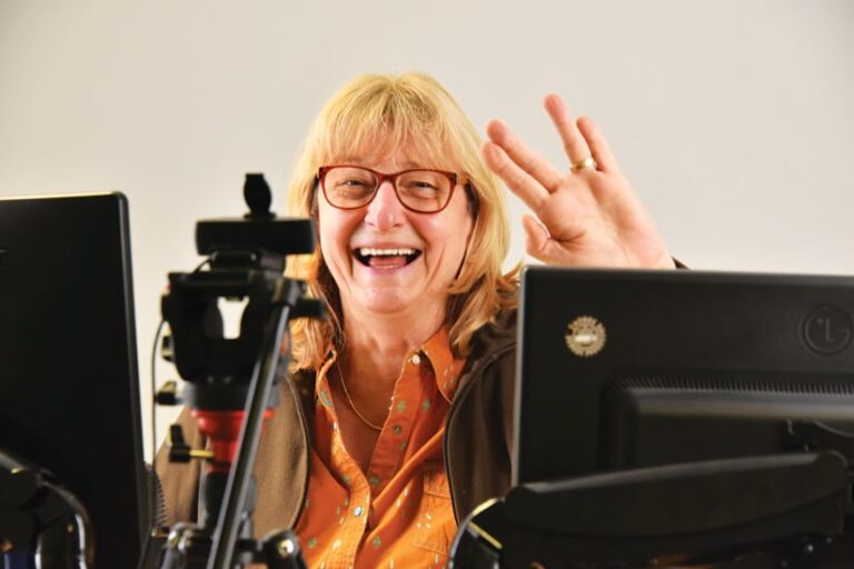
Schmullius, an ebullient professor and chair of the Department for Earth Observation at Friedrich Schiller University Jena in Germany, grew up in Frankfurt as part of a hiking family.
“My father used to hike every Saturday in the forest, and as a hobby, we also visited old castles,” she recalled. “I grew up driving and walking through the landscape. And obviously, I was looking at maps.”
Her love of nature influenced her to study physical geography as an undergraduate. One of her required courses was on air photo interpretation.
“This was in 1982, and at our institute, we didn’t have computer pools,” she recalled. “So we looked at air photos and stereo photogrammetry using stereoscopes.”
Her professor was a geologist who also owned a company that analyzed air photos from all over the world. Schmullius was so captivated by the images she saw in class that she decided to intern at his company.
“They had computers, and for the first time in my life, I saw a near-infrared false color composite of the Brazilian rain forest,” she said. “That was it; I was hooked.”
To continue working in this field, however, Schmullius realized that she would need to study in the United States.
“The company I interned for used Landsat images, and seeing what you could do with them on a computer, I realized that in Germany, we were not at that standard,” she said.
Schmullius applied for a Fulbright scholarship to study at the University of California, Santa Barbara (UCSB). She centered her application on the need to use remote sensing technology to protect the environment, which was becoming a big focus in the United States.
“They loved my application so much that they encouraged me to apply for a two-year, fully funded ITT scholarship,” Schmullius said, referring to the ITT International Fellowship Program, which was sponsored by the International Telephone & Telegraph (ITT) Corporation. “That is what gave me the chance of a lifetime to do my master’s at UCSB. It was one of the best places to study earth observation.”
She took a class on radar taught by visiting professor John Richards, who is now a professor emeritus at Australian National University.
“I didn’t understand much at the time. What he talked about seemed like miracles to me. But that really hooked me on radar,” she said. “That is what great teachers can do.”
Upon completing her master’s degree, Schmullius returned to Germany to look for a job in remote sensing.
“I got the opportunity to work at a very well-known photogrammetry school at the Karlsruhe Institute of Technology,” she said. “They had a project using Landsat data to map land cover, and that is exactly what I had done my master’s thesis on. There were not many people in Germany around 1986 who had that kind of experience, and I really have to say, my training at UCSB had been excellent.”
She worked there for a year and a half before moving to Berlin, where she pursued her PhD at the prestigious Free University of Berlin while working at its Institute for Space Sciences.
“One of Germany’s first astronauts was looking for a PhD student to use an airplane, a little Cessna, as an airborne laboratory for conducting interesting research,” she said.
Because the former astronaut had trained with the National Aeronautics and Space Administration (NASA), he liked that Schmullius had studied in the United States, she said.

“I got accepted as his PhD student, and so another adventure started,” she recalled. “My idea was to bring a radar antenna up in the Cessna to fly over agricultural fields and investigate how those fields looked in different radar wavelengths.”
Similar to how microwaves in kitchens work—heating up food by bringing water molecules into rotation to create warmth—radar transmits pulses of microwave radiation toward the earth’s surface. When these pulses encounter water molecules in soils, vegetation, or snow, for example, parts of these signals bounce back to the radar sensor, denoting (in simplified terms) how much water is present on the observed surface. Taking these measurements over and over, across space and time, shows changes in surface moisture, vegetation structure, or snow volume.
“I got in touch with oceanographers at the University of Hamburg who owned a multifrequency radar antenna for ocean platforms, and my astronaut PhD adviser was crazy enough to say, ‘Okay, let’s do it. Let’s put that radar antenna in the Cessna!’” Schmullius said. “He flew the airplane himself because our setup was a little dangerous. And it worked out. I loved it.”
The dataset they put together was valuable and formed the basis of her PhD dissertation. Because of that experiment, the German Aerospace Center, known by its German acronym DLR, got in touch with Schmullius and offered her a postdoc position exploiting imagery taken by Europe’s first radar satellite, ERS-1, for agricultural monitoring. She accepted.
At the time, DLR was also working with NASA’s Jet Propulsion Laboratory (JPL) and the Italian Space Agency to launch a radar space shuttle mission called SIR-C/X-SAR.
“My boss said, ‘Wouldn’t you be interested in becoming a member of the German payload operations team that’s planning the radar acquisitions in the space shuttle Endeavour?’” Schmullius recalled. “And I said, ‘Well, of course!’”
As part of DLR’s team, Schmullius got to go back to California and work with JPL and a lot of her former UCSB classmates. She was also eventually part of the mission control team at NASA’s Johnson Space Center in Houston, Texas.
“The second shuttle mission in 1994 performed an extremely successful experiment called radar interferometry, which is a very powerful technique used to map topography and changes in topography,” Schmullius said. “The lessons learned paved the way for the Shuttle Radar Topography Mission in 2000, which produced one of the most successful earth observation products: a global digital elevation model.”
The shuttle campaigns ended in 2000, and Schmullius moved into academia as a professor of remote sensing.
“I always loved teaching,” she said.
She was also ready to explore her own interests. Since joining the faculty at Jena, Schmullius has collaborated with scientists all over the world on projects such as producing biomass maps of the Siberian taiga and forests in Mexico, helping Kruger National Park in South Africa map its vegetation structure to analyze the sustainability of elephant populations, developing tools to assess land degradation in southern Africa, and improving crop and surface moisture monitoring in Germany.
Schmullius and her team have also built a radar teaching web tool called EO College that’s used around the world. It is a repository of massive open online courses (MOOCs) on earth observation that range from simple to complex.
“We have 2.5 million page views, 25,000 registered users, and 4,000 course completions, which is a lot in the radar remote sensing world,” she said.
Schmullius believes that transforming her enthusiasm for radar remote sensing into approachable educational material is her greatest legacy. And as the GIS and remote sensing fields continue to unify, she is excited to see what comes next.
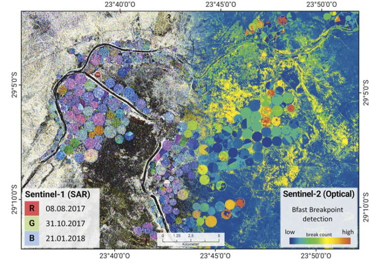
“With Sentinel-1 and Sentinel-2, we now have a fleet of earth observation satellites that let students and scientists bring together radar and optical data to explore changing land surface phenomena. For example, we can acquire images at 6:00 a.m. and 6:00 p.m. and see how the water content of forests and crops has changed. That’s marvelous,” she exclaimed. “With the Copernicus Sentinel fleet, we have reached a new era of how we monitor our earth’s surface in every realm, whether for sustainable land use, necessary infrastructure, climate change impacts, or health care. The data is there, and it’s wonderful, and it’s free. There will be more and more automatic exploitation of these big datasets, but they are useless if they are not brought together with GIS. So both worlds need each other.”

