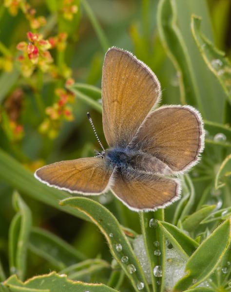
In 1937, the Fender’s blue butterfly was considered extinct due to human activities’ effects on its habitat. In 1989, however, approximately 4,000 of the species were discovered in the wild in Oregon’s Willamette Valley. Eleven years later, in 2000, the Fender’s blue butterfly was put on the endangered species list.
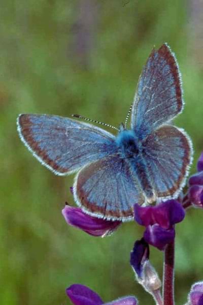
The habitat for these butterflies is highly sensitive to disturbances. The presence of Kincaid’s lupine—a tall, thin, stalk-like plant with purple flowers—and other native lupines is a strong indicator of Fender’s blue butterfly populations, since the plants are primary hosts for the insects’ larvae and the butterflies pollinate the lupines. This means that the decline of lupines endangers Fender’s blue butterflies, and decreases in butterfly populations imperil their own habitat. Thus, mapping the butterflies’ habitat is crucial for protecting them.
To comply with federal protection laws, Yamhill County, Oregon, is mandated to identify, map, and protect Fender’s blue butterflies’ habitats. The county’s public works department—which oversees grass mowing and herbicide spray operations along all county roads—has collaborated for many years with biologists and environmental agencies to collect information on butterfly habitat locations, identify areas where invasive species are present, and take measures to prevent the invasive species’ proliferation.
Until recently, the public works department’s mobile crews carried out these functions using paper maps and GPS receivers. But now, ArcGIS Field Maps provides all staff members with an efficient and comprehensive workflow for finding, recording, and visualizing data about the butterflies’ habitats and worrisome invasive species.
A Complex Process Gets Simplified with a Single App
Identifying and mapping protected butterfly habitats and areas that contain invasive species can be a complex task, especially since some of the protected areas are under private management. Yamhill County mobile crews must take care to avoid spraying or mowing privately managed areas to prevent unnecessary herbicide use and conserve resources.
In the past, mobile crews would use paper maps and road markers and drive along county roads, stopping multiple times to determine where to spray, mow, and disinfect their equipment. This process was slow and cumbersome. For years, the Yamhill County Public Works Department sought a comprehensive solution that could help staff optimize their time and streamline their data recording processes. The ideal solution would also allow employees in the office to track public works vehicles in real time so mobile crews could receive notices when approaching protected areas.
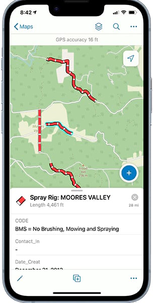
Yamhill County contracted with the Mid-Willamette Valley Council of Governments in Salem, Oregon, to find a comprehensive GIS solution that staff members could use to protect Fender’s blue butterflies’ habitats and grapple with invasive species. After researching potential GIS solutions, the joint team determined that Field Maps would work best, since it combines data collection, map viewing, and location tracking capabilities in a single app that was easy to use and deploy.
Digital Workflows Exceed Expectations
After cleaning and attributing all the GIS data that Yamhill County’s mobile crews had already collected, a GIS analyst created maps of the protected areas and published them as GIS services in ArcGIS Online. The analyst then configured the maps for data collection and set up forms to input protected areas’ attributes, feature templates to help mobile crews categorize their observations, and ways to share the maps. The feature templates, in particular, have been beneficial to Yamhill County staff members when defining default values for things like species type and land management specifications. For one thing, they address the county’s long-standing challenge of getting mobile crews to use uniform naming conventions.
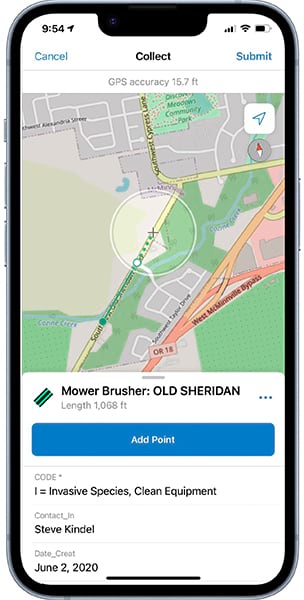
Since Field Maps was deployed two years ago, it has exceeded the Yamhill County Public Works Department’s expectations. Using the app saves staff members and mobile crews time in finding butterfly habitats and invasive species; facilitates better data collection through its user-friendly interface; and, ultimately, improves habitat protection.
Crew members now use iPhones and iPads with cellular data service to display their vehicle’s precise location. Brightly colored maps within the app show protected areas and places with known invasive species, so mobile crews can easily find them. Each protected-area polygon also has a safety buffer—which indicates where mobile crews need to stop spraying and mowing—to account for potential GPS accuracy issues. And the app has become valuable for collecting and updating data in real time on new protected areas.
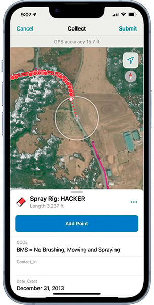
Different custom versions of Yamhill County’s Field Maps deployment have been created to cater to the mowing and spraying crews’ distinct requirements. The team is planning to further improve real-time tracking accuracy as well by pairing Field Maps with higher-precision Global Navigation Satellite System (GNSS) receivers and implementing the app’s new geofencing capabilities.
GIS Serves Conservation Projects Well
Protecting Fender’s blue butterflies has been very successful in Oregon. In February 2023, the Fender’s blue butterfly’s status was updated from endangered to threatened.
Yet the species remains vulnerable to changes in climate and rising temperatures, which also impact lupine habitats. Organizations and residents throughout the Willamette Valley must continue to ensure both species’ survival. In Yamhill County, the use of GIS has played a very important role in this great task—and it can do the same for other, similar conservation projects.


