The Urban and Regional Information Systems Association (URISA) has recognized government agencies’ outstanding achievements in the use of geospatial information technology since 1981, when it first presented the Exemplary Systems in Government (ESIG) Awards. Award winners are effective at applying geospatial technology and data to improve the delivery of government services and increase benefits for residents. The competition is international and open to all public agencies at the local, regional, state and provincial, and federal levels.
Government agencies can compete for the ESIG Awards in one of two categories: enterprise systems, which are used by multiple agencies, and single-process systems, which are used by one agency. Submissions are evaluated on system design and implementation, the impact the system has on the organization, and the resources used to create the system.
The enterprise systems winner for 2024 was the City of Frisco, Texas, which developed a digital twin to give emergency responders rapid access to building information. The single-process systems winner this year was the City of Rockwall, Texas, which developed a dashboard that made it easy to share restaurant health inspection scores with the public.
An Enterprise-Level View of Emergencies
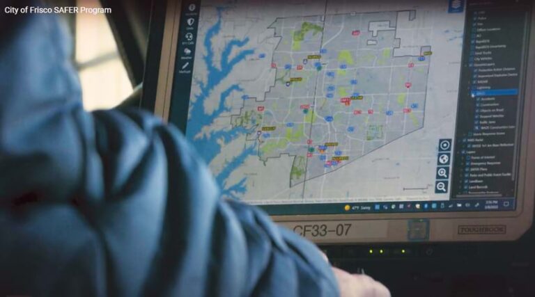
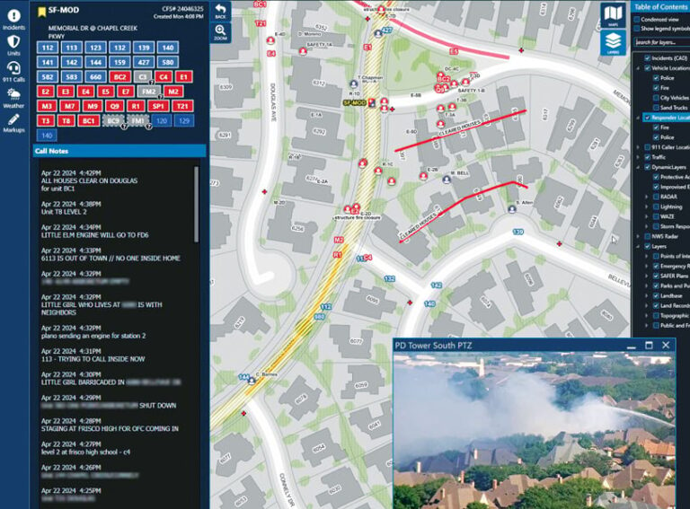
The enterprise system that the City of Frisco developed is called Situational Awareness for Emergency Response, or SAFER. The map-based system—which features aerial maps, floor plans, hazards, and contact information for schools—enables first responders to start planning their operations before they arrive on-site at an emergency.
The project leveraged strong partnerships among fire, dispatch, police, transportation engineering, and IT departments, along with a local school district. In developing an in-house geospatial platform, the City of Frisco realized its vision to enhance situational awareness during emergency response.
Since its implementation, the SAFER platform has gone through a series of transformations, evolving into a public safety digital twin that incorporates more than 30 integrations and 240 GIS data layers. These systems include preplanning resources such as building floor plans and geospatial details related to a variety of resources, including the following:
- Critical infrastructure
- Fire and computer-aided dispatch records
- 911 (emergency) callers
- Fire suppression system impairments
- RapidSOS (an intelligent safety platform)
- Real-time traffic conditions
- Vehicle and Motorola radio GPS locations
- Waze traffic incident reports
- Road closures
- Live video feeds of schools and traffic
- Weather conditions
- Hazardous materials plumes
The SAFER team also created a custom software solution with several components, all of which were developed with in-house resources. Collaboration among multiple city IT departments yielded an innovative product that the ESIG Award judges described as unparalleled in the commercial market and unprecedented among local governments.
“The dedication of the GIS, fire, police, transportation, and other departments to work collaboratively on this is astounding,” one judge observed. “Bravo for ease of user acceptance. The impact is easy to see, given [that] thousands of hours were saved, which is big for efficiency. Resource [and] information sharing is huge, and at the end of the day, if it saves lives and property, it is all worth it.”
A Streamlined Way to Share Restaurant Health Inspection Scores
The single-process system that the City of Rockwall built is a dashboard that displays health inspection scores for restaurants throughout town.
The dashboard was initially implemented as a GIS-centric permitting and inspection solution for the city’s health services department. It was then automated even further to share restaurant inspection scores with the public, local businesses, and other city departments.
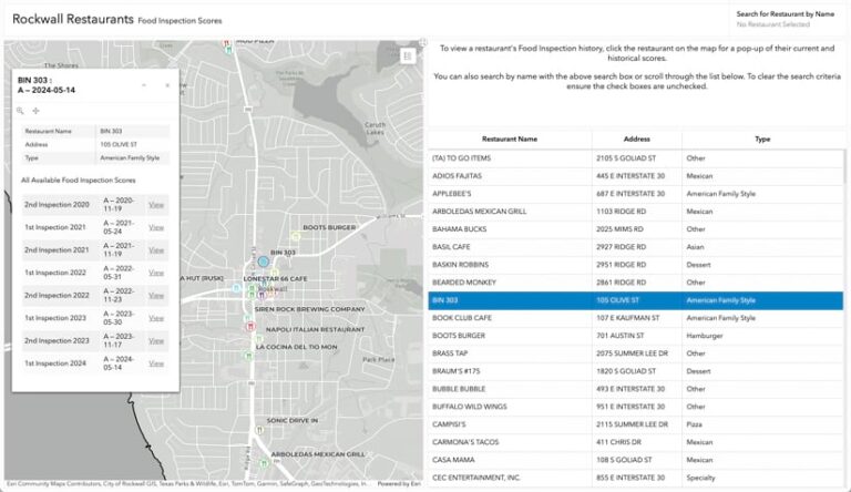
Rockwall’s GIS division automated the publication of restaurant health inspection scores in a manner that users can easily understand. Accessing the app through the health services department’s website, users can either select a restaurant from a list or find one on the map. Once a restaurant is selected, a pop-up displays the establishment’s recent health inspection scores and allows users to view current and historical inspection reports.
The dashboard has reduced the amount of manual and duplicative work that city employees have to do, improving the efficiency, effectiveness, and timeliness of data sharing.
To build the system, GIS staff leveraged spatial views, custom scripts, and web customization tools to create a sustainable and elegant map and dashboard that also give users access to actual health inspection reports. Personnel who provided expert customizations were pivotal to the dashboard’s successful implementation.
“The previous system was not always updated in a timely manner, nor equally, across all restaurants, and [it] required manual data entry,” said one judge. However, this new system, the person noted, “provides clear, current, and—most importantly—accurate information related to restaurant [health inspection] scores.”
Another judge added, “I want the city I live in to do this, too!”


