Communities across the United States face an escalating threat from wildfires—a risk no longer confined to western states. In three of the last nine years, wildfires have scorched more than 10 million acres across the country—a figure that hadn’t been reached in the three prior decades, according to the National Interagency Fire Center.

To adapt to and mitigate this growing risk, communities are moving toward more collaborative and transparent approaches to wildfire risk mitigation, enabling residents to more actively participate in the process. In line with these efforts, wildfire and GIS experts at Esri partner SWCA Environmental Consultants are using Esri products such as ArcGIS Survey123, ArcGIS Field Maps, ArcGIS Experience Builder, ArcGIS StoryMaps, and ArcGIS Hub to help residents create community wildfire protection plans (CWPPs)—reports that outline local priorities for wildfire risk mitigation.
Digitizing Wildfire Risk Assessments
Traditionally, communities across the United States have assessed their wildfire risk using paper forms adapted from National Fire Protection Association protocols. The assessment involves evaluating conditions in the wildland-urban interface—the transition zone between unoccupied land and land that’s been developed by humans.
Using Survey123, SWCA’s GIS team digitizes these forms, enabling risk assessment participants to input data in real time in the field and include notes and photos linked to their locations. In places such as Gilpin County, Colorado, SWCA has trained emergency management employees and other local stakeholders to use Survey123 to assess structural hazards related to potential wildfires.
The use of Field Maps enhances these assessments by giving participants mobile access to crucial data layers, offering baseline information and contextual understanding. The app also allows users to easily note significant on-the-ground details, such as ponds, stock tanks, narrow bridges, and closed roads, that might not be reflected in previously existing imagery. Users can also employ Field Maps to quickly create text-format data summaries that they can then share.

With Experience Builder, SWCA and its clients can tailor collected data and analysis results to present wildfire risks and mitigation strategies in easily accessible formats. The web apps created with Experience Builder let users navigate through various data levels—from community-specific insights to county-wide overviews—that can improve residents’ understanding of wildfire risks and engagement with mitigation plans.
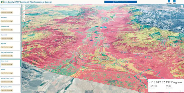
In Inyo County, California, for instance, SWCA performed wildfire risk assessments for more than 40 communities where accessing specific community risk information would have traditionally involved navigating through extensive paper-based documentation. SWCA developed a custom Experience Builder app to simplify this process, enabling county residents and officials to easily locate their community’s information—including risk levels, mitigation actions, and relevant geographic details—by simply typing in a town’s name or navigating to it on a map. The app streamlined information storage, centralized the county’s wildfire preparedness plans, and yielded a readily accessible system that can be updated at any time.
Hub Sites Communicate Plans
SWCA uses hub sites created with ArcGIS Hub to collect and display wildfire planning information for diverse community audiences. Whether a user seeks a high-level overview of wildfire planning efforts, ongoing projects, and financial expenditures or is looking for granular details of specific community engagement initiatives, the hub sites are a key tool for managing and communicating wildfire risk information.
In New Mexico, communities in the Sangre de Cristo Mountains faced unprecedented challenges in 2022 following the Hermit’s Peak/Calf Canyon Fire—the largest wildfire in the state’s history—which burned 341,735 acres. In partnership with SWCA, the New Mexico Forest and Watershed Restoration Institute created a hub site after the fire to serve as a central repository for vital information and to show the community’s resilience and proactive stance after the disaster. The hub site provides residents and stakeholders with comprehensive information, including updates on recovery efforts, new mitigation strategies, and community support initiatives.

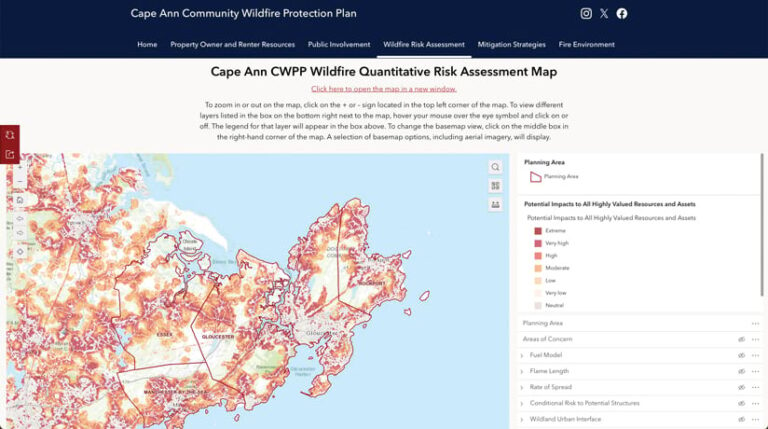
In Massachusetts, Cape Ann’s fire mitigation challenges stem from its dense forests and coastal proximity. The Cape Ann CWPP addresses these risks with tailored strategies for mitigation, community engagement, and emergency preparedness. The town’s CWPP hub site aggregates crucial data and resources to ensure that the community stays informed and is prepared for wildfire threats.
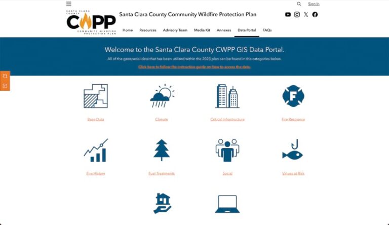
In California, the team at SWCA also helped the Santa Clara County FireSafe Council quickly and efficiently share updated information across agencies and jurisdictions via a hub site. The data is organized, accessible, and easy to share with stakeholder agencies and neighboring municipalities and jurisdictions.
Benefits for Communities Across the Country
By embracing the advanced capabilities of ArcGIS apps and software and fostering close-knit collaboration among community members, SWCA continues to elevate wildfire planning efforts and improve CWPPs—undertakings that benefit wildfire-prone areas across the United States.
For more information on applying GIS to CWPPs, email SWCA principal planner Victoria Amato at vamato@swca.com.


