Data connects individuals, businesses, and societies in unprecedented ways. It is the raw material from which insight, innovation, and progress are woven. When used effectively, data becomes a powerful tool for fostering understanding, making decisions, and shaping the future.
Geospatial data provides the where that gives context to other data, enabling people and organizations to identify patterns and trends; address complex, place-based challenges; optimize resources; and develop more effective strategies. ArcGIS allows users to integrate multiple types of geospatial data from various sources as layers of information that seamlessly integrate within the context of a map, providing a holistic view of virtually any place on Earth—from an office park to a city to an entire country.
Imagery is an increasingly important part of the data ecosystem available to ArcGIS users. And now, the new Content Store for ArcGIS, an integrated web app for ArcGIS Online and ArcGIS Enterprise, provides a single access point to high-quality, current imagery from multiple leading commercial providers.

Data Enables the Geographic Approach
In the past, data was often collected and stored without fully understanding its value or how to maximize its potential, making it more of an overhead than an asset. Today, however, data is a mainstay of modern enterprise operations. With the exponential growth in data availability and advancements in technology, organizations are discovering innovative ways to leverage data at scale, such as using predictive analytics to forecast market trends, implementing real-time monitoring to optimize supply chains, and enhancing customer experiences through personalized marketing.
In any enterprise—whether educational, governmental, or private—it is important to see how things are related through the lens of location. This is called the geographic approach, and it is essential for solving problems, making informed decisions, and planning for the future. GIS, of course, enables the geographic approach by allowing organizations to link information to physical locations. With GIS and the right data, organizations can create detailed maps and visualizations that offer a comprehensive view, going beyond traditional data analysis.
To fully leverage the power of the geographic approach, it is crucial to integrate various types of data, including imagery. Imagery from satellites, airplanes, balloons, drones, and even tablets and phones adds visual richness and unique insight that can’t be derived from other data types. When this data is woven together with other data, it creates a multifaceted understanding of an area of interest, enabling organizations to make well-rounded and informed decisions.
Seamless Access to Geospatial Data
The robust data integration that is core to ArcGIS technology is indispensable for many organizations. But before integration can occur, users need access to relevant data to build their projects. GIS-ready content is crucial for both the users who are building the GIS and the stakeholders who rely on it to make decisions. Having easy access to the data they need, when they need it, not only boosts efficiency for GIS users but also equips decision-makers with relevant and trustworthy information, leading to more effective strategies and improved outcomes.
. A selection of interesting places is also featured.")
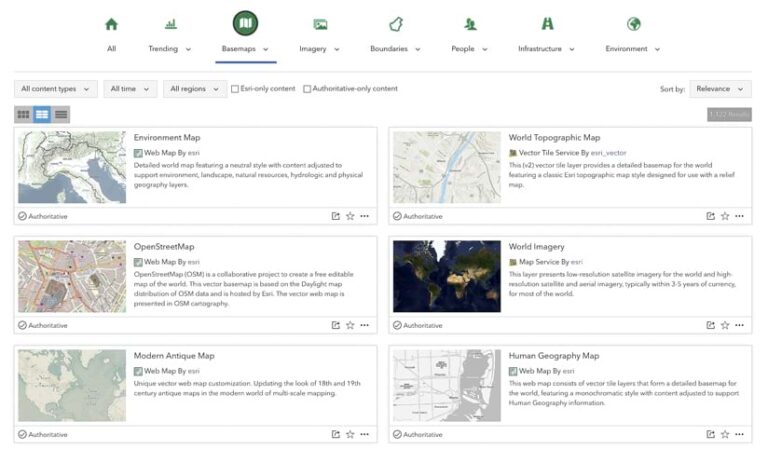
To meet this critical need, ArcGIS Online lets users seamlessly access geospatial data from a variety of sources to build data layers for their maps. They can start by bringing their own data into ArcGIS. Esri also aggregates and curates high-quality data in ArcGIS Living Atlas of the World. This comprehensive library includes maps, apps, and data layers that cover the entire globe and address various topics, from current weather to population characteristics derived from the US Census Bureau.
Additionally, Esri has a wide network of partners that provide valuable apps and data and imagery services on ArcGIS Marketplace. These services expose specific data types, such as social media and point-of-interest data. In many cases they’re designed to support the needs of various industries like banking and real estate. Furthermore, ArcGIS simplifies the process of incorporating data from public repositories managed by government agencies and commercial data providers.
By leveraging these diverse and authoritative data sources, ArcGIS enables users to build and maintain a robust and reliable GIS.
Imagery Stimulates Deeper Insight
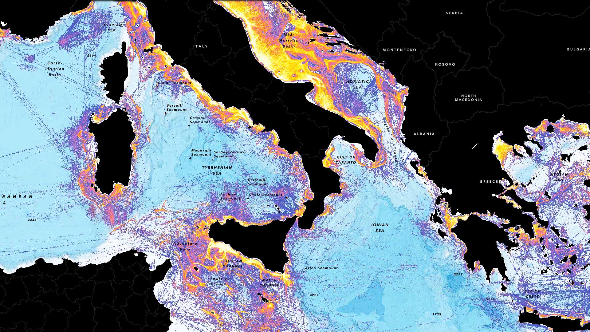
Imagery is rapidly becoming a vital data asset. It provides unique and detailed insight into geographic areas of interest, revealing a wealth of information that was previously untapped. Sourced from a variety of platforms—including cell phones, tablets, traffic cameras, drones, planes, and satellites—imagery is now a critical component of many organizations’ data resources.
In ArcGIS, imagery is treated with the same importance as other data types. It can range from high-resolution satellite imagery to other types of remotely sensed data, such as synthetic aperture radar (SAR) and lidar. Each type of imagery data offers specific advantages—for example, SAR can penetrate cloud cover and lidar provides 3D awareness.
By integrating imagery data into GIS, users can uncover deeper insight, create more accurate and dynamic visualizations of areas of interest, and make more informed and strategic decisions.
An Easier Way to Get Imagery
While many organizations find value in open imagery datasets, commercial imagery providers offer several additional advantages. Commercial imagery provides superior data coverage, higher resolution, and more up-to-date imagery because satellites can revisit the same areas more frequently. It also delivers a wide range of options—such as multiple band combinations, depending on the need—and more opportunities for targeted data collection.
Integrating commercial imagery data with open imagery and other data is ideal, but getting there has been challenging in the past. The market is crowded with providers that offer seemingly similar products, making it difficult to know which data to select. The process of purchasing commercial imagery can be complex as well, involving multiple providers and contracts, which slows down projects.
Content Store for ArcGIS—jointly created by teams from ArcGIS Living Atlas and Esri partner SkyWatch—features imagery from Esri’s cornerstone partner, Maxar, as well as many other providers, including Esri partners Airbus and Planet. For organizations, Content Store simplifies the process of purchasing premium commercial satellite imagery, and for users, it enables them to quickly discover, integrate, and apply imagery to their projects. Users can search Content Store for satellite images based on an area of interest, purchase them, and immediately add them directly to ArcGIS projects.
By combining commercial imagery with data from other repositories, users can leverage a diverse range of sources to enhance their spatial analysis.
The Benefits of Combining Diverse Data Sources
The ability to access, integrate, and analyze diverse data sources is essential in GIS. Whether through the extensive datasets in ArcGIS Living Atlas or the seamless integration of commercial imagery via Content Store for ArcGIS, users of ArcGIS technology can access the data they need to make informative maps and perform comprehensive analyses. This integration enhances the accuracy and relevance of GIS apps, driving innovation and progress across various industries.
As data generation grows, the ability to combine these diverse data sources into a cohesive and insightful geographic view will continue to be key for informed decision-making.