Esri Users Take on Responsibility for Open Data Sharing in Their Agencies

Agencies and organizations at all levels of government are increasingly conscious that being transparent and open will make them more effective and efficient. To expand the number of smart communities in the United States and around the world, the White House and other national governments are calling for government agencies to share more information. Open data fosters trust by promoting constituent engagement and provides validation that equitable and appropriate development is being done.
As agencies start down the path of creating an open data strategy, they typically realize that the GIS department is the most mature, experienced, and prepared team to build powerful information services and make data accessible to different communities. Tens of thousands of government-based GIS teams use ArcGIS as their system of record, so the platform is already integrated with agencies’ enterprise and operations systems. This is beneficial, since ArcGIS is a complete open data solution as well.
Open Data at No Extra Cost
Too often, it is assumed that making data open and available to the public is expensive, complicated, and not very advantageous. Executives deem that forming and executing an open data strategy involves a long process of acquisition, installation, and operational work that burdens already busy IT groups that are just striving to get through their day-to-day work and respond rapidly to unexpected occurrences.
However, many organizations are realizing that ArcGIS is an exhaustive solution for open data. When combined with the rest of Esri’s mapping platform, it can be used to support business development, collaborate with other governments, and tell stories that really engage citizens. The data services already available in ArcGIS can be reused to share integrated, sustainable, and effective data with the public.

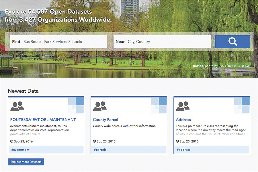
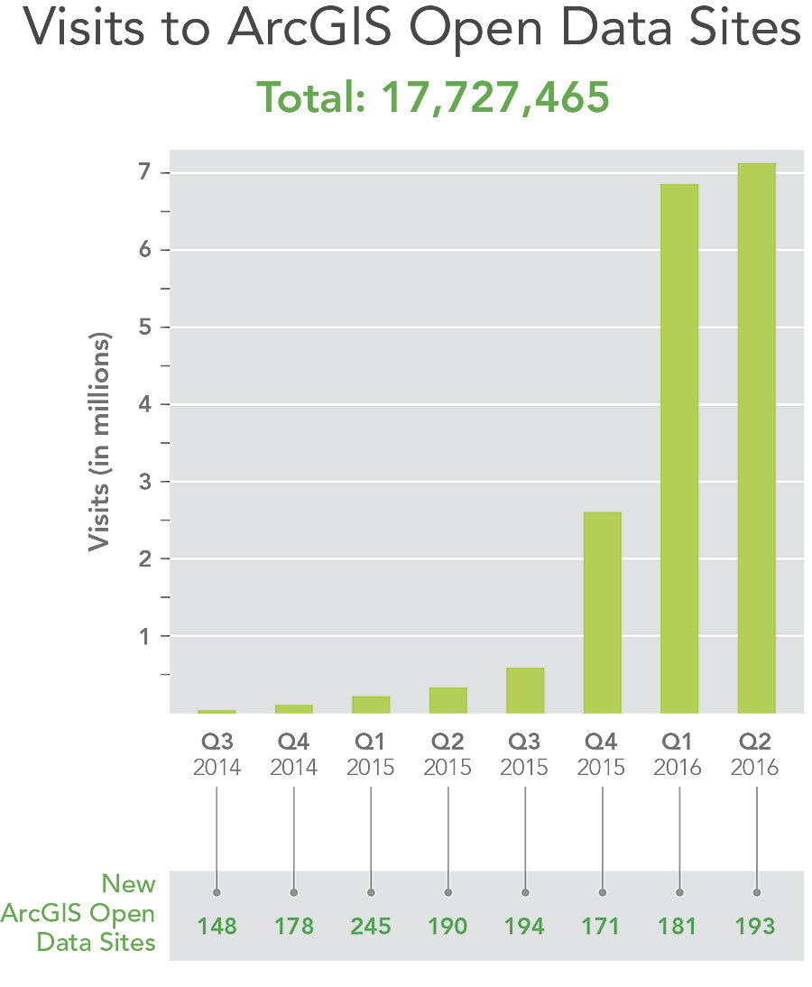
ArcGIS Open Data is included with ArcGIS Online at no extra cost. It requires only a few minutes to enable, build, and publish an open data site. Organizations can create as many open data sites as they need, as well as configure and design them. For example, an organization can have a main ArcGIS Open Data site along with other open data sites for individual agencies, specific initiatives and events, or even local neighborhoods.
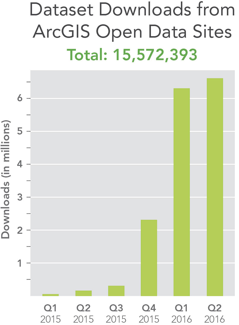
The software can be configured to use existing, on-premises layers in ArcGIS for Server. Alternatively, organizations can publish their data in cloud services. ArcGIS Open Data sites include unlimited bandwidth, and members of the public can download as much data as they want. Citizens can also create public accounts where they can save data, share it, and tell their own stories using an organization’s open data. What’s more, ArcGIS Open Data provides performance dashboards so that agency employees and even the public can monitor and evaluate key initiatives like affordable housing, reducing traffic congestion, and keeping pedestrians safe.

Available to All Governments, Organizations
About 3,500 organizations all over the world already use ArcGIS Open Data. The US Department of Transportation recently launched its National Transit Map, which has reportedly collected 400,000 transit stops and 10,000 routes from 270 agencies and uses ArcGIS Open Data to share the information. In February, the US Department of Homeland Security introduced HIFLD Open from the Homeland Infrastructure Foundation—Level Data subcommittee, which makes national infrastructure data available to support community safety, disaster resilience, and economic development. The US Department of Education and the US Department of Housing and Urban Development have ArcGIS Open Data sites, as do the United Kingdom’s Office for National Statistics and Australia’s Commission on Safety and Quality in Health Care for its Australian Atlas of Health Care.
Smaller towns, nonprofits, and community groups are creating open data sites too. Washington, DC; Bexar County, Texas; Chesterfield County, Virginia; Waukesha County, Wisconsin; and Manlleu, Spain, are just a few places that use ArcGIS Open Data to make their government information a public service.
ArcGIS Open Data is translated into 26 languages, so governments and organizations around the world can build their own open data sites to serve local communities. The World Resources Institute, for example, created forest atlases for the Congo Basin and used ArcGIS Open Data to configure websites in English and French.

Foster Data-Driven Citizenship
A study from the Pew Research Center in April 2015 discovered that while 65 percent of Americans in the previous year had used the Internet to find data or information pertaining to the government, only 5 percent reported that federal and state governments were very effective in sharing data, while just 7 percent said that local governments shared data very effectively.
“There is a real and powerful demand for access to open information,” said Andrew Turner, director and chief technology officer of the Esri R&D Center in Washington, DC. “This presents a tremendous opportunity for government agencies and organizations to meet the needs of their constituents and supporters.”
Every organization with access to ArcGIS can use ArcGIS Open Data to share information. It is integrated with a host of engagement tools, such as Esri Story Maps and Web AppBuilder for ArcGIS, as well as more than 200 open-source projects from Esri and the GIS community. Additionally, app developers can use APIs and platform libraries to build new, innovative solutions that drive economic opportunity and solve important local issues.
With ArcGIS Open Data, Esri empowers any community to have data-driven citizens.

