ArcGIS Enterprise is the backbone of many organizations’ data management and GIS workflows, powering products for collecting field data, conducting spatiotemporal analysis, creating maps and data visualizations, and sharing GIS work with stakeholders. Launched in November 2023, ArcGIS Enterprise 11.2 is part of the ArcGIS 2023 Q4 release and is available to all customers who are up-to-date on maintenance.

Map Viewer and Scene Viewer Get New Analysis Tools
In 11.2, Map Viewer includes spatial and raster analysis tools that were previously only available in Map Viewer Classic. These tools allow users to quantify data patterns and relationships. Users can browse or search for specific tools; set environment settings for an individual tool or a web map; and access a history of which tools have been run, their results, the parameters used, and any errors or warnings. When a user saves a map, the tool history is saved with it, providing job details and reopening tool parameters when the map is shared. This release also features item browsing improvements and scatterplot display features and allows users to configure and view related records in pop-ups.
In addition, updates to Scene Viewer help users demonstrate 3D data in the following ways:
- They can snap to features while measuring distances.
- There are enhanced shading and higher-resolution terrains for elevation modeling.
- Higher-density point clouds capture building shapes for 3D city modeling.
- Higher-quality visuals—such as water reflections, better shading, and sharper labels—are available on all devices and in all ArcGIS web apps.
Updates to Content and Data Management
In terms of content and data management, 11.2 users can manage map services and feature services in the Enterprise portal. Prior to this release, all services referencing user-managed data stores had to be managed through ArcGIS Server Manager; now, some of these workflows can be done directly in the Enterprise portal via the item details page.
Likewise, the workflow to update data for hosted feature layers is easier and more streamlined. The item details page for a hosted feature layer now shows a single Update Data button and provides options to add and update features. Users also can remove fields and update field names when publishing a new hosted feature layer. These layers support overwriting and can be exported to KML for file-sharing via ArcGIS software or elsewhere.
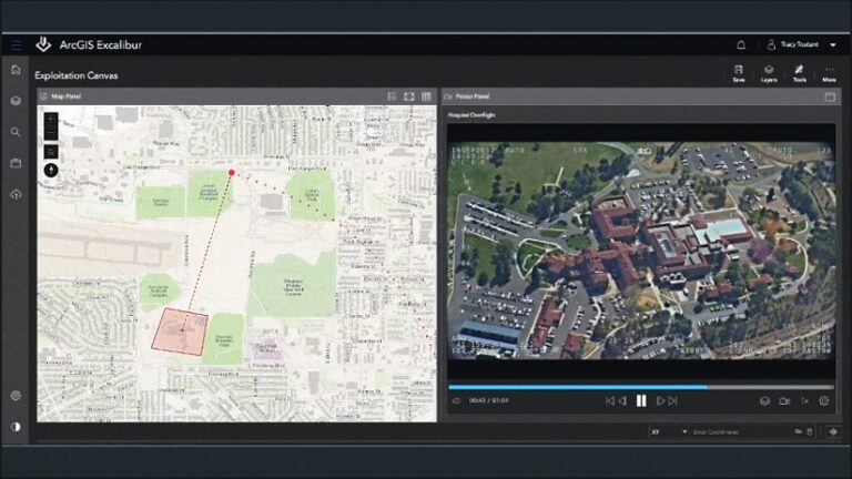
In 11.2, the ArcGIS Data Store comes in a few different configuration types, each of which is employed for a different purpose. The graph store, used by ArcGIS Knowledge Server, can now be configured to be highly available. To implement a highly available graph store, users can simply add a second graph store machine to their system. ArcGIS Video Server—new in 11.2—uses the object store to store video data. Because of this, there is added support to configure backups of the object store to protect against data loss. And the Data Store Configuration wizard has a new option to deploy the object store in single-machine or cluster mode, which benefits users who need high availability or scalability.
A New User Type Streamlines Licensing
The ArcGIS Advanced Editing user type extension, which is being introduced in 11.2, provides additional advanced data editing and geodatabase capabilities in ArcGIS Enterprise, ArcGIS Online, and the ArcGIS Maps SDKs. This new user type extension streamlines licensing by replacing the existing ArcGIS Utility Network, ArcGIS Trace Network, and ArcGIS Parcel Fabric user type extensions and sets a foundation for future ArcGIS web editing capabilities. To learn more about this new user type extension, check out “Introducing the ArcGIS Advanced Editing User Type Extension.”
Several Interesting Features Released in Beta
Some of the new features in ArcGIS Enterprise 11.2 are in beta. Although this enables users to test-drive features and provide feedback to the product teams, beta features do not receive patching and are ineligible for Esri technical support. Limited support is provided via an early adopter community or a similar forum. Users are encouraged to try beta features in test environments rather than production environments. Here are beta features included in this release:
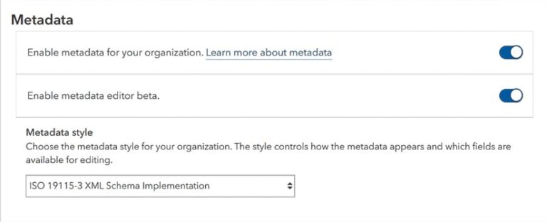
- When enabled by an administrator, a new metadata editor adds a button that allows users to edit an item’s metadata.
- Four new data field types—data only, time only, time stamp offset, and big integer—further refine how users handle date and time data.
- Users can upload 3D models in web scenes. After a 3D model has been uploaded, it can be resized, rotated, and placed anywhere in the scene.
- There’s one-way, feature-service-to-feature-service synchronization. Users can establish a replica of a feature service that references the original data along with the copied data service. They can then run the synchronize replica operation to export and import any changes to the feature service.
- The new ArcGIS Knowledge Studio web app helps users explore and analyze knowledge graph data. Details about Knowledge Studio can be found in the “ArcGIS Knowledge Graphs Are Coming to the Web” article from this issue and here.
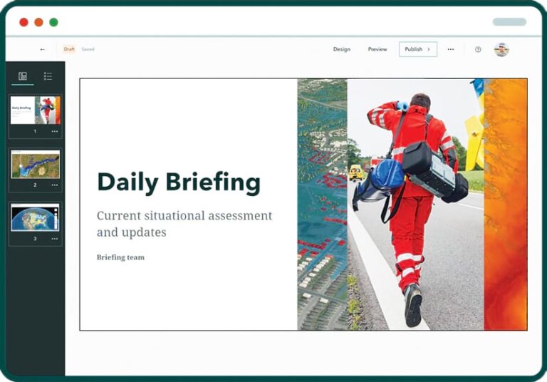
- The ArcGIS StoryMaps briefings feature provides a slide-based output that lets users integrate dynamic maps, data, multimedia, and more to create interactive stories. Also, with the complementary briefings tablet app, users can view and present briefings whether online or offline.
ArcGIS Enterprise on Kubernetes Supports New Environments and More
ArcGIS Enterprise on Kubernetes is key for running a high-performance, high-availability, Kubernetes-based GIS. For users of Windows- or Linux-based software, ArcGIS Enterprise on Kubernetes gives them the same ArcGIS Enterprise experience they are used to as they produce maps and apps, analyze data, and collaborate. New features and enhancements to ArcGIS Enterprise on Kubernetes include the following:
- Users can now license raster analytics to run within the deployment. Running deep-learning, analytics, and raster functions in Kubernetes is a perfect fit for these technologies, as raster analytics are typically batched and require a burst in resources and the need to scale quickly.
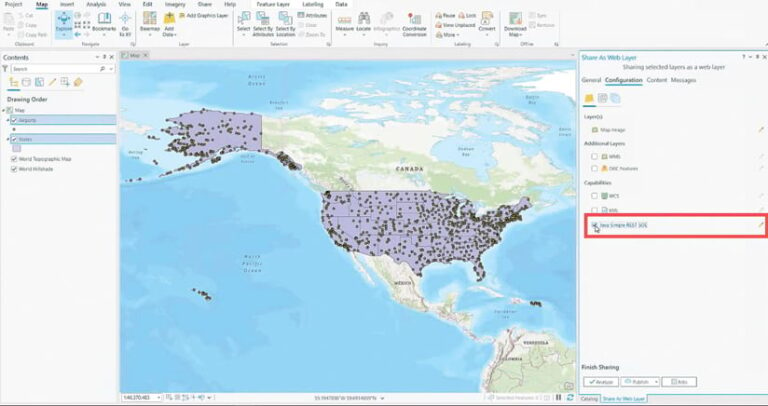
- Server object extensions (SOEs) are now available for ArcGIS Enterprise on Kubernetes map services. SOEs allow users to create service operations to extend the base functionality of map or image services, mostly by using custom code to work with geospatial data and maps. SOEs provide organizations with options to perform well-defined business logic that is not easily accomplished using the ArcGIS client APIs. For this release, SOEs must be enabled when sharing the service from ArcGIS Pro.
- ArcGIS Enterprise on Kubernetes supports two new environments—Rancher RKE and RKE2—opening more opportunities for customers to use Kubernetes.
- There is also new support for Red Hat OpenShift Service on Amazon Web Services (AWS) and Microsoft Azure Red Hat OpenShift. This additional support gives organizations increased flexibility to decide where to host their Red Hat OpenShift clusters.
