ArcGIS Online Functionality Now Available On Premises
It’s a great time to be a GIS professional. Dramatic changes are taking place in the enabling computing and communication technologies that GIS relies on, and new software is leveraging these changes to evolve and transform GIS and our user community. Esri is working hard and is in the process of releasing many new capabilities in ArcGIS 10.2, such as real-time data integration, online analysis tools, spatial analysis in the cloud, location analytics, new templates and apps, and web story maps for everyone. There are also new capabilities enabling new opportunities for developers. These advances are giving rise to a change in the very way we position GIS, from a software system designed to unlock the power of geographic information to a comprehensive platform that promises to transform your work; your organization; and, ultimately, our world.
Portal for ArcGIS
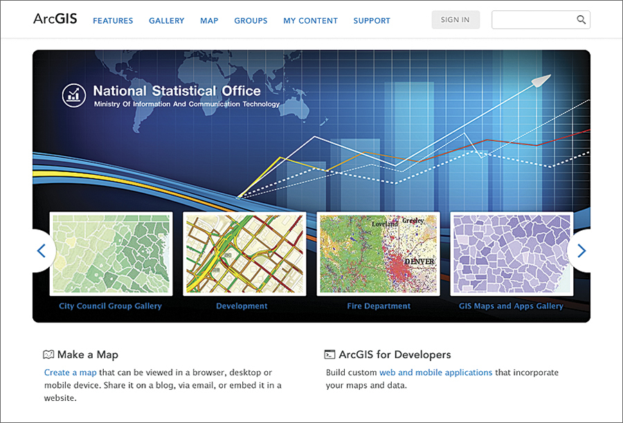
Portal for ArcGIS becomes a full part of the on-premises infrastructure of ArcGIS. In the past four years, Esri has been significantly developing ArcGIS Online deployed in the public cloud. At 10.2, this technology has been engineered into a fully supported product that can be easily deployed on premises and integrated with users’ existing technology.
This technology supports many capabilities:
- Enterprise geospatial content management
- Simple mapping
- Esri Maps for Office
- Integration with enterprise security
- Sharing of data, maps, and apps
- Groups
- Mashups
- Dozens of apps
- Open enterprise integration with Office, SharePoint, SAP, and others
Portal for ArcGIS promises to enable users to easily integrate these mapping and Esri capabilities and to extend mapping and GIS across the organization.
This is a logical way to organize and make available via apps all the geospatial information in an organization. It provides the ability to easily share, integrate, and use information created by geocentric workflows, as well as desktop spreadsheets and enterprise databases across an organization. Apps include easy-to-deploy templates that are easily configured and leveraged.
Real-Time Mapping at Your Command
ArcGIS now brings real-time data into mapping applications, making it possible for people to stay synced with the quickly changing world. A number of new technologies enable the real-time collection and sharing of data with GIS, including the following:
ArcGIS GeoEvent Processor for Server, a new ArcGIS for Server extension, gives users the ability to connect to real-time data streams from a wide variety of sensors, perform continuous processing and analysis of those data streams, and send relevant information to users or other systems. This real-time capability transforms GIS applications into frontline decision apps, helping decision makers respond faster with remarkable accuracy whenever and wherever change happens.
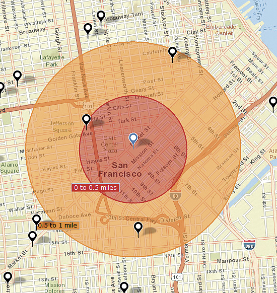
Operations Dashboard for ArcGIS provides a common operating picture for monitoring events. Operations Dashboard integrates maps and a variety of data sources to create comprehensive operational views that can include charts, lists, gauges, and indicators that update automatically as underlying data changes. Operations Dashboard can be used with GeoEvent Processor to monitor unfolding events and generate geofences on the fly using areas determined by specified drive-time analysis, a simple hand-drawn polygon, or existing map features.
Collector for ArcGIS is an app for Apple and Android devices designed with field crews in mind. It’s used to capture and update both tabular and spatial information via smartphones using the built-in GPS capabilities of the device or by tapping on the map. Data captured using Collector for ArcGIS can be displayed immediately in Operations Dashboard and ArcGIS Online web maps.
Web Maps Bring GIS to Everyone
Web maps have emerged as the primary instrument for generating and communicating geographic understanding across enterprises, businesses, and constituencies. They’re easy to use and, with ArcGIS, increasingly powerful and dynamic. ArcGIS is designed to help people easily create, deliver, and use web maps. The following new capabilities in ArcGIS make web maps even more important:
Hosted analysis services are available through a set of online tools that let users perform analysis against their layers hosted in ArcGIS Online, as well as other layers users have access to. Users can also create new hosted layers and tables. These new tools are easily accessible to users who may or may not be familiar with ArcGIS geoprocessing tools, models, or services. Additionally, these online analytics are available as services that developers can use to build custom, workflow-specific apps for use within any organization.
Premium content services now give users the ability to aggregate demographic data on any geographic area from existing administrative, political, or postal boundaries to any arbitrary area defined by a polygon. These new demographic capabilities are available for more than 100 countries through the geoenrichment API. Users can now get demographic data through ready-to-use dynamic web maps that can be brought directly into web, desktop, and mobile applications.
The addition of new landscape services gives users access to incredibly rich biogeographic data that can be used to support natural resource management efforts, as well as land use and conservation planning at regional and national scales. Landscape services include dozens of ready-to-use image services to support analytical tasks, feature services, web maps, and geoenrichment services.
Dynamic image services provide the ability to set the properties on image services within web maps and further mine the information content of image services—particularly for very large collections of imagery. For example, a web map can be used to filter a service containing thousands of Landsat scenes so that only a selection of the relevant scenes are rendered with a selected band combination or use a function such as the Normalized Difference Vegetation Index to return a vegetation index. Configurable web map pop-up windows for dynamic image services provide not only metadata about the specified image but also information about the specific pixel or data values for any location on the map.
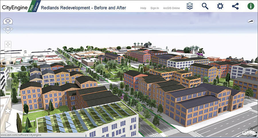
Web scenes for 3D presentations are available through Esri CityEngine Web Viewer. They now allow users to add and explore location-based comments in 3D space, compare side-by-side views, and create fly-throughs of city models, all available through any WebGL-enabled browser.
More Analysis Tools Online
Geographic analysis is the foundation of GIS, and this release of ArcGIS makes analysis more readily available. People working in a wide array of disciplines can make use of spatial analytics to reveal patterns in their data and create new map layers that can be added to web maps.
Advanced analysis tools have been added to ArcGIS Online for analyzing and measuring geographic relationships to uncover hidden patterns, assess trends, and make more informed decisions. These new tools include the following:
Overlay layers for combining two or more layers into one single layer to find which features are on top of other features, such as finding what land use is on top of what soil type
Hot-spot analysis to analyze incident data, such as traffic accidents, or the values associated with features (such as total sales for retail stores) and find statistically significant spatial clusters of high values (hot spots) and low values (cold spots)
Explore correlations to examine the strength of relationships among the numeric attributes of features, such as determining whether proximity to liquor stores has a strong and consistently positive relationship with crime
Find existing locations to select map features that meet a user’s criteria either based on attributes (land value = vacant) or spatial queries (within one mile of a river)
Data enrichment to get information about the people, places, and businesses in a specific area or within a distance or drive time from a location
Location Analytics Empowers More Business Systems
ArcGIS already delivers solutions for business intelligence (BI) platforms, such as IBM Cognos and Microsoft Office, and productivity and collaboration tools, like Microsoft Office and SharePoint. Now organizations with MicroStrategy BI and Microsoft Dynamics Customer Relationship Management will have the ability to analyze their data in a geographic context.
While working within the systems they use every day, these users can do the following:
- Make maps that put data in a spatial context
- Uncover and analyze spatial relationships that charts and graphs cannot reveal
- Enhance their data with Esri basemaps and demographic data
Esri Community Analyst and Esri Business Analyst Online also get productivity-enhancing facelifts and new capabilities, including the following:
Custom study areas can be either hand drawn across multiple geographies (counties, block groups, etc.) or combined with existing geographies, such as three counties, into a single new geography for analysis and generating reports.
Custom variables can be created by defining data ranges, such as “adults aged 55 to 75,” to refine and focus analyses and color-coded maps.
Custom labels, as well as photos, captions, arrows, and flags, can be added to further enrich maps.
Enterprise Security Integration
ArcGIS includes new, improved integration with an organization’s enterprise systems, as well as security enhancements, such as federated authentication for ArcGIS Online and public key infrastructure (PKI) authentication for Portal for ArcGIS.
Federated authentication allows organizational account administrators to configure ArcGIS Online so that users can sign in using their enterprise user names and passwords that already exist within their organizations. This eliminates the need for multiple user credentials for separate applications and provides significant convenience to users in that they don’t need to create and remember new user names and passwords. This type of authentication takes advantage of Security Assertion Markup Language (SAML), an open standard for exchanging authentication and authorization data between end users, identity providers, and service providers. For example, an organization can set up ArcGIS Online accounts to leverage the enterprise Windows Active Directory users, which allows the users to sign in once (aka: single sign on [SSO]) to access many different software systems.
PKI authentication involves using pairs of public and private keys and a certificate authority to verify online identity. Security administrators use PKI to encrypt communication and transactions so that the information is only readable by authorized users and applications with valid digital certificates. For example, an organization can use PKI authentication to create tighter integration between on-premises implementations of Portal for ArcGIS; ArcGIS for Desktop; other ArcGIS applications; and the organization’s enterprise security, data, and services to produce highly secure environments.
New Opportunities for Developers
More and more companies, consultants, and Esri Partners are delivering mobile, desktop, and web apps built on ArcGIS APIs and software developer kits.
A new pricing and licensing model will offer scalable plans based on anticipated volume of use per month. Developers can use their ArcGIS Online subscription to take advantage of hosted services, including geocoding and place search, directions and routing, data query, and a wide selection of ready-to-use basemaps.
Later this year, an online marketplace-style venue will be available for developers to showcase their apps and sell them. More details will be coming soon.
Geotrigger, also available with ArcGIS, allows developers to build smart location-aware apps that are ideal for mobile advertising, analyzing when someone is in a place for a given amount of time, and monitoring the density of mobile users in regions. Geotrigger can be used in combination with other ArcGIS Online services, such as geocoding, routing, basemaps, and geoenrichment services. This state-of-the-art technology is designed to have low impact on mobile device batteries.
ArcGIS: A Continuously Expanding and Sustainable Platform
ArcGIS 10.2 in another milestone in a constantly evolving platform. There are significant improvements in design and usability. It works on personal devices, such as smartphones and tablets, as well as on web and desktop apps, and is increasingly embedded in enterprise systems, large and small, within governments and businesses.
ArcGIS serves real people by helping them add location to their workflows and giving them easy access to powerful analytic capabilities so that they can make plans based on solid information; respond effectively to issues affecting their communities and the environment; and, if necessary, take action in real time to protect their investments, assets, and personnel in the field.
ArcGIS also opens up tremendous opportunities for developers to build integrated solutions for solving their customers’ problems while growing their own business.
ArcGIS is becoming part of everyday worklife for many more people around the world. They’re using it to make better decisions and boost productivity. The work of GIS professionals is also expanding and growing more important. GIS-based maps and geographic analysis are in high demand and are used in nearly every industry to strategize, respond to events, and engage with customers and citizens.

