With a rich history that set the backdrop for the Wild West in the 1800s, San Juan County, New Mexico, has grown into a thriving region with more than 125,000 residents. The burgeoning population means that demands have grown for the local government, which strives to provide residents with the best in services and public safety.
Protecting the environment is one of the local government’s top priorities to promote residents’ well-being and keep the county’s scenic rivers, mountains, mesas, and badlands healthy and flourishing for years to come. One significant issue that was impacting San Juan County’s environment was the illegal dumping of trash, which residents expressed concerns about during a public forum on the local recreation industry.
Due to a lack of residential garbage service, residents of the county’s rural communities take their trash to local transfer stations, and the county then takes it to a landfill. But illegal dumping was—and still is—widespread.

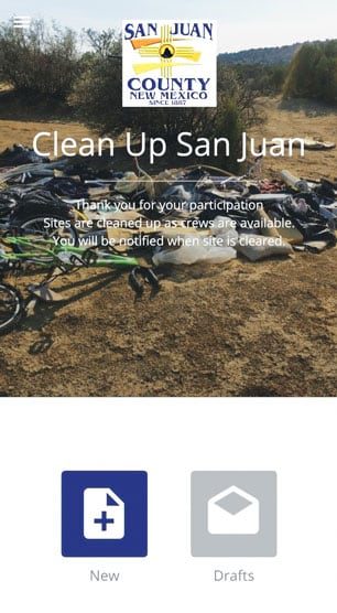
To curb this problem and prevent illegal dumping, the county’s GIS team used AppStudio for ArcGIS to create a new app that helps residents more easily report illegal dumping sites. With the accurate location information the app provides, these citizen reports enable the county to engage in targeted cleanup efforts and more swiftly prosecute wrongdoers.
Initial App Left Users Wanting More
In response to the concerns of illegal dumping, Sherice Snell, the GIS manager for San Juan County, developed the Clean Up San Juan app to report illegal dumping sites. The initial Clean Up San Juan app was a crowdsourced story map to help citizens report illegal dumping from their mobile devices. Though popular with residents, it had several notable limitations for users.

Law enforcement officers use the app to investigate incidents of illegal dumping and prosecute offenders. Dumping on public land is a criminal offense in the county, punishable by a $1,000 fine and/or a maximum of 90 days in jail. As such, the information provided by users is crucial to investigations. According to Snell, the original form didn’t fit the needs of officers, who wanted residents to complete different fields than what the story map provided.
Also, the initial app was not easy to access. Users had to bookmark the URL on their devices and try to access it wherever they were. If there was no cell service at an illegal dumping site, the user had to hope he or she remembered where the site was to report it later, according to Snell. This meant that many illegal dumping sites went unreported and, for the ones that were, the location could have been inaccurate, causing setbacks in investigations.
In 2018, Snell set out to revamp the app and tailor it to the needs of both law enforcement and general users.
Creating a Native App with Very Little Coding
To increase accessibility and improve reporting, Snell decided to create a new app using AppStudio for ArcGIS. The platform allows users to create native apps with little to no coding and has tools for everything from testing to deployment. Snell chose this solution because she was already an ArcGIS Online user, so she knew the tool would seamlessly integrate into her existing platform.
Snell had also previously used the online version of AppStudio and found it simple to use. Employing the desktop version this time around, she retooled the original app and included unique customizations, such as the county’s logo.
“I was able to make little changes to make it look more like it belonged to San Juan County, which was great,” Snell said.
Snell read the documentation and watched YouTube videos to learn how to better use the solution. She noted that online tutorials were key for helping her get the revamped app into app stores, including Google Play and the App Store.
“I’m not the type of person to download the source code and [create a new app]. I need something easy, and AppStudio for ArcGIS was easy for me to use,” said Snell. “Since I’m not a very technical person, this was a huge step for me.”

AppStudio for ArcGIS is easily my favorite tool to have in my back pocket. It makes me look like a rock star!
The new Clean Up San Juan app launched in May 2019. Now, once illegal dumping sites are reported by the public, Snell and other staff members evaluate the claim based on the user’s completed form and an uploaded photo or video. They then turn submissions in, complete with details like GPS coordinates, to the sheriff’s department for further investigation. For submissions without these details, county staff dispatch cleanup crews to clear the sites.
“AppStudio for ArcGIS is easily my favorite tool to have in my back pocket,” said Snell. “It makes me look like a rock star!”
New App Is Easier to Use and More Accurate
With the new Clean Up San Juan app’s improved accessibility and reporting, more than 127,000 pounds of trash have been cleaned up from illegal dumping sites across the county. Because users can download the new app from an app store, they no longer have to find the link on the county’s website and try to save it for later use.

“AppStudio for ArcGIS really took out a lot of the hoops that people had to jump through to use it,” said Snell.
San Juan County officials are receiving positive feedback from residents and county visitors who have used the app. The app has been downloaded more than 500 times between the Android and iOS platforms, and that number continues to rise.
“It’s a great tool for the community, and it’s amazing how supportive everyone has been,” said Snell. “The community loves it.”
The new app is also helpful to local law enforcement and San Juan’s public works department, giving them more information to better do their jobs. When submissions have specific site details, the county sheriff’s office can more easily investigate claims, which also helps the district attorney build successful cases against alleged violators.
For years, citizen reporters had to call the county to provide the latitude and longitude of a dumping site, and county staff had to enter the coordinates in a mapping program to try and locate it. AppStudio streamlines that process with electronic submissions. When users add a photo or video to their submission, the map automatically retrieves the person’s exact location, which improves accuracy for finding sites. Snell also receives submissions in a timely manner and is better able to direct requests to the appropriate stakeholders.

“AppStudio for ArcGIS is pretty accurate. Depending on where the cell towers are, we’re probably 95 percent accurate on [locating sites]. And now our cleanup crews have everything they need on their phone,” said Snell. “If they need to contact the person that submitted [the site], and [he or she] entered contact information, they can call [the person] while they’re out in the field [to get] more information.”
Data about the Clean Up San Juan initiative is also available online in a dashboard that shows which sites are waiting for an evaluation, which ones have been cleaned up, and whether they’re on private property or on Navajo Nation land. This has greatly improved transparency, which Snell said has boosted morale.
“For the most part, people are just very appreciative that we are trying to make this place better,” said Snell. “AppStudio for ArcGIS is helping us make a difference in the community.”

