

We monitor everything and how it all interacts for the big picture of what’s going on up here.
Brandon Berry
Ecological Researcher, Tahoe Environmental Research Center
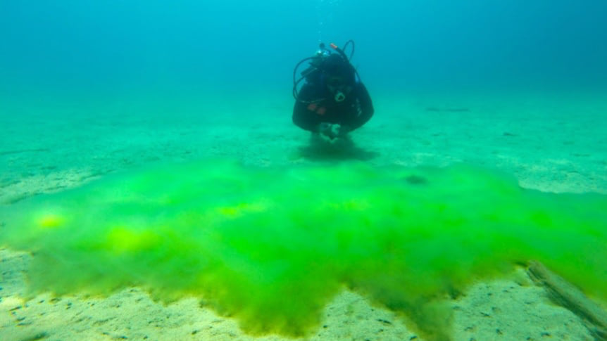
Brandon Berry has an enviable job. In the morning he flies a drone to survey Lake Tahoe shores and in the afternoon he dives into the lake to sample water quality. This hands-on research has its fitness benefits and it’s hard to imagine a more beautiful office.
It’s a year-round job, though. “In the wintertime when the water is freezing cold and it’s snowing, I think my colleagues are less envious,” Berry said.
As ecological researcher for the Tahoe Environmental Research Center (TERC), his work has advanced scientific understanding of algal growth and the invasive Asian clam. Both contribute to degradation of the nearshore in the famously clear mountain-ringed lake.
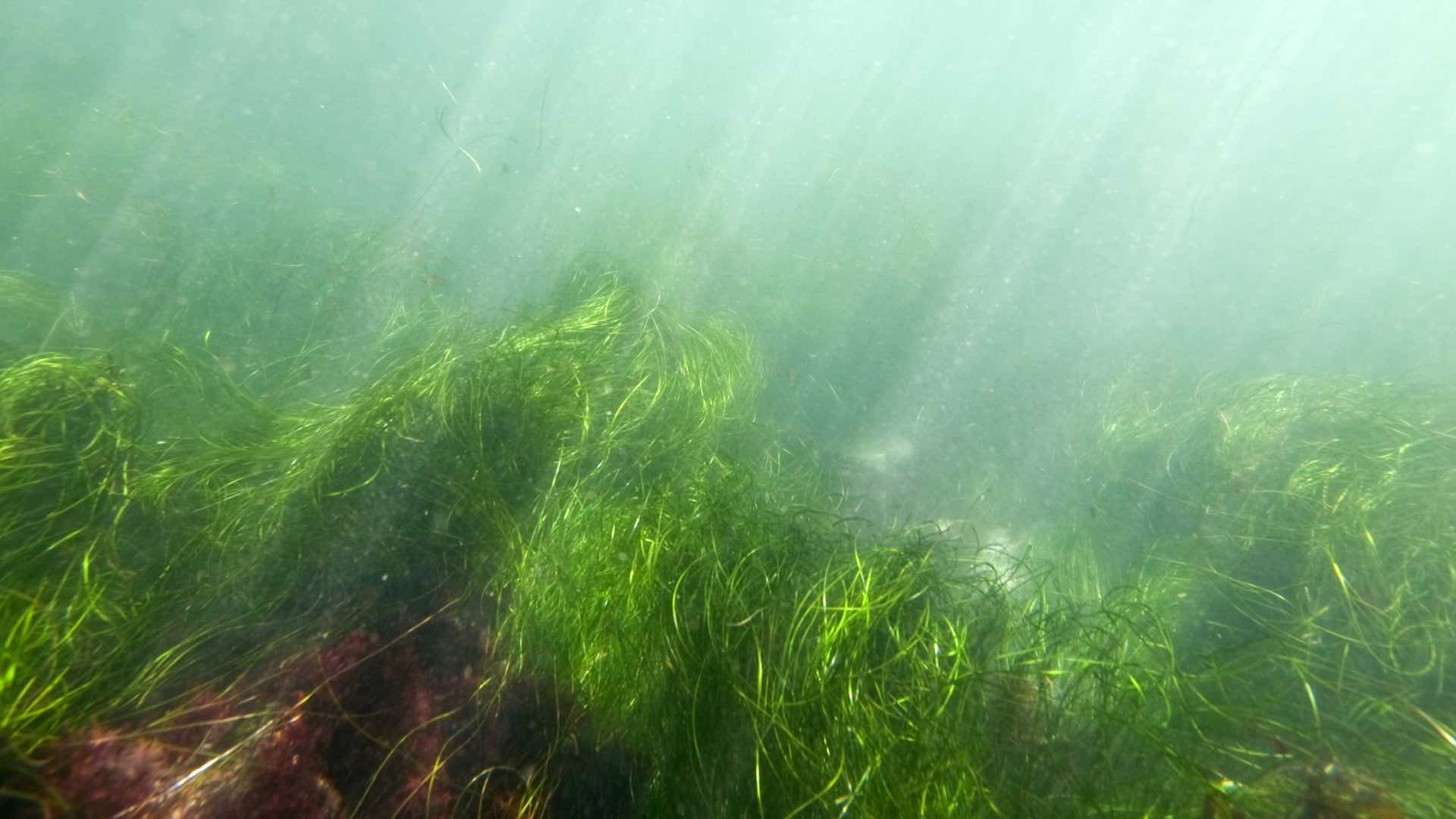
Berry began the drone program at TERC five years ago. He’s used the combination of drones, water sampling, and geographic information system (GIS) technology to record conditions and address Lake Tahoe’s metaphyton problem—free-floating, nuisance algae that forms mats above the bottom of the lake. Dependent on currents and wave patterns, the algae can wash onshore where it rots.
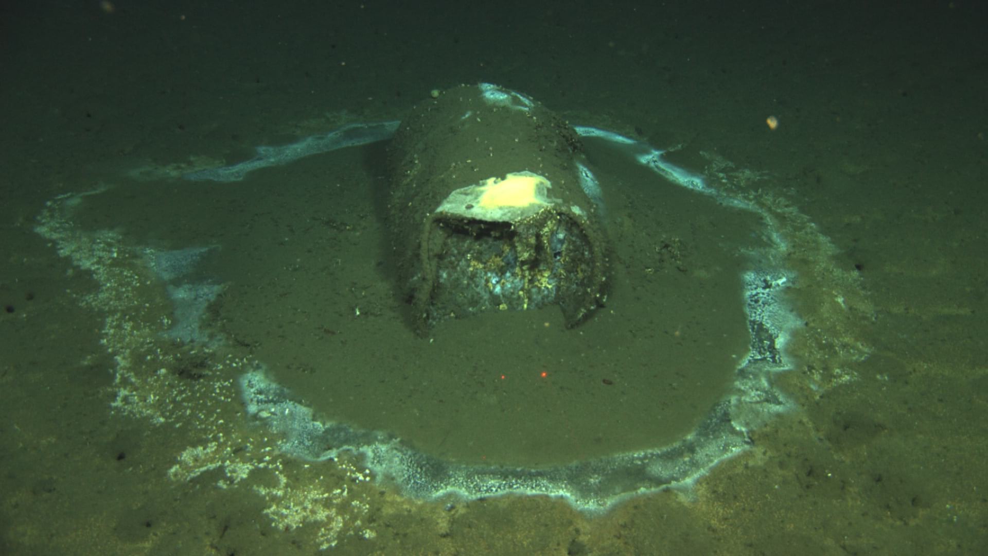
“We’ve discovered that metaphyton is heavily linked to the Asian clam, which are about the size of a quarter when mature, and microscopic as juveniles,” Berry said. These filter feeders take in water and excrete nutrients that cause big blooms of algae.
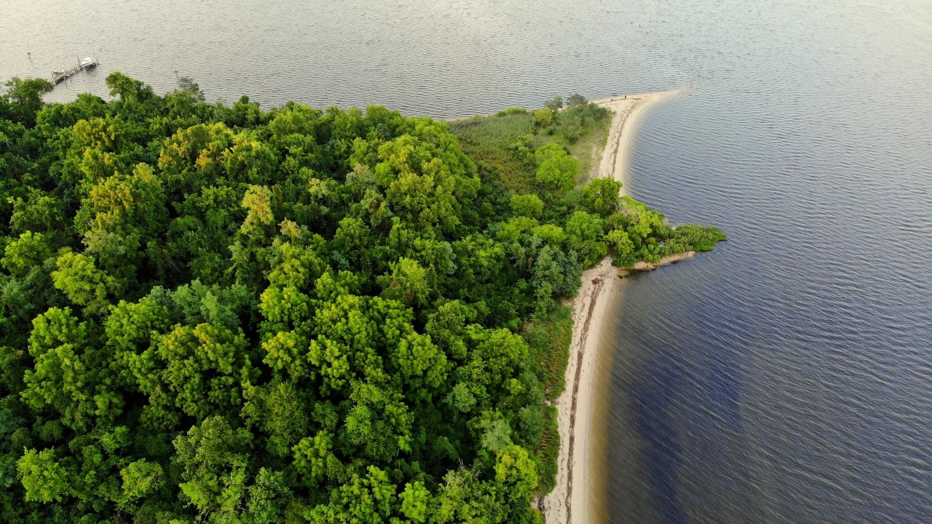
Lake Tahoe is so large that it visibly dips toward the center due to the curvature of the earth. With drones, Berry captures imagery to record the clarity of the lake and the presence of algae around its 72-mile-shoreline.
After flying test plots that ring the lake, he dives in to scoop and sample sand to count the number of clams. Data is processed and analyzed with GIS to communicate conditions and collaborate with other scientists to gain an overall understanding of the lake. This data records changing conditions and informs testing of management techniques to address the problem.
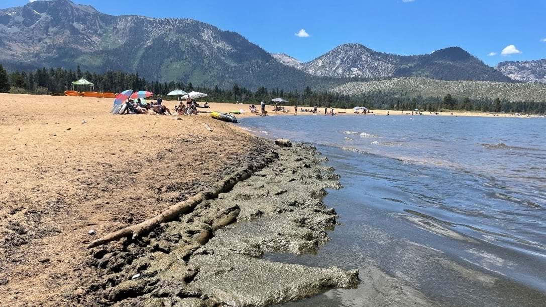
“Tahoe is a popular lake, and the majority of people interact with it right along the shoreline,” Berry said. “When there’s rotting algae on beaches, it causes concern. Right now, aesthetics is one of the main concerns.”
TERC is an offshoot of the University of California, Davis. It was established in 1968 to monitor Lake Tahoe to support state agencies in both California and Nevada, which have jurisdiction for different parts of the lake. For more than 50 years, TERC has recorded warming water temperatures and earlier peak snowmelt. Monitoring has shown changes to the food chain in response to changing climate.
TERC observes this complex ecosystem with a combination of sensors and systems, including a network of water sensors provides real-time reads on quality. Researchers then go out with data capture tools to verify changes. They analyze that data in the office using GIS and other tools to determine the causes of changing conditions.
We monitor everything and how it all interacts for the big picture of what’s going on up here.
When Berry began the drone program, it was uncertain if it would work to see through water and quantify algae volumes. It has proven effective, but there were lessons. For instance, drone flights take place in early morning now, when winds are calm (reducing obscuring ripples), and the sun doesn’t glint off the water.
Berry considers many factors to optimize the quality of the data he collects. He avoids strong winds to ensure safe takeoffs and landings. It’s the trickiest part of each flight, so he keeps a close eye on the wind forecasts. “Ninety-five percent of our flights are over water, and I haven’t lost a drone to the water yet,” he said. “It’s nothing short of a miracle at this point.”
To process and aggregate drone images, Berry uses the cloud-based drone mapping software Site Scan for ArcGIS. After he completes each flight, he uploads images to the cloud while he’s driving to the next site. “By lunchtime, photos are ready to look at and share with the rest of the group,” Berry said.
The team is building a test for machine learning in hopes of automating classification and change detection.
“It’s really nice to have the imagery,” Berry said. “It’s easy to write reports, do science experiments, or analyze data. When you see these big green mats on pristine beaches—bigger than two years ago—it’s got a shock value.”
What started with a few drone tests turned into a sizable drone program.
“Previously we had to track the growth of algae based off small sub-samples,” Berry said. “Now, with the drone work, we can track algae much more spatially. We’re capturing sites with hundreds of meters of shoreline, and it’s easier to track algae growth.”
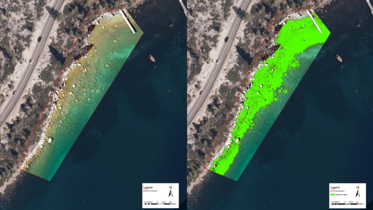
With the success of monitoring metaphyton, the program expanded to monitor attached algae known as periphyton. The periphyton grows on rocks and other objects near shore.
“We’ve tested drones and have proven they work,” Berry said. “We’re now combining everything into a big near-shore monitoring program.”
The program uses a helicopter to regularly fly around the perimeter of the lake, which it can do in an hour. That flight gives the team data about the entire shoreline to pick out any problem spots where algae has popped up. The drone flights monitor specific sites with high-resolution imagery to track the rate of algae growth.
In addition to routine monitoring, TERC’s graduate students, post-doctoral scholars, visiting scientists, and professional staff conduct ongoing research funded by national and state agencies. Research topics include invasive species control, lake currents, sediment resuspension dynamics, lake food webs, landslide risk, and wetlands performance.
The drone effort, for now, is primarily to monitor and understand the algae problem.
“There has been a huge increase in tourism and an increasing amount of concern for algae growth in the near shore,” Berry said. “If mitigation or management becomes a priority, then the monitoring will continue to inform those practices.”
Learn more about how drone mapping provides unprecedented awareness.
June 21, 2021 |
October 25, 2022 |
November 13, 2018 |