
October 18, 2021 |
July 14, 2022
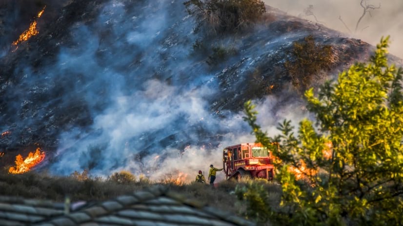
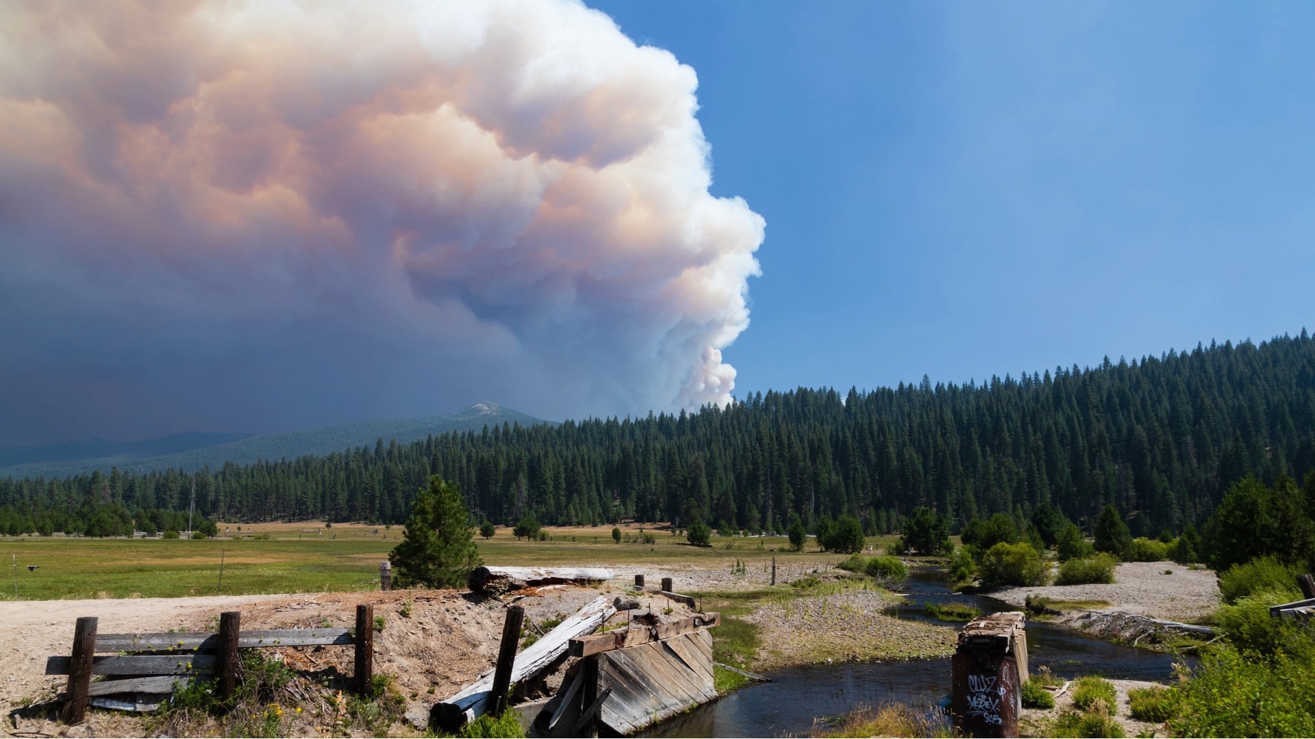
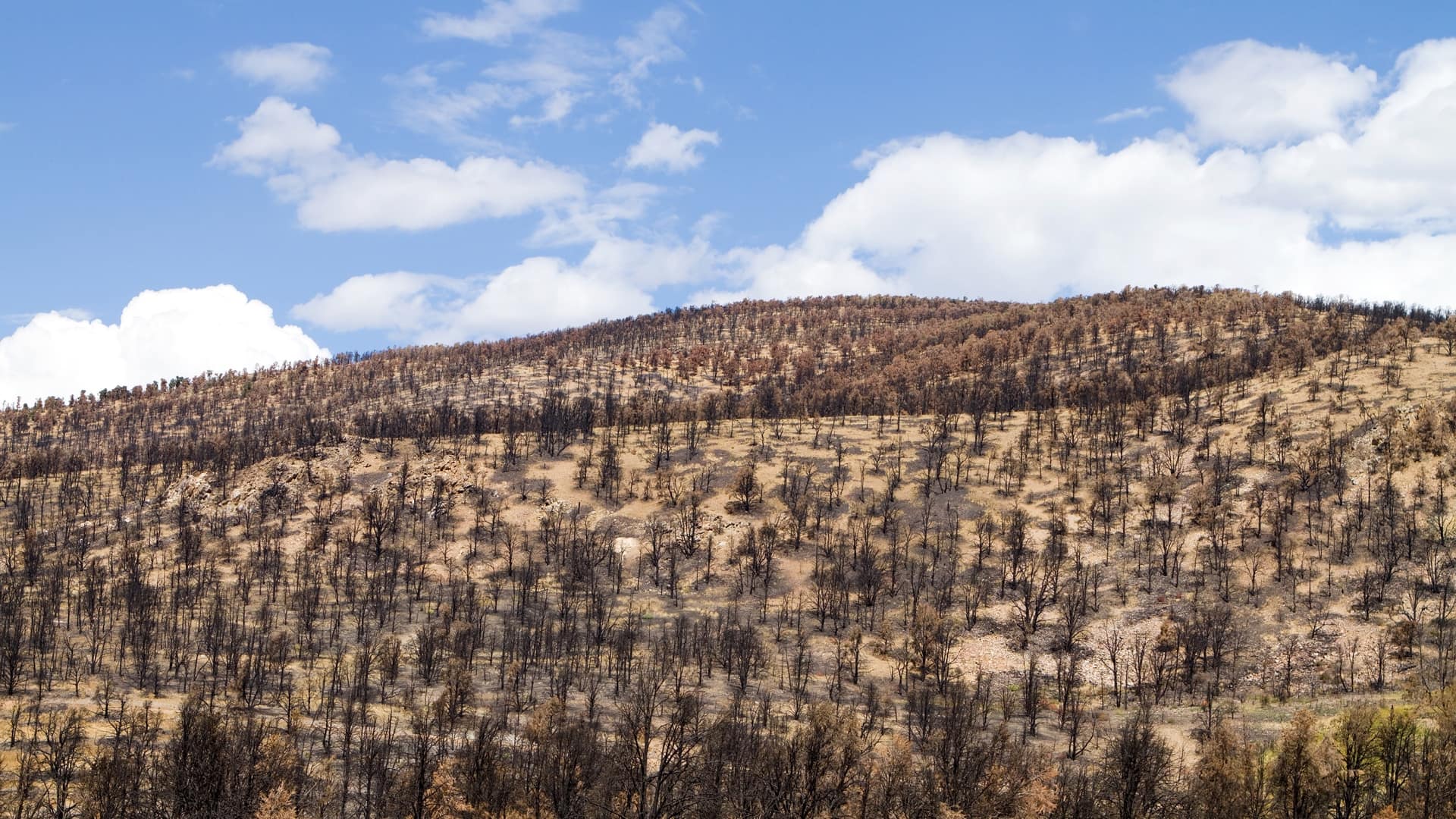
For 95 years, the Fern Lake Backcountry Patrol Cabin inside Colorado’s Rocky Mountain National Park had sheltered rangers, biologists, and search and rescue crews. Then two wildfires imperiled the park in late 2020, and one—the East Troublesome Fire—made it through the entrance, growing to more than 100,000 acres in one day.
The cabin didn’t stand a chance against the blaze. Neither did the Grand Lake entrance station, the historic Onahu Lodge, the Green Mountain cabins, or the Trails and Tack Barn. The damage could have been much worse, though, if not for the mitigation work years earlier to remove trees that had been killed by pine beetles and could have served as fuel.
Today, even the most enduring and recognizable landmarks inside the US National Park System are vulnerable to wildfires made more destructive by climate change. Warmer winters, for example, have allowed pests to thrive and infest thousands of acres of trees—increasing potential kindling for fires across North America.
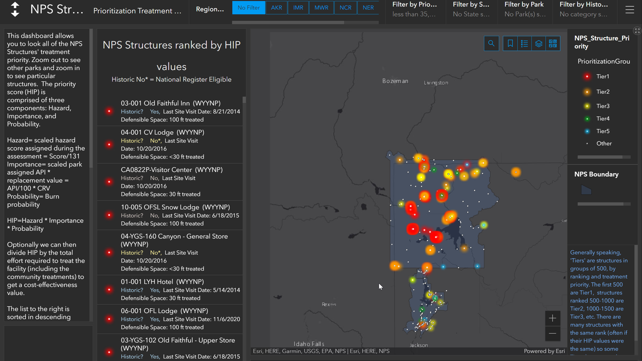
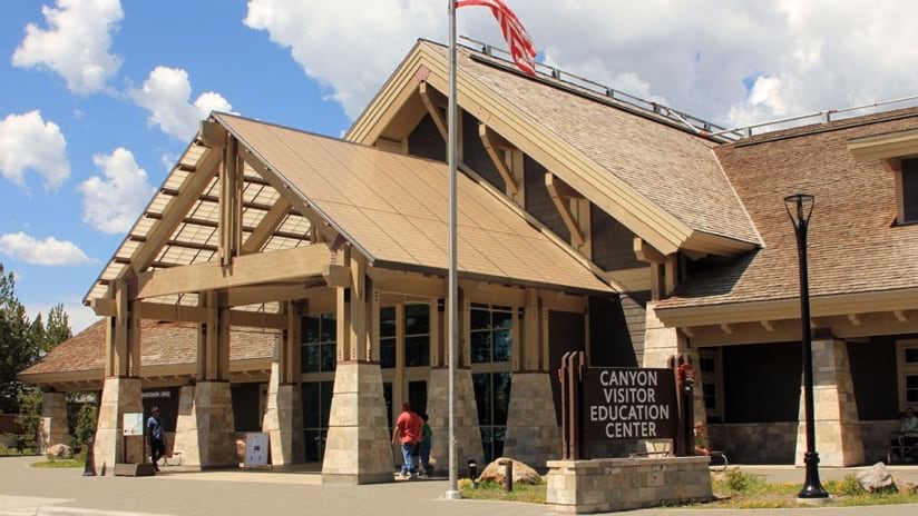
As part of an effort to fortify those landmarks and structures, a small team at the National Park Service has collected data and assessed 98 percent of park structures agency wide. The team created an interactive wildland fire risk assessment site using geographic information system (GIS) technology. The site’s GIS maps and dashboards show the threat each landmark and structure faces, and it details what can be done to achieve greater resilience. Each assessed structure, whether a historic inn or a park entrance sign, is ranked based on vulnerability and value—all visible on a map. With a clear ranking of needs, National Park Service leadership believes they can more strategically invest in efforts to reduce wildfire fuels, especially with an influx of infrastructure funding on the way.
The National Park System has long maintained a facility asset management database with information about each of its built structures. But when it came to noting susceptibility to fire, there was just a single field with a yes-or-no answer to the question, “Wildfire risk?” The database was never intended to detail fire risk with information like what kind of fuels might be nearby, or what resources were available to firefighters for defending a structure from a wildfire. No complete spatial dataset existed for park structures yet either. If that information did exist, it was in a paper record or stored on a hard drive, not in a shared place where it could be considered in the context of the entire National Park System. There was also no accessible historical record of past assessments—those that had been made during a fire. Fires could threaten a group of structures year after year and each time assessments would be repeated from scratch.
That was all before Sarah Hartsburg and Skip Edel began cataloging about 40,000 structures across the country. Hartsburg, the project lead for the National Park Service’s wildland fire risk assessments, and Edel, the National Park Service’s Fire GIS Program lead, thought there was a better way to collect, store and make data about the structures available for planning and wildfire response.
Hartsburg and Edel’s assessment work proved useful recently in New Mexico, as the Hermit’s Peak/Calf Canyon Fire that began in April crept closer to Pecos National Historical Park—home to some of the earliest Native Americans. Assessments of the park’s structures were uploaded into the National Interagency Fire Center’s (NIFC) Structure Triage dataset, providing information to thousands of firefighters and responders.
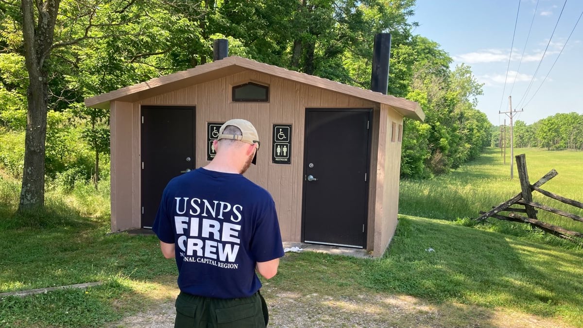
While the assessments don’t include natural landmarks such as trees or rock formations, they do offer a first-ever comprehensive look at each park’s wildfire risks, with assets ranging from the grandest visitor centers to parking structures to modest “comfort station” commodes.
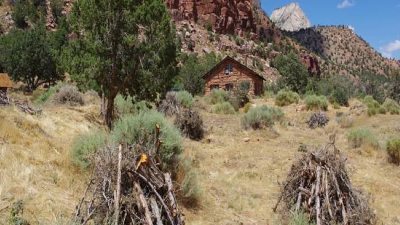
New buildings in the park system are often built with a host of natural threats in mind, but the parks’ many historic structures can be trickier. To retain historic character, many still feature original or similar construction materials–and are not necessarily fire-retardant. In response, the assessments outline ways to fortify the buildings by removing anything that might fuel a fire that’s surrounding the structures while maintaining their history.
“We don’t want to change the structure, but we don’t want it to burn down,” said Edel.
All the collected data appears on an online dashboard that includes a map, searchable by park, by region, or across the entire country—with a list of highest-priority sites based on wildfire vulnerability and value.
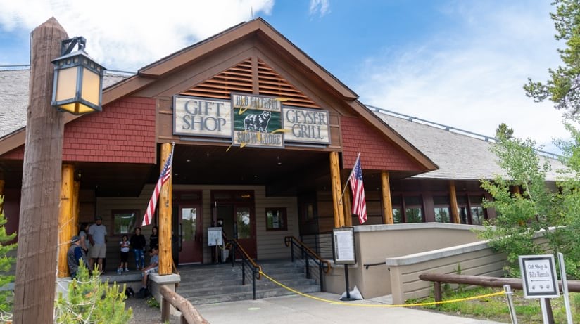
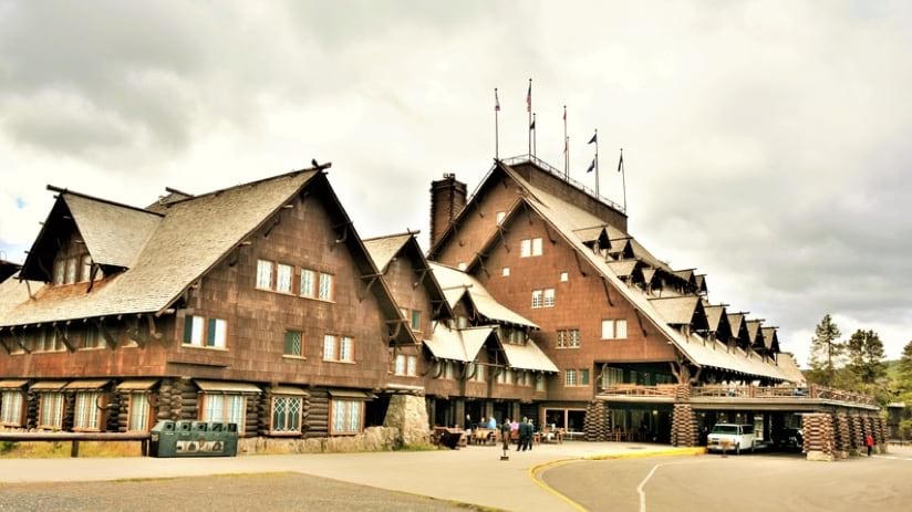
The majestic and historic Old Faithful Inn in Yellowstone ranks first overall, for example.
By sharing the information in a single database and a visual dashboard, people “can see the data; they can touch the data,” Edel said.
Because the data is visualized on a US map rather than in a static list, decision-makers can also see clusters of structures in need of preventative measures, making it more efficient to implement multiple fixes at one time.
Anyone in the National Park System can sign in to the site via a smartphone, tablet, or computer to view the data. Fire managers can edit and update the assessment database including noting steps taken to harden structures.
“We’re able to do this process and present these tools because we’ve invested in the data,” Edel said.
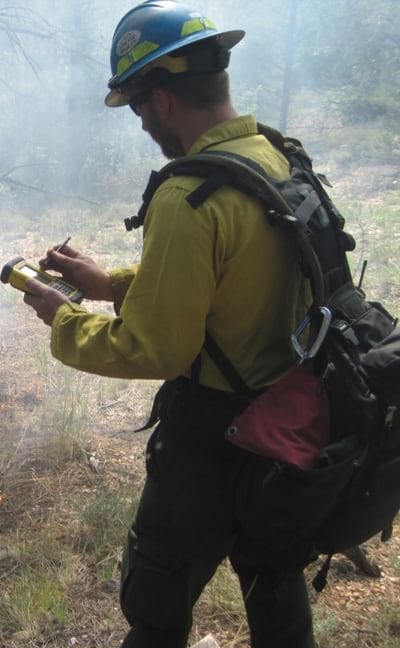
While visiting thousands of sites, Hartsburg and a team of contractors working alongside local park resources used ArcGIS Field Maps, noting details such as a building’s roofing material, any nearby firewood, and the presence of propane tanks and reliable water sources, and taking pictures as they did so.
In 2016, for example, the team visited Isle Royale National Park on Lake Superior in Michigan, accessible only by boat or plane. On her visit to the Daisy Farm Campground area of the island, she noted a heavy fuel load of shrub and timber within 300 feet of a cabin, but she also observed a reliable nearby water source, a fire-resistant roof, and no overhead hazards. Recommendations made after the site visit included removing dead or dying shrubs and trees within 100 feet of the building and installing a sprinkler system to better protect the structure. Included in an assessment report is a detailed estimate of the labor hours or equipment needed to create a defensible space around the structure to protect it from wildfire.
Once the in-person visits were completed, the work moved into a phase where high-priority locations are to be revisited every 5 to 10 years. Each location will be assessed to see what treatments have been or still need to be made to make it more resilient to wildfire threats.
To prioritize the structures, the National Park Service uses data collected during the risk assessment to generate a “likelihood of ignition” score and rating. The criteria is borrowed from the National Fire Protection Association’s Firewise USA program. That score is used in conjunction with the structure’s “asset priority index” value from the Facility Asset Management database, which uses a 100-point scale and is based upon criteria related to how the structure contributes to the park: resource preservation (both natural and cultural), visitor use, park operations, and it’s ability to be substituted. And finally the wildfire hazard potential—based on a geospatial product produced by the USDA Forest Service and Rocky Mountain Research Station—that indicates wildfire likelihood and intensity across the US.
“We throw those things in the GIS blender and come up with a score that we then use for ranking treatment priority and plan across the entire park service where to allocate limited resources,” Edel said. “We have the data, we have the process, and we have the way to then allocate that money in the most prioritized manner. This is a really solid way to make decisions.”
Learn more about how GIS is used for all aspects of wildfire management.

October 18, 2021 |
January 14, 2020 |
November 30, 2021 |