Search for
Found 10659 results
10 item(s) foundMarch 1st, 2022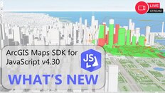 July 10th, 2024May 31st, 2022February 22nd, 2022March 3rd, 2022April 12th, 2022
 February 1st, 2023February 22nd, 2022
ArcGIS Workflow Manager: Build seamless end-to-end workflows across ArcGIS
Scaling GIS processes to successfully perform hundreds or thousands of times poses a challenge for many organizations. It is difficult to consistently coordinate the people, the processes, the data, and the software products required to complete work, particularly now when work occurs anywhere and o…
What's New: ArcGIS Maps SDK for JavaScript v4.30
In this livestream, we'll discuss the exciting new features added in version 4.30 of the ArcGIS Maps SDK for JavaScript. This will be an informal setting for the JavaScript Maps SDK product team to demo new features and answer questions from the audience.
📚 Resources
=============
📙 What's new blog p…
Dawn Wright Plenary Presentation
Dr. Dawn Wright is Chief Scientist of the Environmental Systems Research Institute (aka Esri), a world-leading geographic information system (GIS) software and data science company. Core to Esri’s mission is to inspire and enable people to positively impact their future by connecting them with the geoanalytic …
Integrated Earth Systems and the Weather, Water, and Climate Enterprise
Improving outcomes for our global future - The ocean has a significant influence on weather and climate. Understanding ocean-atmosphere interactions provides humans with forward-looking insight for societal wellbeing. Join Esri Chief Scientist Dawn Wright and inspiring guest Mary C. Erickson, Deputy Dire…
GIS for Environment and Natural Resources
Learn how Esri's ArcGIS provides environment and natural resources agencies with tools needed to become smart communities and gain insights into every aspect of their operations.
ArcGIS enables organizations to keep tabs on resources in real time, make operations as efficient as possible, deliver analysis an…
Real-Time Analysis with ArcGIS Velocity
Suzanne Foss, Product Manager - ArcGIS Velocity, introduces the new ArcGIS Velocity product, which provides easier access to visualize and analyze streaming data in real-time, like those from sensors and vehicles.
-----------------------------------------------------------------------------------------------------------------------…
People Mapping: Finding and Using Demographic Data
Learn how to easily find and use demographic data for more than 170 countries through ArcGIS Living Atlas. This webinar will explore the differences between US Census/ACS data and Esri Demographics, highlight data sources and investigate different topics to better-understand people mapping.
USGS Geospatial Information Response & User Engagement
On day two's technical Plenary Session, we will explore the latest ArcGIS technology and capabilities and report trailblazing apps, products, and developments that help us better understand oceans and climate processes. We will hear from Xan Fredericks, the National Map Liaison to Florida, Puerto Rico, and the U…