Skip to Content
Esri Redistricting

Esri Redistricting

Bringing clarity to the redistricting process

Go to pricing
A graphic of a laptop monitor displaying a colorful district map alongside a pie chart and menu of analysis options

Esri Redistricting is a web-based software that enables governments, advocates, and citizens to complete and share regulation-compliant redistricting plans. Based on Esri’s proven ArcGIS software and dataset components, Esri Redistricting provides comprehensive tools for plan creation, management, visualization, editing, and collaboration.

A modern enterprise approach


Esri Redistricting is trusted, curated, and secure. The easy-to-use interface and simple workflow will usher you through the process.

Legislative requirements and judicial audits

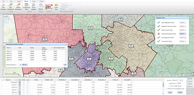
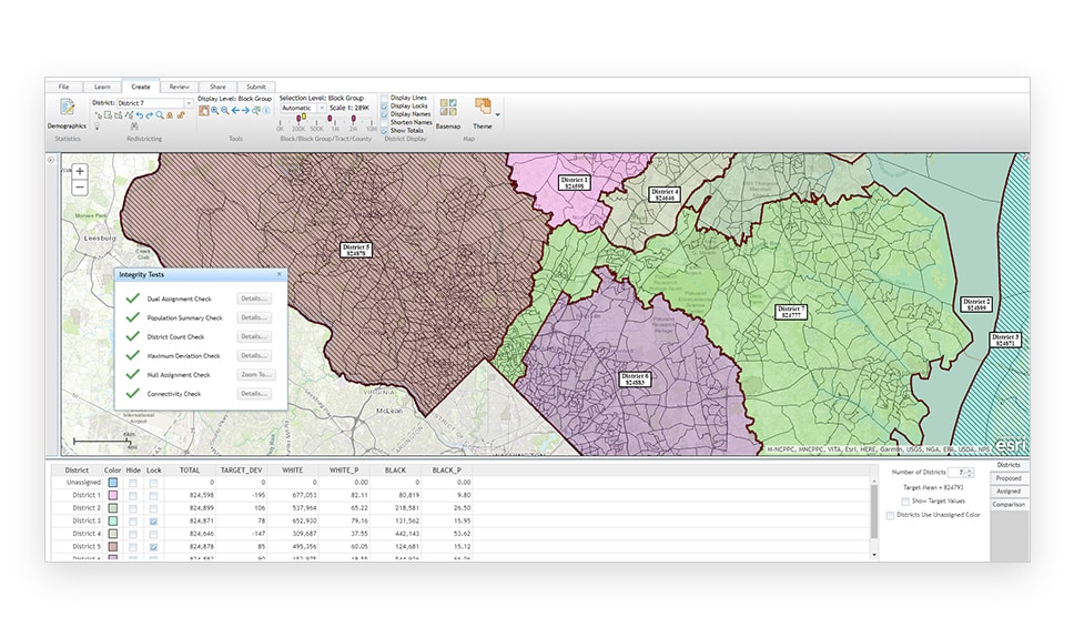
Avoid common pitfalls. Use built-in tools to check compactness and allowable population deviation. Share pre-defined reports that meet legislative requirements.

A multicolored state map with districts shaded different colors, overlaid with menus of analysis options

Secure sharing and collaboration

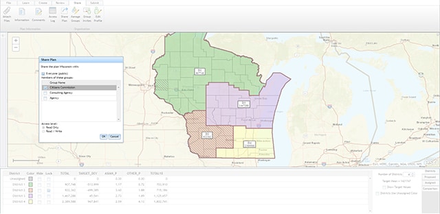
Engage citizen participation via online maps. Use out-of-the-box redistricting and spatial analysis functions, sophisticated geocoding, and plan management tools.

A state map with four districts outlined and shaded in green, purple, brown and ecru, overlaid with a menu of analysis options

Leverage existing GIS investments

No need to train your staff on a new system. Rely on the trusted and stable ArcGIS from Esri, the GIS market leader for more than 45 years.

Eight overlapping images of colorful heat maps, city maps, aerial city photos, and map dashboards on a blue maplike background

How Esri Redistricting works

Report

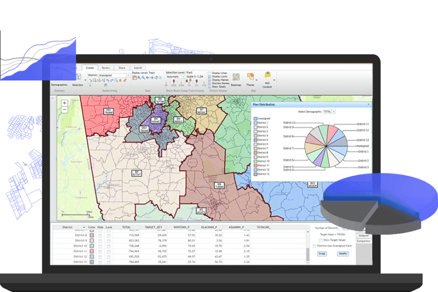
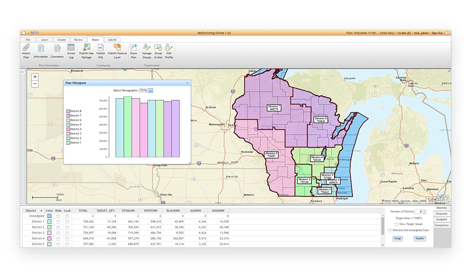
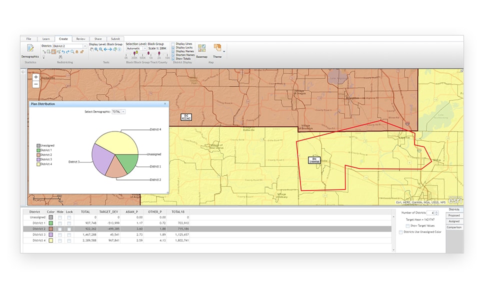
Run, print, and share predefined reports to summarize data and compare potential plans. Create custom reports using any available variable that matters to your organization and your constituents.

A desktop display of a multicolored state map with districts shaded different colors, overlaid with menus of analysis options and bar graphs

Create and edit a plan

Follow a step-by-step workflow to create, edit, view, and share your redistricting plans. Esri Redistricting is map-centric and easy to use. It will usher you through the process.

A desktop display of a district border map with two districts shaded orange and yellow, alongside legends of analysis options and overlaid with a demographics pie chart

Check integrity

Esri Redistricting will help you avoid common missteps such as assigning a geography to more than one territory, checking for compactness, and violating allowable population deviation.

A desktop display of a multicolored state map with districts shaded different colors, overlaid with menus of analysis options

Make thematic maps

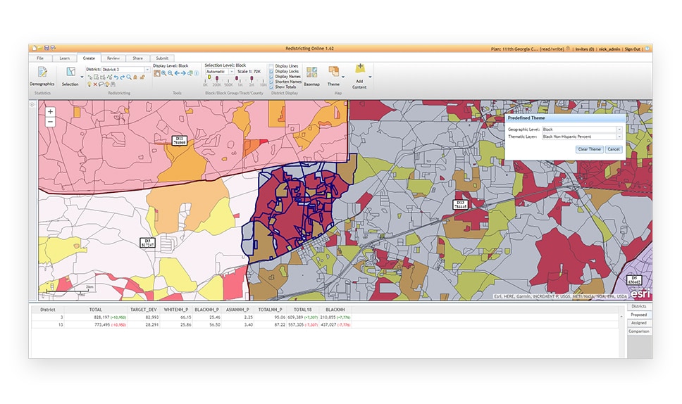
Create thematic maps using rich, authoritative data provided by Esri, including US Census data. Print and share your maps to better communicate your plans and differentiate between alternatives.

A desktop display of a multicolored state map with districts shaded different colors, overlaid with menus of analysis options

Manage and share the plan

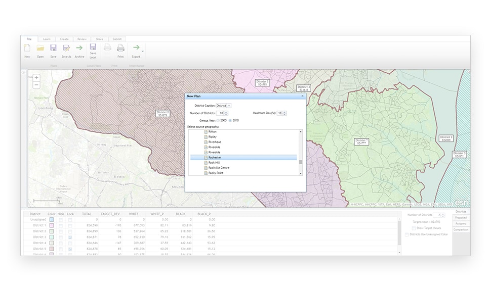
Manage all your plans in one place. Maintain individual plan integrity by locking them as "read only." Share within a secure and curated environment while collaborating with constituents. Gain external input without exposing your data. (Note that, manage and share plan features are available only in Managed Services and On-premises deployments.)

A desktop display of a multicolored state map with districts shaded different colors, overlaid with menus of analysis options

CASE STUDY

GIS empowers Arizona IRC's redistricting success

Learn how Esri partner Timmons Group helped Arizona IRC harness the power of GIS during its recent redistricting process.

Read the case study

Deployment offerings

Esri offers a variety of deployment options, including software-as-a-service (SaaS), Esri Managed Cloud Services, and on-premise for those wanting to leverage private data.

SaaS subscription

Esri Redistricting Online

  • Per user pricing/12-month subscription

  • Access to all functionality in a single-user version

  • Add content from external ArcGIS services

Buy now

Managed Cloud Services

Esri-hosted redistricting

  • Configured instance for organization

  • Custom data packs/integrated customer data

  • All hosting components managed by Esri

Explore managed cloud services

On premises

Deployed on-site

  • Configured and installed behind firewall

  • Custom data packs/integrate your data

  • Hosting components managed by you

Contact us to try it

Purchasing options for Esri Redistricting

Go to Esri Redistricting pricing

Talk to someone on our sales team

1-800-447-9778

7:00 a.m.–5:00 p.m., Monday through Friday (PT)

Outside the US?