ArcGIS Pro: Automating Topographic Mapping
Watch a presentation recording to learn about the latest developments in topographic data and map production management. Registration is required.
Optimize data and map production
An extension for ArcGIS Pro and ArcGIS Enterprise

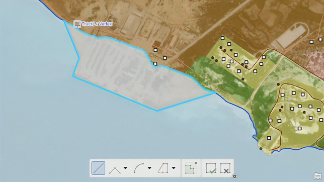
ArcGIS Production Mapping is a configurable extension that optimizes and tailors geographic information system (GIS) production to the way your organization works. It is a specification-driven topographic mapping software for national civilian mapping agencies and authoritative content producers. This extension provides specialized tools to automate the production process from beginning to end through standardization, repeatability, and configuration. This includes tools for data creation and feature extraction from imagery; data management, validation, and visualization; and high-quality, advanced cartographic production and Web GIS integration.
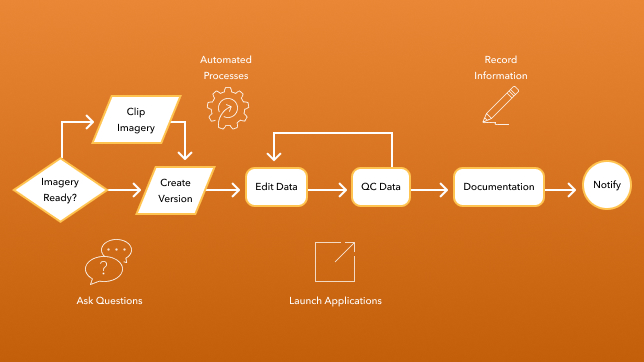
ArcGIS Production Mapping ensures consistency across operations by providing task-based workflows built using ArcGIS Workflow Manager. Each workflow is designed as a simple, focused task to be performed by a single technician. This makes it easy for technicians to understand what work they are required to do.

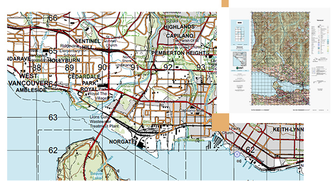
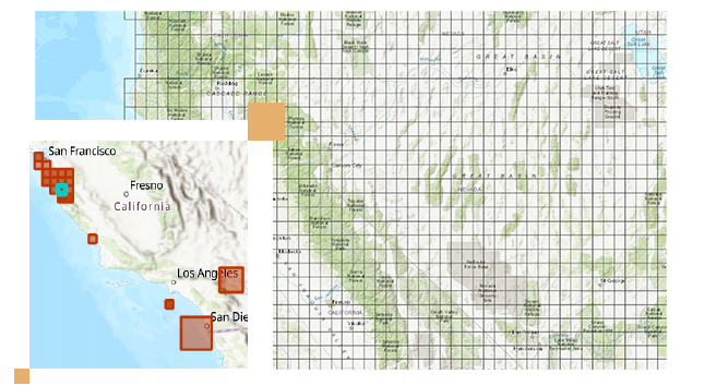
ArcGIS Production Mapping provides out-of-the-box generalization models to automate the creation of maps, charts, and data products at any scale based on the unique characteristics of different data themes. The models automate multi-scale mapping efforts to produce any output scale of data or cartographic product from a single best scale database.
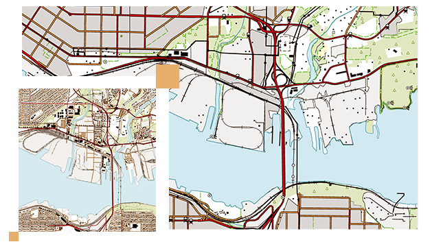
ArcGIS Production Mapping provides tools to help in the automation of map production and cartographic processes. These tools and processes allow users to efficiently create and manage the cartographic production of high-quality printed maps on strict schedules.
The ArcGIS Production Mapping extension reduces the time needed to compile and maintain authoritative content. Efficiently perform database maintenance and improve quality control for data and map products. Ensure consistency by capturing/distributing best practices throughout the organization.
Production Mapping for ArcGIS Server provides an ArcGIS Enterprise portal application that gives managers insight into the status of the work within their organization. Quickly identify work that is at risk, reassign or reprioritize work, and create new work—all within a simple, easy-to-use web application.
Simplify the production mapping process with innovative and modern software
Efficiently capture and manage defense business rules and domain knowledge within repeatable workflows.
With streamlined tools and workflows, ArcGIS Production Mapping enables the efficient creation, maintenance, and review of authoritative and reliable defense content at every stage of the production process.
Seamlessly share authoritative data and products across the ArcGIS system, ensuring efficient dissemination and accessibility.

Boost efficiency, reduce production times, and cut operational expenses through automated processes.
Ensure that your data is accurate and fit for its intended purpose by using the data review component of the ArcGIS Production Mapping extension.
Allocate resources and track the status of a project by using the workflow management component of the ArcGIS Production Mapping extension.
Take advantage of data visualization, advanced analysis, and much more with ArcGIS Pro, a next generation desktop GIS.
Power your location intelligence by organizing and sharing your work on any device, from anywhere, at any time.
Connect with Production Mapping and other topographic mapping software users to ask questions and find resources.
Get the latest information on new tools and capabilities for ArcGIS Production Mapping.