
Anchorage Alaska Earthquake Impact Summary Map
Local impact summary map for the earthquake in Anchorage Alaska November 30, 2018. Zones represent the shaking intensity in various areas.

Access earthquake data, live feeds, technology, and resources
Manage your earthquake response with live feeds and sensor data.
This map is intended to provide general awareness of earthquakes around the world.

View agency and industry best practices using geospatial technology for earthquake response and recovery.
Anchorage Alaska Earthquake Impact Summary Map
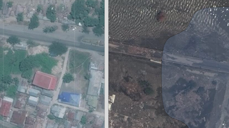
Palu Indonesia Earthquake Story Map
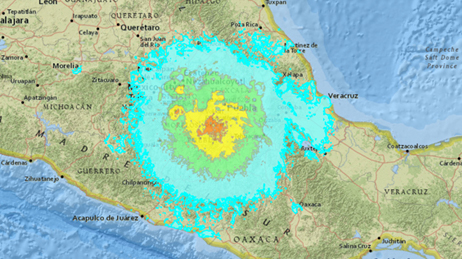
Puebla Earthquake Impact Summary Map
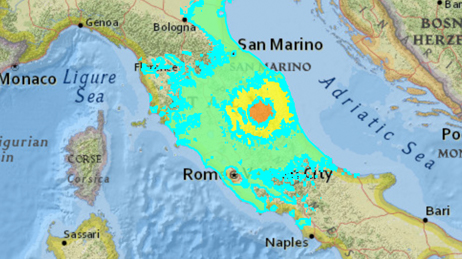
Italian Earthquake Impact Summary Map
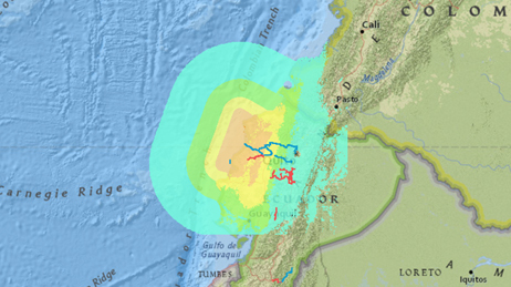
Ecuador Earthquake Story Map Journal
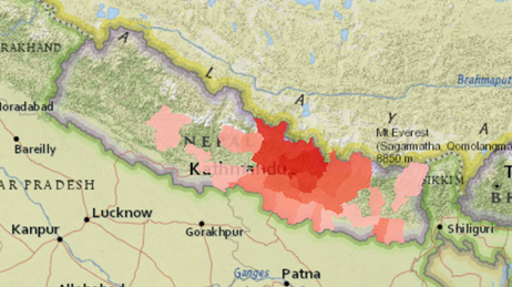
Nepal Key Figures by District story map
Use this collection of applications, map layers, how-to guides, and reports to help plan and manage your earthquake response.
Request embedded maps or interview topic experts for your disaster-related editorial features and news stories.
Explore ArcGIS Solutions, incident-specific data, resource catalogs, and live data feeds to support your disaster response.
See how we help organizations maximize impact for people, planet, prosperity, and peace.
If you need GIS software or support for your current disaster response, please request assistance by completing the form. All requests should be fully justified and are subject to approval.