March 25, 2025 | Multiple Authors | Public Safety
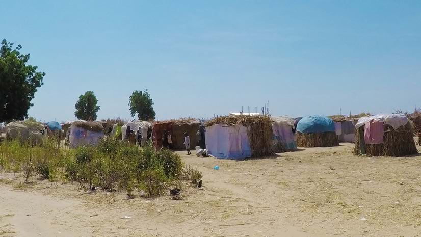
Investigating the Human Toll of Boko Haram with Maps and Satellite Images
GIS allows HumAngle Media to transform abstract data into compelling visual narratives about the millions of displaced people in Nigeria.