spatial@ucsb—A New Kind of Campus GIS Center?
By Michael F. Goodchild, Director of spatial@ucsb
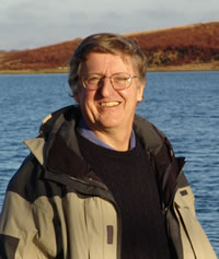 Michael Goodchild is the director of the new Center for Spatial Studies at the University of California, Santa Barbara. |
Search a bit on almost any university campus and you will likely find a GIS center of some kind. It may be part of a department or administered as a campus information technology service or run by the library. It will likely coordinate the Esri site license, collect and provide access to geospatial datasets, and offer short training courses and perhaps a drop-in advice service. Over time, the range of GIS applications has grown, and today it is not unusual to find users in almost any discipline, from sociology to geoscience.
This approach is starting to show its age, however. In 2005, Google released Google Earth and people with little or no background in GIS, geography, or cartography began using it and other similar services to discover the power of mapmaking. Some even began calling themselves neogeographers. Suddenly, it was possible to do some powerful things with geospatial data without committing to what was often a difficult and lengthy learning process. GIS itself became easier to use, cheap GPS made it possible for anyone to collect accurate locations and tracks, and a recent editorial in Nature argued that every scientific observation should now be georeferenced. But mistakes were and are being made, as often happens when powerful technology is put in the hands of people with little background in its underlying concepts and little experience in thinking critically about its products.
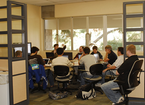 Students gather for a workshop at spatial@ucsb. |
American psychologist Howard Gardner has written extensively about the nature of intelligence and how it is possible to identify several distinct kinds: verbal intelligence, which allows us to think and reason in words; mathematical intelligence, which allows us to manipulate numbers and make logical deductions; and spatial intelligence, which allows us to draw meaning from pictures, images, and maps.
Surprisingly, and despite the fact that we as a society devote years of attention to developing verbal and mathematical skills, we spend virtually no time at all developing spatial intelligence. Although many people have trouble reading maps, we tend to regard that as a given effect of nature rather than a failure to nurture. We put questions involving spatial reasoning on intelligence tests but give children almost no systematic preparation for them. And yet, the current generation of students is perhaps the most spatially aware of all, given its immersion almost from birth in television, video games, and virtual environments like Second Life.
Once all the technicalities are stripped away—once a GIS user begins to see beyond the intricacies of the user interface, the cryptic terminology (think of all those three-letter acronyms beginning with D), and the hassles of importing data—what most distinguishes the GIS professional is a keenly developed spatial intelligence. Spatial thinking is different. I talk to social scientists to whom data is always a table, never a map, and the idea of using a map as a research tool is inconceivable.
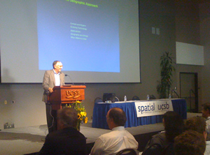 Esri President Jack Dangermond speaks at the opening of spatial@ucsb. |
For a simple test of someone's critical spatial thinking skills, ask for an estimate of the length of the coastline of Italy. Ask Google, and you will get as many answers as you have time for, but any critical spatial thinker knows that there is no answer independent of scale—and that many other properties, including slope and the number of polygons on a map of soil class, are also scale dependent.
GIS professionals will know that relative positional accuracy is almost always substantially better than absolute positional accuracy; they may even know that this is a necessary consequence of Tobler's First Law of Geography, perhaps the most powerful statement ever made about the nature of geographic data.
A Center Devoted to Developing Spatial Intelligence
This is the central background argument for the establishment of spatial@ucsb, known more formally as the Center for Spatial Studies at the University of California, Santa Barbara (UCSB) (http://www.spatial.ucsb.edu). The center was established in July 2007 and had its official opening, featuring Esri president Jack Dangermond and GISCorps' cofounder Shoreh Elhami, in May 2008. The center's basic purpose is to facilitate and develop spatial perspectives, spatial thinking, and spatial intelligence in research and education across the full span of the campus, from theoretical physics to religious studies. At UCSB, many departments, centers, institutes, and services emphasize spatial perspectives (more than 100 faculty members emphasize space in some aspect of their research or teaching). The list includes the Center for the Study of Sacred Space in the Department of Religious Studies, which focuses on such topics as the Asian practice of feng shui, the spatial layout of Shinto shrines in Japan, and the role of space in Native American religious practices of the Pacific Coast. The list includes the Allosphere, a 30-foot-diameter spherical space for exploring immersive environments. The Allosphere is housed in the building constructed for the California NanoScience Institute, a research center that deals with a very different range of spatial scales. We have found that space and spatial thinking play a role in virtually every activity, from the study of art history to the management of campus facilities.
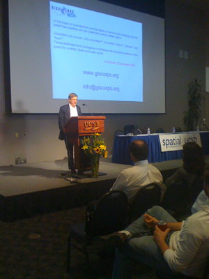 A crowd gathered for the opening of spatial@ucsb listens to Michael Goodchild talk about the GISCorps. |
The center offers short courses, a seminar series, and a drop-in advice service. It has its own research program, building on such UCSB activities as the National Center for Geographic Information and Analysis (NCGIA), the Center for Spatially Integrated Social Science, and the Alexandria Digital Library. The center's primary goal for the next year will be the development of curriculum materials suitable for the undergraduate level so that instructors have ready access to content that can be inserted into existing courses or used as the basis for an entire course. In that sense, spatial@ucsb is responding to a distinct lack of textbooks and other forms of guidance on how to develop critical spatial thinking skills—similar, in fact, to the situation with respect to GIS when NCGIA developed its core curriculum in 1989.
Developing Critical Spatial Thinking Skills in Students
So what exactly might a course in critical spatial thinking cover? A recent report from the National Research Council (Learning to Think Spatially: GIS as a Support System in the K-12 Curriculum, http://www.nap.edu/catalog.php?record_id=11019) describes the kinds of spatial intelligence that could be developed in primary and secondary education and the ways GIS could help.
Children acquire the most basic spatial concepts, such as distance, direction, and territory, in the earliest grades, but other concepts must wait until much later. At the undergraduate level, the student is probably ready to explore the complexities associated with the concepts of region, scale, connectivity, and diffusion; the more statistically minded will encounter spatial dependence, spatial heterogeneity, and uncertainty. Students who have taken courses in statistical testing will be ready to think about the difficulties of applying orthodox statistical assumptions to spatial data, which almost always violates the basic premises of random sampling and independence. Students may even be ready to tackle the challenging areas of spatial statistics and geostatistics and to understand the ecological fallacy and the modifiable areal unit problem. All these concepts have always lain behind any education in GIS, but we now have the opportunity to bring them to the fore and explain their importance to virtually any kind of investigation.
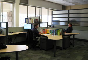 The offices at spatial@ucsb. |
Like all areas of human activity, campuses tend to become "stovepiped" through time, with faculty and students isolated in their own disciplines. Even though we are in the same building, I know very little about what happens in the Department of Film Studies or the Department of Communication (an ironic title in this context)—and they know very little about geography. Spatial thinking provides one of the very few yet powerful themes that can link the disparate activities of a university campus.
But it also provides a very powerful argument underpinning what one might call the knowledge life cycle. Scientific knowledge is acquired by a rigorous process, and scientists often think their task has ended when that knowledge appears in the pages of learned journals. The system of academic reward reinforces this, by measuring productivity in terms of papers despite the lack of any assurance that those papers will actually be read or will influence the world outside the ivory tower in any substantive way. One of the strong arguments for GIS is that it allows scientific knowledge to be implemented in practical applications—the same technology that supports research and knowledge discovery also supports its application in policy development and decision making. Spatial concepts and critical thinking are important to both ends of this knowledge life cycle: at the stage when scientific discoveries are being made and when they are being used to create designs, improve the world, and solve humanity's most pressing problems.
For more information about spatial@ucsb, contact Michael F. Goodchild at good@geog.ucsb.edu.