Winter 2009/2010
Winter 2009/2010 |
|||||||
|
|
|||||||
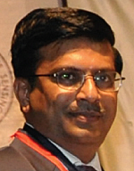
Mukund Rao Steers Data and GIS for Global Spatial Data Infrastructure |
|||
|
To honor this exemplary work record for the past three decades, Rao has been bestowed two honors, the 2008 National Geospatial Award for Excellence from the Indian Society of Remote Sensing and the Exemplary Service Medal from the Global Spatial Data Infrastructure (GSDI) Association. The Indian Society of Remote Sensing recognized Rao's outstanding contributions in promoting geospatial science and technology and applications in India through longtime association and involvement in GIS technology, including his current position as president and chief operating officer of NIIT GIS Limited (Esri India). The GSDI Association recognized Rao for his role in building and developing GSDI in its formative years and steering its activities as its first president from 2004 to 2006. Rao served as president at the GSDI-7/8 conferences in Bangalore, India/Cairo, Egypt, and has been involved in directing and furthering the technology and application of SDI throughout the world.
"To me, these awards are a humble reminder of the opportunity I've had to work with GIS right from the beginning," says Rao. He was introduced to GIS in 1984 while working at the Indian Space Research Organization (ISRO) to create the first prototype of the Natural Resources Information System (NRIS), a solution for handling images, making thematic maps, and supporting decision making in natural resources management. Rao conceptualized and performed an initial study for the Mineral Exploration Information System (MEIS), which was an integration of images with geophysical and geochemical data that allowed analysts to find mineral indicators. Rao discovered GIS through a course introducing the fundamental concepts of GIS in Mumbai, India, led by one of the early originators of GIS, Dr. Duane Marble, professor emeritus of geography at the Ohio State University. Later, in 1987, Rao was exposed to an excellent training suite in GIS at the Asian Institute of Technology (AIT). In 1985, Rao was involved in the process of selecting the best-suited GIS package for the support of India's remote-sensing applications and the NRIS program (finally, ISRO selected PC ARC/INFO, then the later versions of ArcInfo). "The innovative methods of handling maps, building spatial models, and creating different spatial perspectives captivated me right away—I could easily perceive their importance and relevance due to my background in geology, where maps and visualization are the key," adds Rao. He went on to apply GIS to urban and regional planning and wasteland management in many cities in India. Ultimately, he became the lead in the NRIS program of ISRO and was instrumental in developing the comprehensive NRIS Standards for GIS in India and, more recently, the National Natural Resources Management System (NNRMS) Standards, the national standards for EO and GIS. During the late 1990s, Rao realized that SDI was the path for both the NRIS and ISRO imaging programs, conceptualizing India's NSDI program and transforming it into an intergovernmental mechanism. Rao was the key person in authoring the NSDI Strategy and Action Plan and prepared the NSDI Metadata Standards. To demonstrate the first GIS portal for NNRMS, Rao developed a prototype that was officially launched and hosted on ISRO's Web site in early 2000. Soon after, he steered the concept of agency SDI portals through the National Urban Information, NNRMS, and a number of state-level portals of SDI, bringing about an integrated system for India's NSDI. This system is now becoming the foundation of NSDI in India. He is currently working on concepts for SDI Applications Portal services and enabling a cross-linking network of application visualization for SDI. This activity launched Rao into the GSDI movement, and he was elected as the first president of the GSDI Association. During this time, GSDI was incorporated and its activities defined, including a coordinated approach furthering SDI throughout the world through cookbooks, Esri grant projects, conferences, and committee activities. In 2005, Rao took over as CEO of Navayuga Spatial Technologies, an Indian startup company located in Bangalore, and headed up many successful projects, including the establishment of an ArcGIS software-based enterprise solution for the Ras-Al Khaimah emirate in the United Arab Emirates (UAE) and the largest enterprise solution project in India, the creation of an SDI in Delhi. Since joining Esri India in 2008, Rao has been involved in furthering GIS throughout India by promoting efficient and successful business models. With a deep understanding of earth observation and GIS, Esri India now operates and helps many successful GIS projects in India and other parts of the world, focusing on urban, power, utilities, disaster, and imagery sectors. Rao is quick to point out that his associations with other leaders in the field have helped him achieve his successes in spearheading the movement of GIS and remote sensing to assist in solving the challenges faced in the world. Jack Dangermond, president of Esri, and Dr. Krishnaswamy Kasturirangan, the former chairman of ISRO and chairman of the Planning Commission of India, are two such leaders. Rao also credits a large number of professionals that he has worked with in India and abroad for his GIS accomplishments, learning from their capabilities and expertise in undertaking GIS activities in a better and meaningful way. Rao is a strong believer that GIS representation will be a key factor in most human activities and a benefit to society and humanity, providing the key technology necessary for information processing and visualization. "While, on one hand," says Rao, "GIS will become easier and simpler to use—thus making it usable by the common man—it will also become integrative and overarching to bring together various technologies of surveying, imaging, and mapping for GIS content; databases and warehousing for GIS storage; and seamless data fusion and merging for GIS applications. Finally, it will provide a tremendous way of visualizing information in a spatial domain. No longer are maps the only output from a GIS." More InformationFor more information, contact Mukund Rao (e-mail: Mukund.rao@niit-tech.com). |
 A geologist by education, Dr. Mukund Rao understands how studying the earth can uncover solutions to problems that affect people all over the world. His passion for understanding the earth and its activities led Rao to a rich career furthering earth observation, GIS, and spatial data infrastructure (SDI) applications at both the national and international levels.