Winter 2009/2010
Winter 2009/2010 |
|||||||
|
|
|||||||
Kingston University London: 20 Years of GIS Education |
||||
|
By Kenneth Field, Course Director, Kingston Centre for GIS
With more than 650 graduates of the bachelor's degree course, 50 master's graduates, and more than 400 students of our distance-learning training course for professional in-service training, as well as successful doctoral candidates, the university has many students who have gone on to develop careers in the geographic information (GI) industry. At least 10 KUL graduates currently work for Esri, and many students work for data and solutions providers. KUL GIS graduates are in demand by diverse organizations, including environmental agencies; local government; retail, commercial, mapping, transportation, and utilities organizations; and software firms. One of our first master's graduates, Armen Asyran, recently helped compile Earth, which is the world's largest atlas published by Millennium House. KUL has been a world leader in GIS throughout its first 20 years and firmly intends to remain so. Since the initial decision was made in 1988 to establish the first bachelor's degree course and a centre of excellence in GIS, many changes have taken place, but the current faculty is committed to developing interesting, cutting-edge courses, undertaking research and consultancy, and maintaining and developing links to the GI industry to support common goals. The GIS faculty at KUL has pioneered a number of developments subsequently taken up by the university. Tim Linsey and Ed Parsons were responsible for making online resources available via the Mosaic Web browser in the early 1990s with GISWWW and its own bulletin board. Parsons also built his own local area network within the university for the distribution of GIS resources. Faculty members are also routinely involved in national-level resource initiatives, such as the development of MasterMap Download, the academic interface for Ordnance Survey's MasterMap data, which faculty helped shape prior to its rollout to all UK universities. With a strong team of former faculty members and alumni who continue to support KUL, there exists a unique group of academics and professionals who have shaped this major contribution to the development of GIS. Close liaison with the GIS sector keeps the course current and directly relevant to the needs of employers. Links with suppliers, consultants, bureaus, and a wide range of users have been established, resulting in student visits, internships, and guest lecturers. This collaboration provides crucial support for the course and helps maintain KUL's reputation among employers. High-quality, externally funded research has characterized the work of the faculty and informed teaching in areas such as remote sensing of hazards and upland forests, spatial statistics and the handling of geographic information, image-based systems, multimedia, and virtual reality development in GIS, as well as the application of GIS to environmental problems. Ongoing is a two-year project to explore use of students' personal technologies for data gathering and sharing and the role of social networking sites, such as Twitter and Facebook, for the creation of collaborative geolearning environments and innovative Twitter maps—which, taken together, I call "cartoblography." Research, Consultancy, and Commercial LinksUnder the consultancy name Kingston Centre for GIS, the faculty has delivered training workshops and seminars at GI industry events for the past 20 years, such as the annual Solutions Centre events at UK GIS conferences. The Kingston Technical workshop series is now delivered at the annual Association for Geographic Information (AGI) GeoCommunity conference. KUL also gets involved in GIS Day by hosting a day of events for local schoolchildren, and plans are under way to take part in the National Geographic Society/Esri GeoMentor scheme. Vanessa Lawrence, CB, Ordnance Survey's CEO and director, is a fellow of KUL and recipient of an honorary doctorate and visits regularly to deliver a keynote lecture that is normally timed to contribute to GIS Day. KUL also supports and encourages growth in GIS courses elsewhere. In 2006, KUL led a major European-funded project to establish a GIS curriculum, course, lab, and staff training at the University of Sarajevo, Bosnia-Herzegovina. KUL also runs an annual GIS summer school in conjunction with AGI.
Commercial and academic links feed directly into the course through our innovative Contemporary Issues in GIS invited-speaker series, which has seen a number of illuminating speakers over the years. Faculty members are also in demand by other institutions as advisers, adjunct tutors, and external examiners, such as Penn State's Masters in GIS (James O'Brien), the UNIGIS MSc programme (Nigel Walford), and the Royal School of Military Survey MSc course in defence geographic information (Kenneth Field). Such networks are important to share expertise, disseminate findings and experience, and support healthy inter- and intrasectoral collaboration. KUL is also supporting Esri (UK) Ltd. in developing its Enterprise Training Lab based on applications and student projects developed over recent years. The GIS Road Map at KUL: Another 20 Years and BeyondThe last 20 years have seen phenomenal change and growth in technology, data, software, and the GI industry. KUL has been part of that growth and has led initiatives to keep courses at the forefront of GIS education. As KUL embarks on the next 20 years, there are echoes of 1989 and the drivers that stimulated the initial development of the course. Perhaps now, more than ever, an increasingly democratized approach to handling spatial data and mapping has caught the public's imagination and illustrated the power of the geographic approach. Ever more jobs and careers require graduates to be highly skilled and trained professionals in GI systems and science. The impact of online data providers and the rapid diffusion of mobile and Internet mapping applications have reignited interest in the combination of geography and technology that should provide a steady supply of students to courses and serve the now maturing discipline well in the future. Many more pivotal positions in GI-related careers will be needed—careers for people who can now gain professional recognition as Chartered Geographers with expertise in the field of GIS (CGeogGIS). The recent review and events marking the 20th anniversary of the milestone Chorley Report on Handling Geographic Information (1987) in Britain (see below) reaffirmed the position of GIS at the heart of spatial data infrastructures. The Infrastructure for Spatial Information in Europe (INSPIRE) initiative promotes data interoperability and sharing of spatial information and provides a framework across Europe. The newly released Location Strategy for the United Kingdom (Geographic Information Panel, 2008) puts the nature of place, where events happen and impact the people and assets at that location, at the centre of national, regional, and local initiatives and service delivery. The purpose is to better plan and to manage risk and use resources more efficiently, maximizing the value of geographic information to the public, government, and UK business and industry. This is a crucial document in shaping the information economy for the coming years and emphasizes the continued need for suitably knowledgeable and well-trained graduates in GI systems and science. In 2008, GIS was officially included as a core component of the school geography curriculum, meaning that every schoolchild will now be formally introduced to GIS. Along with KUL, other universities and Esri (UK) are making great strides to support development of GIS at the school level, which should see a thriving graduate and postgraduate market emerge. The Early Years in Kingston upon Thames: From Idea to InceptionIn honor of this 20th anniversary, I would now like to reflect on the history of the course and reveal some of the stories that have characterized GIS at Kingston. Since 1947, the School of Geography at Kingston Polytechnic had developed a strong reputation for its bachelor's degree course in geography. The cartography component had always been a core component of the course, and staff research interests with Ph.D. awards at the time focused on digital cartography and expert systems. Courses in digital cartography; remote sensing; and, in 1986, an option in GIS were introduced into its geography course. Only 250 metres along the road, the Environmental Studies Department of Kingston College of Further Education (KCFE) had been involved with cartography and related subjects since the 1960s. Demand for suitable qualifications in cartography by people working within established cartographic agencies led to the development of two-year part-time Ordinary and Higher National certificates in 1968 and 1970, respectively. These incorporated all aspects of cartographic practice, theory, and production methods, as well as surveying, photogrammetry, mathematics, and geography. The rapid expansion of digital cartography in the 1980s and development of the new discipline of GIS had a major effect on the education programmes of both institutions. These developments provided the context for the institutions, in the late 1980s, to jointly develop a new range of educational and training courses in GIS that reflected the strong growth of technology in geography during that decade as geographers sought to develop links between increasingly available data and the computer's ability to facilitate effective storage, manipulation, and analysis. A proposed bachelor's degree course in GIS emerged as a collaborative development concerned with spatial data handling and the application of GIS technologies to a wide spectrum of problems and their solutions. The aim of the course was to enable students to acquire knowledge, skills, and expertise in GIS, integrated with mapping technology, for the purposes of spatial data management. Justification for the world's first degree course in GIS gained support on the basis of an expanding market for GIS specialists identified in two key publications. Both the 1984 Report on Remote Sensing and Digital Mapping (House of Lords Select Committee on Science and Technology, 1984) and the 1987 Report to the Secretary of State for the Environment of the Committee of Enquiry into the Handling of Geographic Information, chaired by Lord Chorley, identified the need for degree courses in GIS. The Chorley Report particularly stated "it is apparent that there continues to be a serious gap between education and training requirements and actual provision in the geographic handling areas. In our view, this gap is a factor holding back the use of technology for handling spatial data and the shortage of trained personnel could be even more of a constraint in the future as demand increases." The Chorley Report concluded that there was "a need to increase substantially, and at all levels, the provision of trained personnel." Evidence from both the U.S. and UK markets suggested that the rapid expansion of GIS technology would lead to the establishment of whole new GIS-based employment areas, including local government, utilities, commerce (in particular, sales and marketing), and environmental management. The AGI formed as a direct consequence of recommendations in the Chorley Report and identified a growth in demand for spatial information, computer systems that utilize this data, and trained personnel who can operate such systems. In the UK, �70M had been spent on GIS technology by the end of 1988, with an annual cost of �30M by the turn of the decade. Many HEIs subsequently incorporated GIS units into existing geography courses, and one-year master's courses began to appear. The appropriateness of the "bolt-on" GIS unit, the problems of what to teach and how to properly resource practical exercises, and the lack of experience within existing staff were all problems that had to be addressed. The need for individuals with multiple skills in underlying subject areas, such as geography, engineering, and business; in conceptual and practical considerations of GIS; and in broader IT and management issues demanded a more substantive educational approach. At the school level, the inclusion of geography in the national curriculum and the general popularity of the subject was leading to oversubscribed geography degree programmes. The rise in interest in computing and information technology subjects and the increasing role of computers in society also suggested that the development of a new academic course that married these together could provide a popular subject. This potential was supported by the fact that the GIS unit in the geography degree course at KUL was itself oversubscribed.
Market research of 45 leading firms and establishments that had some involvement with GIS found overwhelming support for a bachelor's degree course and a growing need for graduates. Further support and advice on the course design were received from the AGI, British Cartographic Society, British Computer Society, and Ordnance Survey. The survey response was also crucial in the naming of the course, a decision which, with hindsight, was remarkably astute. The course was originally to be titled Environmental Information Management and Mapping Systems. On recommendation, the title changed to Geographical Information Systems, reflecting a terminology that was to become ubiquitous. With impetus established, a committed group of people in the School of Geography at the Polytechnic, alongside staff from KCFE, prepared course documents in January 1989 that were ratified by the Council for National Academic Awards (CNAA) in June. The first intake of 35 students in September 1989 was impressive for such an innovative course and fully justified its development. Within two years, there were more than 40 students majoring in GIS, and in 1991, a Higher National Diploma (HND) course in GIS was added to its portfolio, with an intake of 20. In 1992, the Polytechnic was granted permission to become a university, and Kingston University London was born as the first cohort of students graduated with the highest student retention rate in the university, along with the highest level of graduate employment within six months of taking the course. By 1997, there were approximately 70 students per annum studying GIS. The aim of the bachelor's degree course was to provide students with the skills and understanding necessary to apply GIS technology to a wide range of environments. This provided a framework for understanding GIS concepts and how they are integrated into broader information technology strategies. Objectives were to
Course content was organized around four underlying themes. The environmental information theme examined sources and character of social, economic, and physical data operating over various spatial and temporal scales and their measurement and description. Information collection methods covered principles of data collection and capture, photogrammetry, remote sensing, surveying, and social and economic surveys. Data analysis explored GIS and other information systems for data management, intelligent data manipulation, spatial and statistical analysis, and system design and evaluation. Finally, information management and communication focused on cartography and digital mapping, report compilation and desktop publishing, management, and budgeting implications. The course engendered an applied philosophy so students gained knowledge and understanding of the application of GIS to effectively examine and solve spatial questions. Back to the Now
The current curriculum introduces GIS across four Year 1 modules: Digital Earth, GIS Techniques, Applications of Geoanalysis, and Fundamental Programming Concepts. In Year 2, modules offered include Digital Mapping, Remote Sensing, Spatial Databases, Geographical Analysis and Modelling, GIS Software Development and Customisation, GIS for Enterprise and Research, and Mobile GIS. The final year promotes specialties in a wide range of options, including geovisualization, GeoWeb applications, crime pattern analysis, GIS and health, GIS and hazards, systems analysis and design, high-definition surveying, and geodemographic analysis. The bachelor's degree course now also has Joint Honours options where students can combine a major in GIS with a minor in computing, Web technologies, business administration, or landscape architecture. This provides tremendous scope for linking GIS with a range of other subjects at KUL. In 2003, fieldwork was embedded into the programmes to take GIS out of the classroom, and this has since provided a focus for some innovative work in mobile GIS, fast becoming a contemporary area of expertise at KUL. Current curriculum initiatives are focusing on server-based GIS both in class and for mobile GIS and high-definition surveying with terrestrial lidar for data gathering, handling, manipulation, and visualization. Alongside the bachelor's degree course, KUL has successfully delivered a Continuing Professional Development (CPD) distance-learning training course for professional in-service training since 1994. This is a nonaccredited option that many hundreds of employees have studied part-time in distance-learning mode. Despite preeminence in the provision of a bachelor's degree course, it wasn't until 2002 that KUL added a master's programme to its portfolio. The Masters in Applied GIS combined a major in GIS with a minor in environmental science. In 2008, provision was extended by the addition of a distance-learning Masters in GI Systems and Science. Both programmes are recruiting strongly as GIS becomes ever more pervasive in a wide range of activities that require professionals to retrain and seek professional development and qualifications in GIS. KUL will continue to support state-of-the-art GIS education and make it available to all those who join the world's first GIS course as it embarks on the next 20 years. Esri Development CenterKUL is also extremely proud of its recent accreditation as an Esri Development Center (EDC), which provides recognition and special status to university departments that have exemplary programs. Being an EDC site brings a number of benefits, including an annual student of the year award that was conferred for the first time in 2009, suitably commemorating 20 years of the course. The 20th Anniversary CelebrationTo celebrate the 20th anniversary, KUL will be holding a reunion reception for past and present GIS staff, alumni, and current students in 2010. For details of the event, contact Dr. Kenneth Field through the Kingston Centre for GIS Web site (www.kingston.ac.uk/centreforGIS). Changing Faces of GIS Faculty, Keeping Pace with Change, and Recognition and RewardsMany people have contributed to GIS at KUL. Some remain, while some have moved on and made other significant contributions in academia and business, leaving openings where new faculty have taken up the reins. KUL has also benefited from its relationship with a number of major figures in GIS over the years. A substantial financial commitment was made in terms of staffing and computer technology to launch the course. This was vital to success, and resourcing remains a vital aspect of quality course provision. Over the years, the Kingston Centre for GIS has frequently been recognized and honored. Visit www.esri.com/arcnews/kingston or www.kingston.ac.uk/centreforGIS for a list of key individuals, important technology, and awards. AcknowledgmentsMany thanks to all those past and present faculty members who contributed to this review. As ever, it's a team effort. About the AuthorDr. Kenneth Field is course director and principal lecturer at Kingston Centre for GIS, Kingston University London. He has been editor of The Cartographic Journal since 2005 and is a member of the Council of the British Cartographic Society. His teaching and research focus areas are cartography and geovisualisation, as well as mobile GIS and mobile mapping. More InformationFor more information, contact Kenneth Field (e-mail: Ken.Field@kingston.ac.uk). |
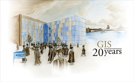
 In the United Kingdom, Kingston University London (KUL) holds a special place in the history of academic programmes in geographic information systems. In 1989, Kingston was the first higher education institution (HEI) in the world to design and offer a three-year bachelor's degree wholly in GIS. September 2009 marked 20 years of the course as it comes of age and welcomes its 21st intake.
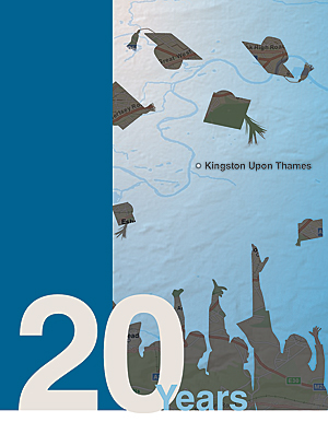
 The general framework survives to this day, though the balance and course content have changed considerably to both reflect developments in GIS and lead curriculum initiatives in the science and delivery of GIS. Core modules in GIS are now delivered to all students of geography, environmental science, geology, and forensic science in Year 1 (approximately 250 students). This reflects the maturation of GIS as a discipline and the enabling role it plays for all geoscience subjects. It also reflects the philosophy of embedding GIS as a framework for study across a range of subjects in the university that extends to landscape architecture, computing, business, and surveying. Modules in photogrammetry and topographic techniques have long gone but have been replaced by emerging areas, such as mobile GIS and GeoWeb applications, which keep the course on the cutting edge.