King County Documents ROI of GIS
$776 Million Saved During 18 Years
Home to Microsoft, Amazon.com, and Starbucks, King County, Washington, has a population close to two million people. GIS is critical to serving these citizens. Today, King County's GIS program supports an estimated 1,000 county employees in 42 agencies who use GIS data and applications in their daily work.
 An economist at the University of Washington recently conducted a study measuring the return on investment (ROI) of the enterprise GIS program, which the county has operated for the past two decades. The study indicated that the county has accrued net benefits between $776 million and $1.7 billion during an 18-year period, with costs of about $200 million.
GIS applications help staff improve operations in a wide range of departments, including the Department of Natural Resources and Parks (DNRP) and the Department of Community and Human Services. Citizens also use GIS frequently through public-facing maps like My Commute, which shows road closures and traffic conditions. The county estimates that its popular iMap, which allows users to create customized views of spatial information, receives almost 15 million hits a month from 150,000 user sessions.
In addition to traditional GIS applications, the county uses GIS to support key campaigns like the Equity and Social Justice initiative. This agenda aims to ensure that the county distributes services equitably and that all citizens experience fairness and equal opportunity. For example, GIS services help county leaders determine whether communities have enough parks and if social services are distributed fairly to all neighborhoods. GIS is also used to site waste transfer stations to ensure equity for county areas by not overloading them with certain types of facilities.
"Waste transfer station siting and disaster debris planning are important," says Gary Hocking, King County Information Technology service delivery manager, who oversees GIS for the county.
Like Hocking, Greg Babinski, King County GIS Center finance and marketing manager, knows the GIS program provides value to users, the county government, and citizens, but he wanted to see numbers.

King County's My Commute map keeps citizens up-to-date on road closures and traffic conditions.
Determining Value
Babinski began talking with fellow URISA board member and Oregon geographic information officer Cy Smith in 2008 about doing a return on investment study with an independent economist to measure the ROI that has accrued as a result of the King County GIS program.
Those discussions led Babinski to the cost-benefit analysis work of Dr. Richard Zerbe, a renowned economist at the University of Washington and director of the UW Benefit-Cost Analysis Center at the Evans School of Public Affairs. Zerbe agreed to conduct an ROI study on the county's GIS program. He and his associates studied the 18-year period from the beginning of the GIS program in 1992 until 2010, with Babinski participating in the study as the project manager. King County and the State of Oregon cofunded the study. Smith explained that an extensive literature review conducted for the study indicated that no such study to measure the accrued ROI for an enterprise GIS program had been done before.
To begin their research, Zerbe's team met with county staff. They conducted face-to-face interviews with 30 county employees to gauge the role of GIS in various agencies and to better understand the kinds of work GIS facilitates. The team then sent a survey to employees to determine current production levels and the pre-GIS levels. One hundred seventy-five GIS professionals and users responded to the survey.
The savings in time and effort were monetized based on salary figures and full-time employee statistics to determine what it would cost agencies to replicate their pre-GIS level of output with GIS technology as well as the cost of replicating current GIS-aided production levels without GIS technology.

This simulated aerial view over Seattle can provide King County planners with an eye in the sky wherever they need one. (Created by Victor High, senior GIS analyst)
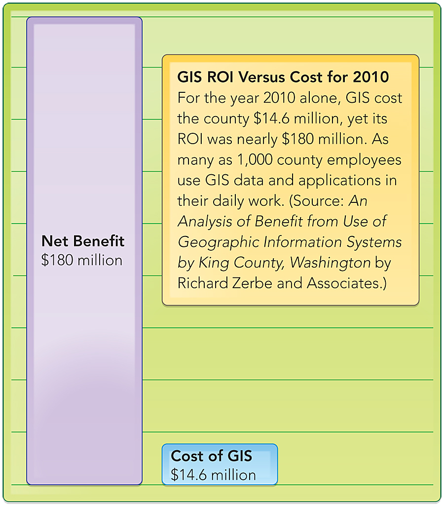
For 2010, for example, they determined that the cost of GIS was $14.6 million and the net benefit was approximately $180 million. The study by Richard Zerbe and Associates used a "with versus without" approach. While costs for all years were available, estimating benefits for the 18-year period was challenging. How opportunity cost was calculated had a substantial effect on the resultant ROI value. In addition, benefits are measured in outputs that are quantitatively and qualitatively better with GIS, leading to increased demand for these outputs. Assigning a dollar value to these more useful outputs is difficult. These factors were expressed in the three estimates in net benefits between 1992 and 2010: a conservative estimate of net benefit of approximately $776 million, a less conservative benefit level of $1.76 billion, and the least conservative estimate of almost $5 billion. (See the original report [PDF] for a complete description of the methodology used.)
"It's important in this day and age in government to be able to validate your benefits and provide cost-benefit analysis for investments," says Hocking. "We had our own anecdotal evidence of the value of GIS, but now we have solid evidence of that value."
King County chief information officer Bill Kehoe agrees and views the GIS service as a trailblazer for IT-based county services. "Our GIS service is an example of a high-performing IT service that is providing a large amount of customer efficiency for the investment," he says. "The GIS service is a model that we want all our services within King County IT to aspire to."
The ROI study doesn't just validate King County's investment in GIS; it also provides strong evidence other governments can use to show that GIS improves government operations and delivers significant value.
To view the full ROI study, visit esriurl.com/KCROI [PDF]. For more information about King County Information Technology, contact Gary Hocking, King County (e-mail: gary.hocking@kingcounty.gov), or visit www.kingcounty.gov/operations/it.aspx, or contact Chris Thomas, Esri (e-mail: cthomas@esri.com).