Esri GPS Base Station Joins National Network
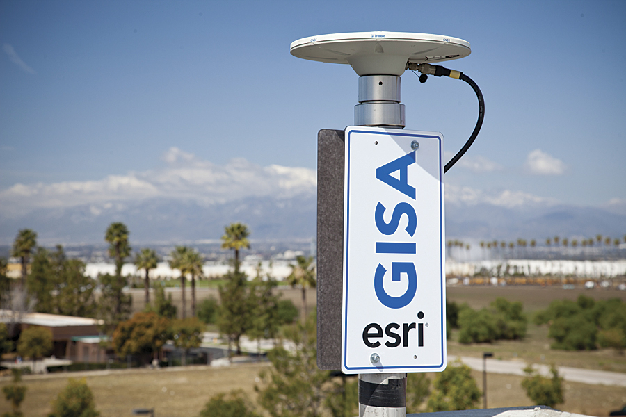
The Esri GPS base station, GISA, is mounted to a building In Redlands, California.
Esri recently installed a GPS base station to assist its GIS developers and support surveyors, engineers, scientists, and those in public works and public safety in the community surrounding the Esri campus in Redlands, California. The base station, named GISA, has been accepted by the National Geodetic Survey (NGS) and incorporated into the national Continuously Operating Reference Station (CORS) network.
NGS manages the CORS network that provides data to support 3D positioning, meteorology, space weather, and geophysical applications throughout the United States, US territories, and a few other countries. The CORS network is made up of more than 1,800 independently owned and operated stations and 200 entities, including government, academic, and private parties. As organizations such as Esri share data with NGS, NGS analyzes and distributes the data free of charge.
"GPS, originally designed as a US Department of Defense system, has become part of everyday life, with technology in all types of devices from smartphones to shipping containers," says Brent Jones, Esri surveying and engineering manager. "The Esri GPS base station is a great benefit to the community, as professionals can use it in surveying and positioning to achieve accurate locations in real time."
Mounted on an Esri-owned building in Redlands, GISA operates a Trimble NetR9, dual-frequency GPS/Global Navigation Satellite System (GNSS) receiver with a Zephyr Geodetic Model 2 antenna. GISA broadcasts real-time GPS/GNSS data on the Internet in industry-standard Radio Technical Commission for Maritime Services formats, which allows GPS users to obtain real-time centimeter positions.
"As the use of GPS and GNSS continues to grow, the demand for more precise positioning data also increases," says Kevin M. Kelly, the Esri geodesist who led the effort to establish the base station. "The transportation, surveying, engineering, and environmental communities are employing high-accuracy field units capable of receiving precise GPS and GNSS signals offering positional accuracies of one inch or better."
The City of Redlands allowed access to the Redlands Municipal Airport for testing of GISA. Allen Instruments and Supplies of Anaheim, California, performed a terrestrial laser scan of the GISA site.
GISA stores GPS and GNSS signals in data files on a secure Esri server accessible to the public via the Esri website at gnss.esri.com.