"Managing GIS"
A column from Members of the Urban and Regional Information Systems Association
Let's Exchange Competition for Cooperation
By Claudia Paskauskas, GIS Manager, East Central Florida Regional Planning Council
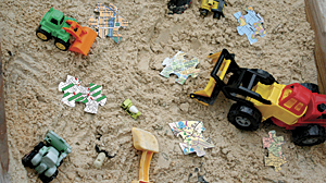
Photo credit: Gina Marchica
I would like to invite you on a trip back to our childhood. Let's think of the time that we were around two or three years old. Do you remember how the playground rules were back at that time? Lots of children playing with lots of toys. It was so hard to share our toys with somebody else. But then, all of a sudden, a little kid would come from nowhere wanting to play with our toys and keep offering his for us to play with until we finally decided to give it a try. It was always a hard decision to make—sharing our toys and playing with somebody else's—but it was always enjoyable and rewarding doing so because then we had a friend to play with, and things from that point on became way more fun than when we played alone!
Fast-forwarding and getting back to our current time, when we think of GIS collaboration, things are not much different from the playground rules. We have our data, our applications, our techniques, our models, our layers, and our services—our toys. And it's so hard to share them with others for reasons that vary on a case-by-case basis. Sometimes we have unique techniques and we don't want to share that with the competition. Other times, we just don't want to go through the entire documentation process that can take time to be completed. Yet other times, we just forget to scope time in our projects to share the final product with the GIS community via the clearinghouses and other resources, not to mention what it takes to collaborate in terms of stretching our comfort zone, exposing our work to peer evaluation, and many other reasons that we could write an entire new article about. But then your coworker encourages you to attend a local GIS user group meeting, and you listen to that presentation that gives you hints about how to improve your own project. Another situation could be how great it feels networking with other GIS professionals during a conference or during a GIS professional organization after-hours event just because you could help someone else answer a question that had been puzzling them. The point I am trying to make here is that it takes a leadership attitude to enable and accomplish collaboration.
One of the most basic leadership principles emphasizes the importance of individuals taking single steps to create big impacts. A leader doesn't need to be someone that's in a decision-making position or have formal authority. A leader is someone who can socially influence others to accomplish a common goal. Leaders come in various shapes and flavors. Leaders are simply messengers of new ways of thinking or transitioning processes or are simply supportive of new ideas and concept development. Leaders often are mentors. Leaders are passionate about what they do. Leaders engage. Leaders share, guide, and facilitate accomplishments. Leaders always strive and shine in what they do. Usually when you teach, you end up learning and knowing way more than that audience you are trying to educate. And that is just one of the beauties of having a leadership attitude.
Some people freeze when the word leadership is said aloud. Others think that being a leader is too much trouble, and they are already busy enough at work to get one more thing added to their plates. A common mind-set when the subject is leading can be easily illustrated in the following question: Why would my county, city, or even self want to collaborate and promote common professional growth in local GIS user group meetings, write articles, or mentor someone when I alone can deliver the highest-quality GIS projects on a daily basis?
One might also wonder why a GIS professional would want to do more than their own daily work. Why would a GIS professional want to contribute time, knowledge, and expertise to GIS professional organizations, local GIS groups, and data clearinghouses, aiding other peers and/or organizations and enabling them to grow stronger?
The problem embedded when someone thinks of these questions is more fundamental than it seems. The reality is that some professionals think they can survive forever by just flying solo. That notion clouds their ability to see the benefits of working and growing together.
By simply not being on the same page, this thinking may have effectively caused several significant duplications of effort and service. Loss of time. Loss of money. Loss of momentum to grow strong together as a knowledgeable GIS community. Loss of the opportunity to make a difference and be part of the solution. That's what happens when we don't have the mind-set of collaborating and sharing.
If all sides of our GIS community collectively discuss the common wants, needs, standards, and guidelines, duplication of efforts will not be an issue. Then, through collaboration, we can support the GIS community during these difficult economic times where budget constraints can unfortunately hinder success. History shows why collaborating is better than competing. When team players, being competitors or not, get together to help communities recover from unforeseen events like natural disasters, everybody wins. The community gets back to its normal life faster, jobs are created, knowledge is shared, and professionals get their skill sets sharpened. It's a win-win situation. No competition. Just collaboration!
The overwhelming support and participation of many GIS professionals, counties, cities, and organizations indicate that the GIS community would like to continue to work together. Pulling and tugging in different directions does not seem to make sense when we have collaboratively achieved better results shortcutting in project development by simply utilizing data that has been shared. Other successful proof that working together as a solid regional GIS community is worth it is reflected in the relationships built during several GIS functions, such as user groups, GIS Day celebrations, workshops, conferences, and specialized training.
For our GIS community to succeed, we must work together on projects and educational opportunities that make sense. Let us not be mistaken—competition is out there, and it is healthy. However, our spirit of competition needs to be a productive one that only makes us work harder and be that much stronger.
Working as a solid community means that everyone involved gets a little dirty, because we'll have to work at it. It's going to be work, but it's work worth doing. But the greater goal—not personal gain—has to be at the heart of what's driving us.
Ultimately, building a strong regional GIS community isn't something that can be accomplished by a handful of people. If something is to get done, it will be by individuals that simply have a passion for some segment of the work that's to be done.
Maybe that passion is in improving education and mentoring someone, developing grassroots efforts by being a mentor in local schools or maybe supporting the planning and execution of user groups, regional events, and newsletter publications. It could also be by volunteering with GIS professional organizations or even simply sharing data or supporting the development of new, needed data guidelines.
Regardless of the specific area of interest, the important factor is to simply become involved and help be a solution to some of our GIS community's issues and needs. One action at a time. Being a leader or just following one. Sharing your toys.
The sooner we all realize that cities; counties; organizations; companies; and, most importantly, professionals cannot survive without each other's collaboration, participation, and understanding, the better off we will all be.
I encourage you to share your toys. Going solo is good, but by traveling the journey together, we can accomplish much more.
About the Author
Claudia Paskauskas, PMP, MCSD, GISP, is the GIS manager for the East Central Florida Regional Planning Council (ECFRPC). She brings more than 18 years of IT professional experience, including GIS, working for private and government sectors. She is the vice president of the Florida URISA Chapter (FLURISA), chair of the URISA Leadership Academy, and the 2011 GIS-Pro URISA conference program chair.
For more information, or if you are looking to get involved in the GIS community or learn how to start your own collaborative GIS program, contact me (e-mail: Claudia@ecfrpc.org, tel.: 407-262-7772). There are plenty of opportunities out there where you could start making a difference.
Acknowledgments
Photo credit: Gina Marchica (e-mail: gmarchica@ecfrpc.org). Credits for the passion to carry on my mission of inspiring GIS peers to give their best and make a difference: the ECFRPC GIS team and CFGIS community, FLURISA, and URISA members.